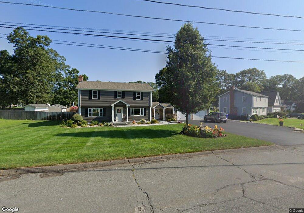
71 Pershing Rd Windsor Locks, CT 06096
Estimated Value: $404,000 - $453,846
4
Beds
2
Baths
2,183
Sq Ft
$199/Sq Ft
Est. Value
About This Home
This home is located at 71 Pershing Rd, Windsor Locks, CT 06096 and is currently estimated at $433,462, approximately $198 per square foot. 71 Pershing Rd is a home located in Hartford County with nearby schools including North Street School, South Elementary School, and Windsor Locks Middle School.
Ownership History
Date
Name
Owned For
Owner Type
Purchase Details
Closed on
Jul 26, 2011
Sold by
Pizzoferrato Franco
Bought by
Nelson Shawn I and Nelson Jennifer A
Current Estimated Value
Home Financials for this Owner
Home Financials are based on the most recent Mortgage that was taken out on this home.
Original Mortgage
$192,800
Outstanding Balance
$131,070
Interest Rate
4.49%
Estimated Equity
$302,392
Purchase Details
Closed on
Aug 24, 1990
Sold by
Lamore Douglas
Bought by
Pizzofurato Franco
Create a Home Valuation Report for This Property
The Home Valuation Report is an in-depth analysis detailing your home's value as well as a comparison with similar homes in the area
Home Values in the Area
Average Home Value in this Area
Purchase History
| Date | Buyer | Sale Price | Title Company |
|---|---|---|---|
| Nelson Shawn I | $241,000 | -- | |
| Pizzofurato Franco | $174,900 | -- |
Source: Public Records
Mortgage History
| Date | Status | Borrower | Loan Amount |
|---|---|---|---|
| Open | Pizzofurato Franco | $192,800 | |
| Previous Owner | Pizzofurato Franco | $93,359 | |
| Previous Owner | Pizzofurato Franco | $100,000 |
Source: Public Records
Tax History
| Year | Tax Paid | Tax Assessment Tax Assessment Total Assessment is a certain percentage of the fair market value that is determined by local assessors to be the total taxable value of land and additions on the property. | Land | Improvement |
|---|---|---|---|---|
| 2025 | $7,548 | $314,650 | $59,710 | $254,940 |
| 2024 | $4,131 | $146,790 | $47,600 | $99,190 |
| 2023 | $3,865 | $146,790 | $47,600 | $99,190 |
| 2022 | $3,792 | $146,790 | $47,600 | $99,190 |
| 2021 | $3,792 | $146,790 | $47,600 | $99,190 |
| 2020 | $3,792 | $146,790 | $47,600 | $99,190 |
| 2019 | $3,792 | $146,790 | $47,600 | $99,190 |
| 2017 | $3,746 | $140,500 | $46,100 | $94,400 |
| 2016 | $3,746 | $140,500 | $46,100 | $94,400 |
| 2015 | $3,764 | $140,500 | $46,100 | $94,400 |
| 2014 | $3,924 | $149,600 | $52,400 | $97,200 |
Source: Public Records
Map
Nearby Homes
Your Personal Tour Guide
Ask me questions while you tour the home.