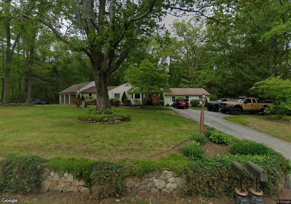
71 Pole Bridge Rd North Scituate, RI 02857
Estimated Value: $520,000 - $585,000
3
Beds
2
Baths
2,802
Sq Ft
$196/Sq Ft
Est. Value
About This Home
This home is located at 71 Pole Bridge Rd, North Scituate, RI 02857 and is currently estimated at $548,160, approximately $195 per square foot. 71 Pole Bridge Rd is a home located in Providence County with nearby schools including North Scituate School, Scituate Middle School, and Scituate High School.
Ownership History
Date
Name
Owned For
Owner Type
Purchase Details
Closed on
Oct 13, 2018
Sold by
Frederickson Timothy B
Bought by
Fredrickson Timothy B and Frederickson Paula S
Current Estimated Value
Purchase Details
Closed on
Dec 17, 1996
Sold by
Carlevale Roy E and Carlevale Anna
Bought by
Frederickson Timothy B
Home Financials for this Owner
Home Financials are based on the most recent Mortgage that was taken out on this home.
Original Mortgage
$85,000
Interest Rate
7.75%
Purchase Details
Closed on
Nov 8, 1990
Sold by
Johnson Alice L
Bought by
Carlevale Roy E
Create a Home Valuation Report for This Property
The Home Valuation Report is an in-depth analysis detailing your home's value as well as a comparison with similar homes in the area
Home Values in the Area
Average Home Value in this Area
Purchase History
| Date | Buyer | Sale Price | Title Company |
|---|---|---|---|
| Fredrickson Timothy B | -- | -- | |
| Frederickson Timothy B | $120,000 | -- | |
| Carlevale Roy E | $130,000 | -- |
Source: Public Records
Mortgage History
| Date | Status | Borrower | Loan Amount |
|---|---|---|---|
| Previous Owner | Carlevale Roy E | $46,000 | |
| Previous Owner | Carlevale Roy E | $61,000 | |
| Previous Owner | Carlevale Roy E | $100,000 | |
| Previous Owner | Carlevale Roy E | $85,000 |
Source: Public Records
Tax History Compared to Growth
Tax History
| Year | Tax Paid | Tax Assessment Tax Assessment Total Assessment is a certain percentage of the fair market value that is determined by local assessors to be the total taxable value of land and additions on the property. | Land | Improvement |
|---|---|---|---|---|
| 2025 | $6,192 | $357,300 | $118,600 | $238,700 |
| 2024 | $6,192 | $357,300 | $118,600 | $238,700 |
| 2023 | $5,988 | $357,300 | $118,600 | $238,700 |
| 2022 | $5,853 | $357,300 | $118,600 | $238,700 |
| 2021 | $5,487 | $293,600 | $98,400 | $195,200 |
| 2020 | $5,364 | $293,600 | $98,400 | $195,200 |
| 2019 | $5,253 | $293,600 | $98,400 | $195,200 |
| 2018 | $4,979 | $256,800 | $85,700 | $171,100 |
| 2017 | $4,833 | $256,800 | $85,700 | $171,100 |
| 2016 | $4,633 | $256,800 | $85,700 | $171,100 |
| 2015 | $4,330 | $226,000 | $79,300 | $146,700 |
| 2014 | $4,289 | $226,000 | $79,300 | $146,700 |
Source: Public Records
Map
Nearby Homes
- 17 Country Side Ln
- 22 Oakridge Rd
- 111 Peeptoad Rd
- 12 Tamarac Dr Unit B
- 6 Tamarac Dr Unit C
- 15 Chiswick Rd
- 125 Smith Ave Unit 4C
- 125 Smith Ave Unit 8F
- 125 Smith Ave Unit 1B
- 125 Smith Ave Unit 5C
- 110 Hopkins Ave
- 111 Smith Ave Unit 7
- 56 Pine Ledge Rd
- 42 Hopkins Ave
- 62 Orchard Ave
- 66 Orchard Ave
- 68 Orchard Ave
- 22 Liberty Ln
- 40 Hartford Ave
- 136 Aldrich Rd
- 0 Colonial Rd
- 67 Pole Bridge Rd
- 4 Colonial Rd
- 3 Colonial Rd
- 83 Pole Bridge Rd
- 63 Pole Bridge Rd
- 8 Mary Elizabeth Dr
- 89 Pole Bridge Rd
- 15 Colonial Rd
- 6 Country Side Ln
- 3 Country Side Ln
- 56 Pole Bridge Rd
- 96 Pole Bridge Rd
- 16 Country Side Ln
- 47 Pole Bridge Rd
- 84 Countryside Dr
- 7 Country Side Ln
- 4 White Pine Dr
- 102 Pole Bridge Rd
- 50 Pole Bridge Rd