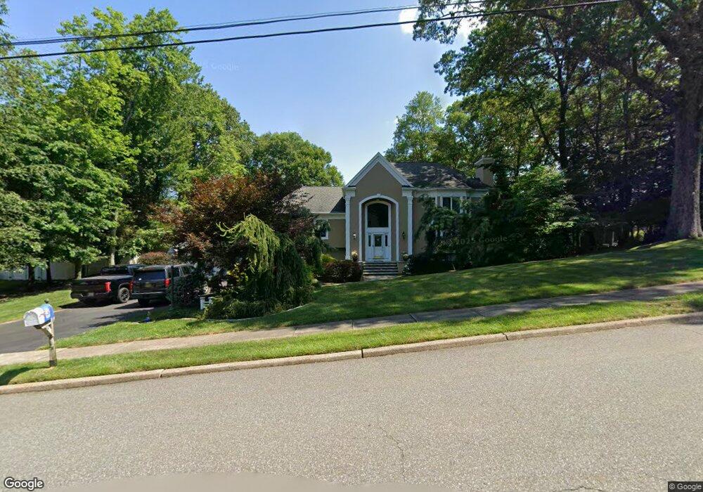
71 Powhatan Path Oakland, NJ 07436
Estimated Value: $1,120,000 - $1,338,000
Studio
--
Bath
3,415
Sq Ft
$361/Sq Ft
Est. Value
About This Home
This home is located at 71 Powhatan Path, Oakland, NJ 07436 and is currently estimated at $1,232,228, approximately $360 per square foot. 71 Powhatan Path is a home located in Bergen County with nearby schools including Manito Elementary School, Valley Middle School, and Indian Hills High School.
Ownership History
Date
Name
Owned For
Owner Type
Purchase Details
Closed on
Mar 25, 1994
Sold by
Pagani George and Pagani Vita
Bought by
Larkin Jeremiah and Larkin Nancy
Current Estimated Value
Home Financials for this Owner
Home Financials are based on the most recent Mortgage that was taken out on this home.
Original Mortgage
$200,000
Interest Rate
7.15%
Create a Home Valuation Report for This Property
The Home Valuation Report is an in-depth analysis detailing your home's value as well as a comparison with similar homes in the area
Home Values in the Area
Average Home Value in this Area
Purchase History
| Date | Buyer | Sale Price | Title Company |
|---|---|---|---|
| Larkin Jeremiah | $257,000 | -- |
Source: Public Records
Mortgage History
| Date | Status | Borrower | Loan Amount |
|---|---|---|---|
| Closed | Larkin Jeremiah | $200,000 |
Source: Public Records
Tax History
| Year | Tax Paid | Tax Assessment Tax Assessment Total Assessment is a certain percentage of the fair market value that is determined by local assessors to be the total taxable value of land and additions on the property. | Land | Improvement |
|---|---|---|---|---|
| 2025 | $21,579 | $1,014,400 | $360,400 | $654,000 |
| 2024 | $21,126 | $938,200 | $320,100 | $618,100 |
| 2023 | $20,848 | $889,900 | $301,300 | $588,600 |
| 2022 | $20,848 | $886,400 | $292,500 | $593,900 |
| 2021 | $20,062 | $653,500 | $231,500 | $422,000 |
| 2020 | $19,598 | $653,500 | $231,500 | $422,000 |
| 2019 | $18,912 | $653,500 | $231,500 | $422,000 |
| 2018 | $18,514 | $653,500 | $231,500 | $422,000 |
| 2017 | $18,272 | $653,500 | $231,500 | $422,000 |
| 2016 | $17,775 | $653,500 | $231,500 | $422,000 |
| 2015 | $17,422 | $653,500 | $231,500 | $422,000 |
| 2014 | $17,063 | $653,500 | $231,500 | $422,000 |
Source: Public Records
Map
Nearby Homes
- 40 Pawnee Ave
- 39 Andrew Ave
- 8 Iroquois Ave
- 695 Ramapo Valley Rd
- 7 Valley Forge Rd
- 8 Stony Point Rd
- 12 Fordham Rd
- 23 Colgate Rd
- 737 Surrey Ln
- 731 Surrey Ln
- 793 Iron Latch Rd
- 550 Ramapo Valley Rd
- 88 Lakeshore Dr
- 509 Ramapo Valley Rd
- 450 Saddle Back Trail
- 425 Saddle Back Trail
- 724 Tall Oaks Ct
- 732 Mardinly Ave
- 853 Shadow Ridge Rd
- 1044 Ramapo Valley Rd
- 81 Iroquois Ave
- 65 Powhatan Path
- 72 Cherokee Trail
- 89 Iroquois Ave
- 66 Cherokee Trail
- 70 Powhatan Path
- 76 Powhatan Path
- 64 Powhatan Path
- 6 Algonquin Trail
- 80 Iroquois Ave
- 71 Cherokee Trail
- 99 Iroquois Ave
- 65 Cherokee Trail
- 58 Powhatan Path
- 94 Iroquois Ave
- 72 Iroquois Ave
- 53 Powhatan Path
- 54 Cherokee Trail
- 10 Algonquin Trail
- 9 Chicasaw Dr
Your Personal Tour Guide
Ask me questions while you tour the home.