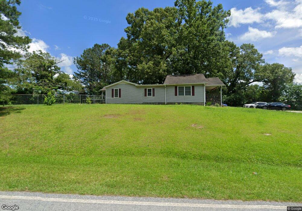
71 Red Land Rd Franklin, GA 30217
Estimated Value: $194,314 - $323,000
3
Beds
2
Baths
1,700
Sq Ft
$150/Sq Ft
Est. Value
About This Home
This home is located at 71 Red Land Rd, Franklin, GA 30217 and is currently estimated at $255,079, approximately $150 per square foot. 71 Red Land Rd is a home located in Heard County with nearby schools including Heard County High School.
Ownership History
Date
Name
Owned For
Owner Type
Purchase Details
Closed on
Apr 16, 2004
Sold by
Scott James
Bought by
Combs Debra S
Current Estimated Value
Purchase Details
Closed on
Mar 2, 1995
Sold by
Scott James and Scott Kathy
Bought by
Scott James
Purchase Details
Closed on
Dec 1, 1982
Sold by
Looney Clyde
Bought by
Scott James and Scott Kathy
Purchase Details
Closed on
Mar 1, 1978
Bought by
Looney Clyde
Create a Home Valuation Report for This Property
The Home Valuation Report is an in-depth analysis detailing your home's value as well as a comparison with similar homes in the area
Home Values in the Area
Average Home Value in this Area
Purchase History
| Date | Buyer | Sale Price | Title Company |
|---|---|---|---|
| Combs Debra S | $75,000 | -- | |
| Scott James | -- | -- | |
| Scott James | $9,000 | -- | |
| Looney Clyde | $7,000 | -- |
Source: Public Records
Tax History Compared to Growth
Tax History
| Year | Tax Paid | Tax Assessment Tax Assessment Total Assessment is a certain percentage of the fair market value that is determined by local assessors to be the total taxable value of land and additions on the property. | Land | Improvement |
|---|---|---|---|---|
| 2024 | $1,004 | $49,774 | $3,702 | $46,072 |
| 2023 | $959 | $45,920 | $3,085 | $42,835 |
| 2022 | $763 | $36,555 | $2,467 | $34,088 |
| 2021 | $658 | $29,926 | $2,467 | $27,459 |
| 2020 | $662 | $29,834 | $2,467 | $27,367 |
| 2019 | $662 | $29,834 | $2,467 | $27,367 |
| 2018 | $675 | $29,834 | $2,467 | $27,367 |
| 2017 | $628 | $27,827 | $1,407 | $26,420 |
| 2016 | $628 | $27,827 | $1,407 | $26,420 |
| 2015 | -- | $25,112 | $3,167 | $21,946 |
| 2014 | -- | $25,119 | $3,167 | $21,952 |
| 2013 | -- | $29,912 | $3,166 | $26,745 |
Source: Public Records
Map
Nearby Homes
- The Lambert Plan at Patterson Park
- The Bradford Plan at Patterson Park
- The Millie Plan at Patterson Park
- The Coleman Plan at Patterson Park
- The Northern Hills Plan at Patterson Park
- The Nelson Plan at Patterson Park
- 125 Patterson Dr
- 155 Patterson Dr
- 25 Patterson Dr
- 105 Patterson Dr
- 0 Bevis Rd Parcel 5
- 0 Bevis Rd Parcel 4
- 23 Rivers Edge Ln Unit LOT 11
- 21 Rivers Edge Ln Unit LOT 12
- 22 Rivers Edge Ln Unit LOT 7
- 12 Rivers Edge Ln Unit LOT 2
- 24 Rivers Edge Ln Unit LOT 8
- 20 Rivers Edge Ln Unit LOT 6
- 27 Rivers Edge Ln Unit LOT 9
- 25 Rivers Edge Ln Unit LOT 10
- 11655 Ga Highway 100
- 0 Red Land Rd Unit 7186576
- 0 Red Land Rd Unit TRACT 1 7493230
- 0 Red Land Rd Unit TRACT 3 7493226
- 0 Red Land Rd Unit TRACT 2 7493229
- 0 Red Land Rd Unit 8116795
- 0 Red Land Rd Unit 8533484
- 11710 Ga Highway 100
- 11710 Ga Highway 100
- 11710 Ga Highway 100
- 11730 Ga Highway 100
- 115 Redland Rd
- 115 Red Land Rd
- 11630 Georgia 100
- 11732 Ga Highway 100
- 11635 Ga Highway 100
- 145 Redland Rd
- 145 Red Land Rd
- 11588 Ga Highway 100
- 11588 Ga Highway 100