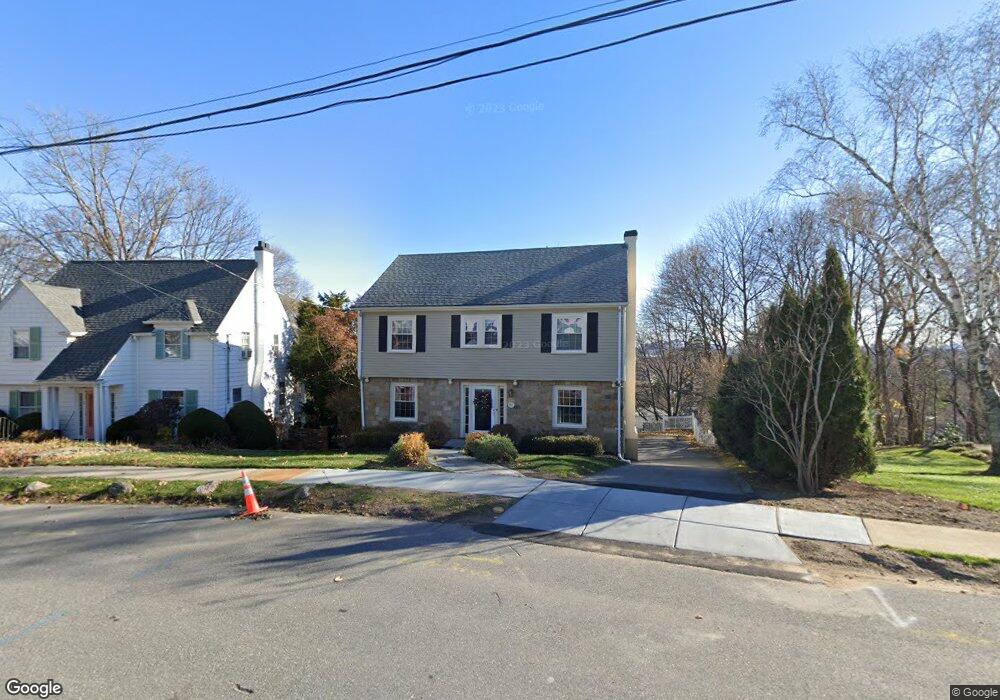
71 Richmond Rd Belmont, MA 02478
Belmont Hill NeighborhoodEstimated Value: $1,506,000 - $1,765,983
3
Beds
3
Baths
1,617
Sq Ft
$1,009/Sq Ft
Est. Value
About This Home
This home is located at 71 Richmond Rd, Belmont, MA 02478 and is currently estimated at $1,630,996, approximately $1,008 per square foot. 71 Richmond Rd is a home located in Middlesex County with nearby schools including Winn Brook Elementary School, Winthrop L Chenery Middle School, and Belmont High School.
Ownership History
Date
Name
Owned For
Owner Type
Purchase Details
Closed on
Oct 21, 2016
Sold by
Tingos Vicky
Bought by
Tingos Vicky and Tingos Perry
Current Estimated Value
Purchase Details
Closed on
Mar 30, 2006
Sold by
Hurley Cornelius K and Philbin Ellen K
Bought by
Rogaris Panagiotis and Rogaris Vicky
Home Financials for this Owner
Home Financials are based on the most recent Mortgage that was taken out on this home.
Original Mortgage
$335,000
Interest Rate
6.32%
Mortgage Type
Purchase Money Mortgage
Purchase Details
Closed on
Nov 1, 1999
Sold by
Raymond L Mannix T and Davin Kenneth J
Bought by
Hurley Cornelius and Philbin Ellen K
Home Financials for this Owner
Home Financials are based on the most recent Mortgage that was taken out on this home.
Original Mortgage
$306,400
Interest Rate
7.78%
Mortgage Type
Purchase Money Mortgage
Create a Home Valuation Report for This Property
The Home Valuation Report is an in-depth analysis detailing your home's value as well as a comparison with similar homes in the area
Home Values in the Area
Average Home Value in this Area
Purchase History
| Date | Buyer | Sale Price | Title Company |
|---|---|---|---|
| Tingos Vicky | -- | -- | |
| Rogaris Panagiotis | $670,000 | -- | |
| Hurley Cornelius | $386,250 | -- |
Source: Public Records
Mortgage History
| Date | Status | Borrower | Loan Amount |
|---|---|---|---|
| Previous Owner | Hurley Cornelius | $300,000 | |
| Previous Owner | Hurley Cornelius | $330,000 | |
| Previous Owner | Rogaris Panagiotis | $335,000 | |
| Previous Owner | Hurley Cornelius | $306,400 |
Source: Public Records
Tax History Compared to Growth
Tax History
| Year | Tax Paid | Tax Assessment Tax Assessment Total Assessment is a certain percentage of the fair market value that is determined by local assessors to be the total taxable value of land and additions on the property. | Land | Improvement |
|---|---|---|---|---|
| 2025 | $19,352 | $1,699,000 | $762,000 | $937,000 |
| 2024 | $17,498 | $1,657,000 | $897,000 | $760,000 |
| 2023 | $17,534 | $1,560,000 | $871,000 | $689,000 |
| 2022 | $17,143 | $1,483,000 | $843,000 | $640,000 |
| 2021 | $18,533 | $1,606,000 | $992,000 | $614,000 |
| 2020 | $14,839 | $1,349,000 | $758,000 | $591,000 |
| 2019 | $13,829 | $1,185,000 | $642,000 | $543,000 |
| 2018 | $13,256 | $1,091,000 | $557,000 | $534,000 |
| 2017 | $12,868 | $1,014,000 | $487,000 | $527,000 |
| 2016 | $11,543 | $919,000 | $487,000 | $432,000 |
| 2015 | $11,159 | $865,000 | $434,000 | $431,000 |
Source: Public Records
Map
Nearby Homes
- 10 Radcliffe Rd
- 242 Claflin St
- 43 Brunswick Rd
- 4 Stony Brook Rd
- 125 Claflin St
- 335 Lake St
- 170 Clifton St
- 326 Lake St
- 7 Broad St
- 7 Woodland St
- 176 Channing Rd
- 33 Wellington Ln
- 155 Highland Ave Unit 1
- 152 Scituate St
- 142 Highland Ave Unit 142
- 125 Channing Rd
- 789 Concord Turnpike
- 314 Channing Rd
- 135 Pleasant St Unit 34 prev 13
- 119 Gloucester St