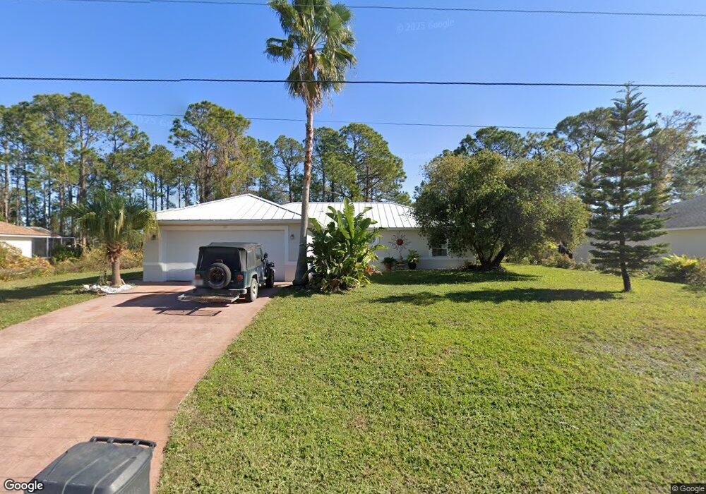
71 Rockefeller Dr Palm Coast, FL 32164
Estimated Value: $285,883 - $330,000
3
Beds
2
Baths
1,408
Sq Ft
$219/Sq Ft
Est. Value
About This Home
This home is located at 71 Rockefeller Dr, Palm Coast, FL 32164 and is currently estimated at $308,221, approximately $218 per square foot. 71 Rockefeller Dr is a home located in Flagler County with nearby schools including Rymfire Elementary School, Indian Trails Middle School, and Matanzas High School.
Ownership History
Date
Name
Owned For
Owner Type
Purchase Details
Closed on
Jul 20, 1998
Sold by
Amaral Custom Homes Inc
Bought by
Lopes Sonia M
Current Estimated Value
Home Financials for this Owner
Home Financials are based on the most recent Mortgage that was taken out on this home.
Original Mortgage
$64,000
Outstanding Balance
$13,120
Interest Rate
7.02%
Estimated Equity
$295,101
Purchase Details
Closed on
Feb 26, 1998
Sold by
Lopes Sonia M and Lopes Francisco J
Bought by
Amaral Custom Homes Inc
Purchase Details
Closed on
Jul 24, 1997
Sold by
Schmitz Richard L and Schmitz Jerry H
Bought by
Lopes Sonia M and Lopes Francisco J
Create a Home Valuation Report for This Property
The Home Valuation Report is an in-depth analysis detailing your home's value as well as a comparison with similar homes in the area
Home Values in the Area
Average Home Value in this Area
Purchase History
| Date | Buyer | Sale Price | Title Company |
|---|---|---|---|
| Lopes Sonia M | $75,300 | -- | |
| Amaral Custom Homes Inc | -- | -- | |
| Lopes Sonia M | $4,800 | -- |
Source: Public Records
Mortgage History
| Date | Status | Borrower | Loan Amount |
|---|---|---|---|
| Open | Lopes Sonia M | $64,000 |
Source: Public Records
Tax History Compared to Growth
Tax History
| Year | Tax Paid | Tax Assessment Tax Assessment Total Assessment is a certain percentage of the fair market value that is determined by local assessors to be the total taxable value of land and additions on the property. | Land | Improvement |
|---|---|---|---|---|
| 2024 | $1,286 | $115,487 | -- | -- |
| 2023 | $1,286 | $112,124 | $0 | $0 |
| 2022 | $1,259 | $108,858 | $0 | $0 |
| 2021 | $1,231 | $105,687 | $0 | $0 |
| 2020 | $1,223 | $104,227 | $0 | $0 |
| 2019 | $1,193 | $101,884 | $0 | $0 |
| 2018 | $1,179 | $99,984 | $0 | $0 |
| 2017 | $1,143 | $97,928 | $0 | $0 |
| 2016 | $1,110 | $95,914 | $0 | $0 |
| 2015 | $1,111 | $95,247 | $0 | $0 |
| 2014 | $1,113 | $94,491 | $0 | $0 |
Source: Public Records
Map
Nearby Homes
- 67 Rolling Sands Dr
- 54 Rockefeller Dr
- 53 Rockefeller Dr
- 8 Rolling Sands Dr
- 20 Roxland Ln
- 60 Rolling Sands Dr
- 98 Roxboro Dr
- 10 Rocking Ln
- 106 Rolling Sands Dr
- 37 Rose Dr
- 14 Roxanne Ln
- 7 Russkin Ln
- 24 Rockingham Ln
- 19 Russman Ln
- 11 Russkin Ln
- 8 Rocking Ln
- 5 Rockefeller Dr
- 35 Russell Dr
- 21 Rockefeller Dr
- 22 Ruth Dr
- 73 Rockefeller Dr
- 69 Rockefeller Dr
- 75 Rockefeller Dr
- 67 Rockefeller Dr
- 68 Rockefeller Dr
- 5 Rose Dr
- 7 Rose Dr
- 72 Rocking Horse Dr
- 66 Rockefeller Dr
- 65 Rockefeller Dr
- 1 Rose Dr
- 77 Rolling Sands Dr
- 25 Rockne Ln
- 64 Rockefeller Dr
- 70 Rocking Horse Dr
- 63 Rockefeller Dr
- 23 Rockne Ln
- 114 Roxboro Dr
- 13 Rose Dr
- 75 Rolling Sands Dr