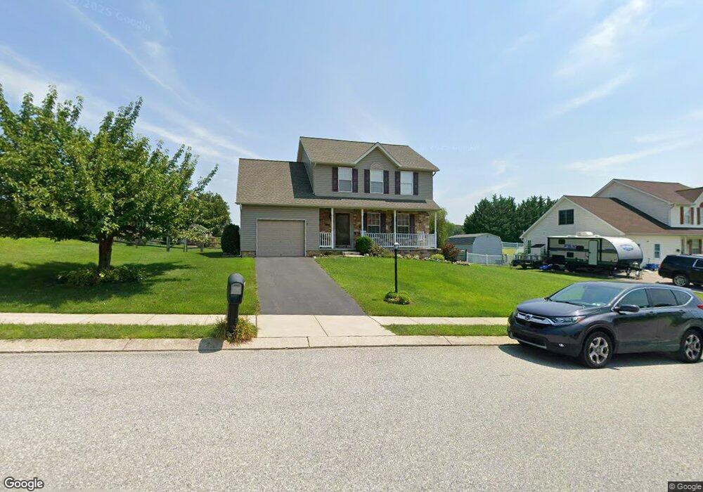
71 S Kennard Dale Ave Stewartstown, PA 17363
Estimated Value: $382,090 - $427,000
4
Beds
3
Baths
1,853
Sq Ft
$220/Sq Ft
Est. Value
About This Home
This home is located at 71 S Kennard Dale Ave, Stewartstown, PA 17363 and is currently estimated at $408,523, approximately $220 per square foot. 71 S Kennard Dale Ave is a home located in York County with nearby schools including South Eastern Intermediate School, South Eastern Middle School, and Kennard-Dale High School.
Ownership History
Date
Name
Owned For
Owner Type
Purchase Details
Closed on
Sep 15, 2023
Sold by
Johnson Michael T and Johnson Bonnie S
Bought by
Johnson Michael T
Current Estimated Value
Purchase Details
Closed on
Aug 30, 2006
Sold by
Borges David S and Borges Marcy R
Bought by
Johnson Michael T and Johnson Bonnie S
Home Financials for this Owner
Home Financials are based on the most recent Mortgage that was taken out on this home.
Original Mortgage
$285,900
Interest Rate
6.83%
Mortgage Type
VA
Purchase Details
Closed on
Feb 2, 2001
Sold by
Royal Bldg Inc
Bought by
Borges David S and Borges Marcy R
Home Financials for this Owner
Home Financials are based on the most recent Mortgage that was taken out on this home.
Original Mortgage
$153,261
Interest Rate
7.14%
Create a Home Valuation Report for This Property
The Home Valuation Report is an in-depth analysis detailing your home's value as well as a comparison with similar homes in the area
Home Values in the Area
Average Home Value in this Area
Purchase History
| Date | Buyer | Sale Price | Title Company |
|---|---|---|---|
| Johnson Michael T | -- | None Listed On Document | |
| Johnson Michael T | $279,900 | None Available | |
| Borges David S | $161,328 | -- |
Source: Public Records
Mortgage History
| Date | Status | Borrower | Loan Amount |
|---|---|---|---|
| Previous Owner | Johnson Michael T | $285,900 | |
| Previous Owner | Borges David S | $153,261 |
Source: Public Records
Tax History Compared to Growth
Tax History
| Year | Tax Paid | Tax Assessment Tax Assessment Total Assessment is a certain percentage of the fair market value that is determined by local assessors to be the total taxable value of land and additions on the property. | Land | Improvement |
|---|---|---|---|---|
| 2025 | $6,228 | $194,630 | $40,690 | $153,940 |
| 2024 | $6,228 | $194,630 | $40,690 | $153,940 |
| 2023 | $6,228 | $194,630 | $40,690 | $153,940 |
| 2022 | $6,228 | $194,630 | $40,690 | $153,940 |
| 2021 | $6,034 | $194,630 | $40,690 | $153,940 |
| 2020 | $6,034 | $194,630 | $40,690 | $153,940 |
| 2019 | $6,014 | $194,630 | $40,690 | $153,940 |
| 2018 | $6,014 | $194,630 | $40,690 | $153,940 |
| 2017 | $6,014 | $194,630 | $40,690 | $153,940 |
| 2016 | $0 | $194,630 | $40,690 | $153,940 |
| 2015 | -- | $194,630 | $40,690 | $153,940 |
| 2014 | -- | $194,630 | $40,690 | $153,940 |
Source: Public Records
Map
Nearby Homes
- 94 Piston Ct
- 82 Piston Ct
- 2 S Main St
- 9 W Pennsylvania Ave
- 13 Baneberry St
- 17 Charles Ave
- 231 Cool Spring Ln
- 103 Hershey Cir
- 18007 Dave Anne Cir
- 18010 Dave Anne Cir
- 4341 Forbes Dr
- 4303 Forbes Dr
- 10 Black Oak Ct
- 150 Patterson Dr Unit 47
- 18183 Piedmont Rd
- 180 Patterson Dr Unit 50
- 0 Five Forks Rd Unit PAYK2095070
- 0 Five Forks Rd Unit PAYK2095050
- 8287 Pleasant Valley Rd
- 2430 Harris Mill Rd
- 75 S Kennard Dale Ave
- 76 S Kennard Dale Ave
- 67 S Kennard Dale Ave
- 78 S Kennard Dale Ave
- 63 S Kennard Dale Ave
- 80 S Kennard Dale Ave
- 1 Jasmine Ln
- 79 S Kennard Dale Ave
- 68 S Kennard Dale Ave
- 2 Jasmine Ln
- 82 S Kennard Dale Ave
- 55 S Kennard Dale Ave
- 3 Jasmine Ln
- 83 S Kennard Dale Ave
- 64 S Kennard Dale Ave
- 51 S Kennard Dale Ave
- 54 College Ave
- 9 Chantilear Ct
- 84 S Kennard Dale Ave