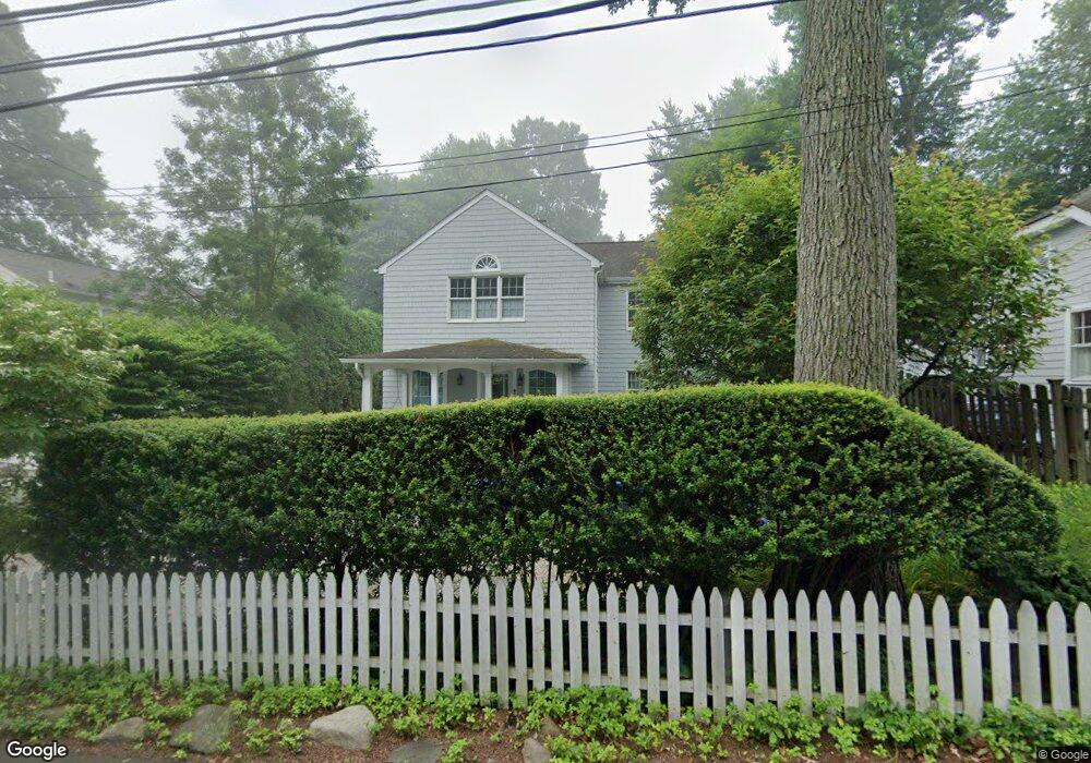
71 Sedgewick Ave Darien, CT 06820
Estimated Value: $1,809,205 - $2,224,000
3
Beds
3
Baths
2,288
Sq Ft
$863/Sq Ft
Est. Value
About This Home
This home is located at 71 Sedgewick Ave, Darien, CT 06820 and is currently estimated at $1,974,551, approximately $863 per square foot. 71 Sedgewick Ave is a home located in Fairfield County with nearby schools including Royle Elementary School, Middlesex Middle School, and Darien High School.
Ownership History
Date
Name
Owned For
Owner Type
Purchase Details
Closed on
Jun 16, 2025
Sold by
Arstorp Peder and Arstorp Julia
Bought by
Arstorp T T and Arstorp A
Current Estimated Value
Purchase Details
Closed on
Jun 6, 1994
Sold by
Fisher Carolyn
Bought by
Arstorp Peder and Arstorp Julia
Create a Home Valuation Report for This Property
The Home Valuation Report is an in-depth analysis detailing your home's value as well as a comparison with similar homes in the area
Home Values in the Area
Average Home Value in this Area
Purchase History
| Date | Buyer | Sale Price | Title Company |
|---|---|---|---|
| Arstorp T T | -- | -- | |
| Arstorp Peder | $312,000 | -- |
Source: Public Records
Mortgage History
| Date | Status | Borrower | Loan Amount |
|---|---|---|---|
| Previous Owner | Arstorp Peder | $328,815 | |
| Previous Owner | Arstorp Peder | $250,000 | |
| Previous Owner | Arstorp Peder | $437,000 | |
| Previous Owner | Arstorp Peder | $273,750 |
Source: Public Records
Tax History
| Year | Tax Paid | Tax Assessment Tax Assessment Total Assessment is a certain percentage of the fair market value that is determined by local assessors to be the total taxable value of land and additions on the property. | Land | Improvement |
|---|---|---|---|---|
| 2025 | $13,265 | $856,940 | $560,840 | $296,100 |
| 2024 | $12,588 | $856,940 | $560,840 | $296,100 |
| 2023 | $11,293 | $641,270 | $400,610 | $240,660 |
| 2022 | $11,049 | $641,270 | $400,610 | $240,660 |
| 2021 | $10,799 | $641,270 | $400,610 | $240,660 |
| 2020 | $10,491 | $641,270 | $400,610 | $240,660 |
| 2019 | $10,562 | $641,270 | $400,610 | $240,660 |
| 2018 | $11,128 | $692,020 | $465,710 | $226,310 |
| 2017 | $11,183 | $692,020 | $465,710 | $226,310 |
| 2016 | $10,913 | $692,020 | $465,710 | $226,310 |
| 2015 | $10,623 | $692,020 | $465,710 | $226,310 |
| 2014 | $10,387 | $692,020 | $465,710 | $226,310 |
Source: Public Records
Map
Nearby Homes
- 25 Lakeside Ave
- 10 Stony Brook Rd
- 20 Locust Hill Rd
- 2 Settlers Trail Unit 2
- 44 Andrews Dr
- 5 Shields Ln
- 26 Holly Ln
- 16 Fairfield Ave
- 19 Circle Rd
- 3 Revere Rd
- 18 Winding Ln
- 7 Buttonwood Ln
- 9 Point o Woods Rd S
- 7 Raiders Ln
- 29 Richmond Dr
- 171 Raymond St
- 2 Red Rose Cir
- 10 Cross Rd
- 12 Dellwood Rd
- 32 Relihan Rd
- 73 Sedgwick Ave
- 108 Leroy Ave
- 69 Sedgwick Ave
- 110 Leroy Ave
- 29 Lakeside Ave
- 104 Leroy Ave
- 23 Lakeside Ave
- 105 Leroy Ave
- 21 Lakeside Ave
- 74 Sedgwick Ave
- 73 Sedgewick Ave
- 68 Sedgewick Ave
- 27 Lakeside Ave
- 76 Sedgwick Ave
- 100 Leroy Ave
- 19 Lakeside Ave
- 76 Sedgewick Ave
- 74 Sedgewick Ave
- 17 Lakeside Ave
- 64 Sedgwick Ave
Your Personal Tour Guide
Ask me questions while you tour the home.