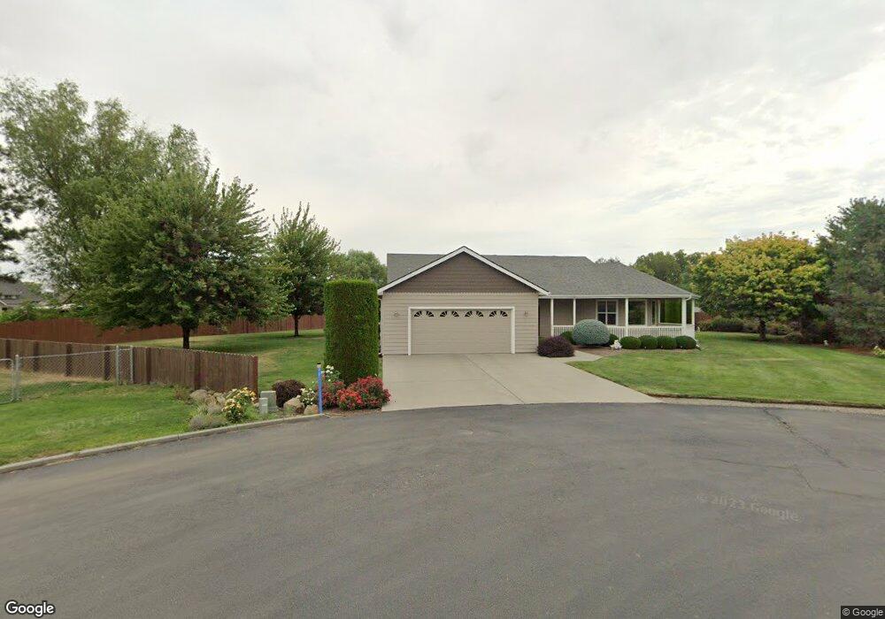
71 Sterling Ln Walla Walla, WA 99362
Estimated Value: $546,000 - $623,000
3
Beds
2
Baths
2,246
Sq Ft
$259/Sq Ft
Est. Value
About This Home
This home is located at 71 Sterling Ln, Walla Walla, WA 99362 and is currently estimated at $581,456, approximately $258 per square foot. 71 Sterling Ln is a home located in Walla Walla County with nearby schools including Davis Elementary School, John Sager Middle School, and Liberty Christian School.
Ownership History
Date
Name
Owned For
Owner Type
Purchase Details
Closed on
Oct 3, 2007
Sold by
Brooks Gene A and Brooks Patricia A
Bought by
Locati Patricia Jean
Current Estimated Value
Home Financials for this Owner
Home Financials are based on the most recent Mortgage that was taken out on this home.
Original Mortgage
$120,000
Outstanding Balance
$75,893
Interest Rate
6.46%
Mortgage Type
Purchase Money Mortgage
Estimated Equity
$505,563
Create a Home Valuation Report for This Property
The Home Valuation Report is an in-depth analysis detailing your home's value as well as a comparison with similar homes in the area
Home Values in the Area
Average Home Value in this Area
Purchase History
| Date | Buyer | Sale Price | Title Company |
|---|---|---|---|
| Locati Patricia Jean | $338,500 | Land Title Of Walla Walla Co |
Source: Public Records
Mortgage History
| Date | Status | Borrower | Loan Amount |
|---|---|---|---|
| Open | Locati Patricia Jean | $120,000 |
Source: Public Records
Tax History Compared to Growth
Tax History
| Year | Tax Paid | Tax Assessment Tax Assessment Total Assessment is a certain percentage of the fair market value that is determined by local assessors to be the total taxable value of land and additions on the property. | Land | Improvement |
|---|---|---|---|---|
| 2024 | $6,341 | $524,010 | $90,000 | $434,010 |
| 2023 | $6,341 | $524,010 | $90,000 | $434,010 |
| 2022 | $6,044 | $484,550 | $90,000 | $394,550 |
| 2021 | $6,084 | $424,340 | $55,000 | $369,340 |
| 2020 | $5,963 | $390,760 | $55,000 | $335,760 |
| 2019 | $5,392 | $390,760 | $55,000 | $335,760 |
| 2018 | $4,858 | $360,240 | $55,000 | $305,240 |
| 2017 | $4,675 | $289,800 | $55,000 | $234,800 |
| 2016 | $4,805 | $289,800 | $55,000 | $234,800 |
| 2015 | $4,729 | $278,400 | $55,000 | $223,400 |
| 2014 | -- | $278,400 | $55,000 | $223,400 |
| 2013 | -- | $278,400 | $55,000 | $223,400 |
Source: Public Records
Map
Nearby Homes
- 247 NW Laurella Ln
- 40 NW B St
- 70 NE Rose St
- 160 NE Rose St
- 0 York St Unit NWM2428794
- 914 & 928 NE Rose St
- 238 N East Damson Place
- 28 SW Evans Ave
- 609 W Whitman Dr
- 214 E Whitman Dr
- 218 E Whitman Dr
- 31 NE Tremont Dr
- 226 E Whitman Dr
- 662 SW 1st St
- 136 Blalock Dr
- 35 NE Alpine Dr
- 840 NE Karol Loop
- 301 NE Danner Ln
- 604 SW 4th St
- 461 NE Lambert Ave
- 33 Corbin Ln
- 136 NW Blalock Ave
- 61 Sterling Ln
- 180 Blalock Dr
- 146 NW Blalock Ave
- 146 Blalock Dr
- 21 Corbin Ln
- 707 Wallula Ave
- 34 Corbin Ln
- 18 Sterling Ln
- 16 Corbin Ln
- 739 Wallula Ave
- 141 NW Blalock Ave
- 131 NW Blalock Ave
- 151 NW Blalock Ave
- 37 Sterling Ln
- 161 NW Blalock Ave
- 757 Wallula Ave
- 171 NW Blalock Ave
- 134 NW Maria St