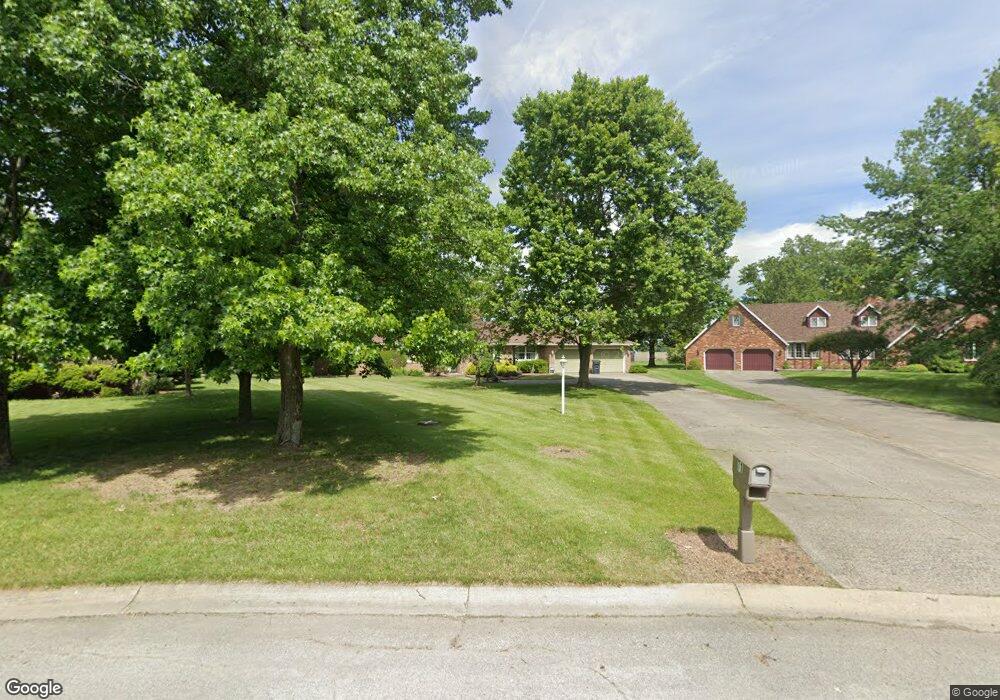
71 Westwood Dr Fremont, OH 43420
Estimated Value: $251,000 - $281,644
3
Beds
3
Baths
2,056
Sq Ft
$128/Sq Ft
Est. Value
About This Home
This home is located at 71 Westwood Dr, Fremont, OH 43420 and is currently estimated at $262,411, approximately $127 per square foot. 71 Westwood Dr is a home located in Sandusky County with nearby schools including Fremont Ross High School and St. Joseph School.
Ownership History
Date
Name
Owned For
Owner Type
Purchase Details
Closed on
Dec 24, 2021
Sold by
Benson Christopher J
Bought by
Benson Rachael M
Current Estimated Value
Purchase Details
Closed on
Jun 22, 2016
Sold by
Benson Rachael M
Bought by
Rachael M Benson and Christopher J /Surv
Home Financials for this Owner
Home Financials are based on the most recent Mortgage that was taken out on this home.
Interest Rate
3.54%
Purchase Details
Closed on
Jul 17, 2013
Sold by
Benson Christopher J
Bought by
Benson Rachael M
Purchase Details
Closed on
Aug 29, 2008
Sold by
Wilkins Gary L and Wilkins Judith L
Bought by
Benson Christopher J and Benson Rachael M
Home Financials for this Owner
Home Financials are based on the most recent Mortgage that was taken out on this home.
Original Mortgage
$172,900
Interest Rate
6.31%
Mortgage Type
Purchase Money Mortgage
Purchase Details
Closed on
Feb 1, 1993
Bought by
Benson Rachael M and Benson Christopher J
Create a Home Valuation Report for This Property
The Home Valuation Report is an in-depth analysis detailing your home's value as well as a comparison with similar homes in the area
Home Values in the Area
Average Home Value in this Area
Purchase History
| Date | Buyer | Sale Price | Title Company |
|---|---|---|---|
| Benson Rachael M | -- | None Listed On Document | |
| Rachael M Benson | -- | -- | |
| Benson Rachael M | -- | Attorney | |
| Benson Christopher J | $182,000 | First American | |
| Benson Rachael M | $124,000 | -- |
Source: Public Records
Mortgage History
| Date | Status | Borrower | Loan Amount |
|---|---|---|---|
| Previous Owner | Rachael M Benson | -- | |
| Previous Owner | Benson Christopher J | $172,900 |
Source: Public Records
Tax History Compared to Growth
Tax History
| Year | Tax Paid | Tax Assessment Tax Assessment Total Assessment is a certain percentage of the fair market value that is determined by local assessors to be the total taxable value of land and additions on the property. | Land | Improvement |
|---|---|---|---|---|
| 2024 | $2,722 | $70,000 | $14,770 | $55,230 |
| 2023 | $2,722 | $56,950 | $12,010 | $44,940 |
| 2022 | $2,365 | $56,950 | $12,010 | $44,940 |
| 2021 | $2,436 | $56,950 | $12,010 | $44,940 |
| 2020 | $2,387 | $54,680 | $12,010 | $42,670 |
| 2019 | $2,385 | $54,680 | $12,010 | $42,670 |
| 2018 | $2,267 | $54,680 | $12,010 | $42,670 |
| 2017 | $2,214 | $51,880 | $12,010 | $39,870 |
| 2016 | $1,940 | $51,880 | $12,010 | $39,870 |
| 2015 | $1,909 | $51,880 | $12,010 | $39,870 |
| 2014 | $1,972 | $51,350 | $11,480 | $39,870 |
| 2013 | $1,931 | $51,350 | $11,480 | $39,870 |
Source: Public Records
Map
Nearby Homes
- 17 Adams Dr
- 2484 Buckland Ave
- 2020 Elm Dr
- 822 Upton Rd
- 1719 Buckland Ave
- 614 3rd Ave
- 2242 Napoleon Rd
- 855 Rambo Ln
- 520 Everett Rd
- 515 Everett Rd
- 880 Cleveland Ave
- 43 Sun Valley Dr Unit 43
- 1485 Autumn Woods Dr
- 115 N Taft Ave
- 2119 Lake St
- 1611 Mcpherson Blvd
- 10 Meadowbrook Dr
- 10 Meadowbrook Ln
- 816 Lime St
- 1342 Mcpherson Blvd