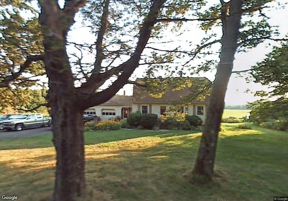
71 Whittemore St Leicester, MA 01524
Estimated Value: $507,993 - $660,000
3
Beds
2
Baths
2,311
Sq Ft
$246/Sq Ft
Est. Value
About This Home
This home is located at 71 Whittemore St, Leicester, MA 01524 and is currently estimated at $567,498, approximately $245 per square foot. 71 Whittemore St is a home located in Worcester County with nearby schools including Leicester Integrated Preschool, Leicester Memorial Elementary School, and Leicester Middle School.
Ownership History
Date
Name
Owned For
Owner Type
Purchase Details
Closed on
Nov 15, 2010
Sold by
Bennett Elmer W
Bought by
Suprenant Arthur H and Suprenant Christine L
Current Estimated Value
Purchase Details
Closed on
Oct 1, 2010
Sold by
Fountaine Clifford and Hanrahan Cathleen
Bought by
Supernant John R and Supernant Carl W
Purchase Details
Closed on
Jan 7, 2008
Sold by
Suprenant Christine L
Bought by
Suprenant Rt and Suprenant
Create a Home Valuation Report for This Property
The Home Valuation Report is an in-depth analysis detailing your home's value as well as a comparison with similar homes in the area
Home Values in the Area
Average Home Value in this Area
Purchase History
| Date | Buyer | Sale Price | Title Company |
|---|---|---|---|
| Suprenant Arthur H | $10,000 | -- | |
| Suprenant Arthur H | $10,000 | -- | |
| Suprenant Arthur H | $10,000 | -- | |
| Supernant John R | $16,000 | -- | |
| Supernant John R | $16,000 | -- | |
| Supernant John R | $16,000 | -- | |
| Suprenant Rt | -- | -- | |
| Suprenant Rt | -- | -- | |
| Suprenant Rt | -- | -- |
Source: Public Records
Tax History Compared to Growth
Tax History
| Year | Tax Paid | Tax Assessment Tax Assessment Total Assessment is a certain percentage of the fair market value that is determined by local assessors to be the total taxable value of land and additions on the property. | Land | Improvement |
|---|---|---|---|---|
| 2025 | $5,001 | $424,900 | $77,000 | $347,900 |
| 2024 | $4,731 | $377,000 | $66,600 | $310,400 |
| 2023 | $4,507 | $350,500 | $66,600 | $283,900 |
| 2022 | $4,344 | $310,500 | $63,600 | $246,900 |
| 2021 | $4,646 | $307,100 | $63,600 | $243,500 |
| 2020 | $4,276 | $286,800 | $62,100 | $224,700 |
| 2019 | $4,005 | $265,600 | $55,700 | $209,900 |
| 2018 | $3,836 | $238,400 | $55,700 | $182,700 |
| 2017 | $3,655 | $236,100 | $55,700 | $180,400 |
| 2016 | $3,640 | $244,300 | $69,400 | $174,900 |
Source: Public Records
Map
Nearby Homes
- Lot B Paxton St
- Lot A Paxton St
- 56 Lake Sargent Dr
- 27 Winslow Ave
- 0 S Main St Unit 73392435
- 0 Hawthorne St Unit 73444632
- 1326 Main St
- 80 Rawson St
- 1472 Main St
- 1569 Main St
- 390 Marshall St
- 350 Marshall St
- 502 Pine St
- 500 Main St
- 135 Henshaw St
- 19 Laurelwood Ave
- 19 South St
- 23 South St
- 10 Conway Dr
- 18 Brown St
- 75 Whittemore St
- 67 Whittemore St
- 100 Whittemore St
- 28 Washburn St
- 233 Paxton St
- 17 Whittemore St
- 243 Paxton St
- 217 Paxton St
- 1 Washburn St
- 12 Whittemore St
- 27 Washburn St
- 230 Paxton St
- Lot 0 Route 56
- 0 Route 56 Unit 71612111
- 0 Route 56 Unit 71612109
- 0 Route 56 Unit 71940327
- 0 Route 56 Unit 72580403
- 0 Camelot Unit 30421183
- 00 Smugglers Cove
- Lot 9 Smugglers Cove