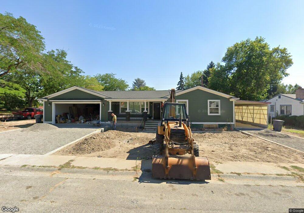
71 Willis St Richland, WA 99354
Estimated Value: $366,000 - $463,000
4
Beds
2
Baths
1,570
Sq Ft
$261/Sq Ft
Est. Value
About This Home
This home is located at 71 Willis St, Richland, WA 99354 and is currently estimated at $409,716, approximately $260 per square foot. 71 Willis St is a home located in Benton County with nearby schools including Jefferson Elementary School, Chief Joseph Middle School, and Hanford High School.
Ownership History
Date
Name
Owned For
Owner Type
Purchase Details
Closed on
Jan 11, 2023
Sold by
Wallace Living Trust
Bought by
Wallace Special Needs Trust
Current Estimated Value
Purchase Details
Closed on
Apr 24, 2017
Sold by
Wallace Joyce R
Bought by
Wallace Joyce R and Wallace Bennett Leonard
Purchase Details
Closed on
Jan 17, 2017
Sold by
Wallace Joyce R
Bought by
Wallace Joyce R and Wallace Bennett Leonard
Purchase Details
Closed on
Aug 4, 2016
Sold by
Janos Wanda K
Bought by
Wallace Joyce and Wallace Ben
Create a Home Valuation Report for This Property
The Home Valuation Report is an in-depth analysis detailing your home's value as well as a comparison with similar homes in the area
Home Values in the Area
Average Home Value in this Area
Purchase History
| Date | Buyer | Sale Price | Title Company |
|---|---|---|---|
| Wallace Special Needs Trust | -- | -- | |
| Wallace Joyce R | -- | None Available | |
| Wallace Joyce R | -- | None Available | |
| Wallace Joyce | $135,000 | Cascade Title Company |
Source: Public Records
Tax History Compared to Growth
Tax History
| Year | Tax Paid | Tax Assessment Tax Assessment Total Assessment is a certain percentage of the fair market value that is determined by local assessors to be the total taxable value of land and additions on the property. | Land | Improvement |
|---|---|---|---|---|
| 2024 | $2,924 | $340,240 | $50,000 | $290,240 |
| 2023 | $2,924 | $310,470 | $50,000 | $260,470 |
| 2022 | $2,948 | $273,260 | $50,000 | $223,260 |
| 2021 | $2,897 | $265,820 | $50,000 | $215,820 |
| 2020 | $3,073 | $250,930 | $50,000 | $200,930 |
| 2019 | $2,304 | $251,820 | $36,000 | $215,820 |
| 2018 | $2,243 | $202,900 | $36,000 | $166,900 |
| 2017 | $1,866 | $165,120 | $36,000 | $129,120 |
| 2016 | $1,839 | $156,400 | $36,000 | $120,400 |
| 2015 | $1,874 | $156,400 | $36,000 | $120,400 |
| 2014 | -- | $156,400 | $36,000 | $120,400 |
| 2013 | -- | $156,400 | $36,000 | $120,400 |
Source: Public Records
Map
Nearby Homes
- 1920 Howell Ave
- 1912 Hood Ave
- 2045 Davison Ave
- 1918 Pike Ave
- 515 Blue St
- 2110 Davison Ave
- 562 Fuller St
- 1604 Johnston Ave
- 7524 Kohler Rd
- 324 Saint St
- 1609 Judson Ave
- 519 Singletree Ct
- 1914 Mahan Ave
- 1962 Mahan Ave
- 12621 Jayleen Way
- 7004 Ricky Rd
- 609 Torbett St
- 1511 Goethals Dr
- 6626 Elvy Way Unit 12
- 6638 Elvy Way Unit 13
- 73 Willis St
- 70 Mcmurray St
- 1904 Davison Ave
- 75 Willis St
- 1909 Davison Ave
- 1900 Davison Ave
- 72 Willis St
- 74 Mcmurray St
- 1908 Davison Ave
- 1910 Harris Ave
- 74 Willis St
- 77 Willis St
- 1834 Hunt Point
- 1911 Harris Ave
- 1913 Davison Ave
- 76 Mcmurray St
- 71 Mcmurray St
- 1912 Harris Ave
- 1912 Davison Ave
- 73 Mcmurray St