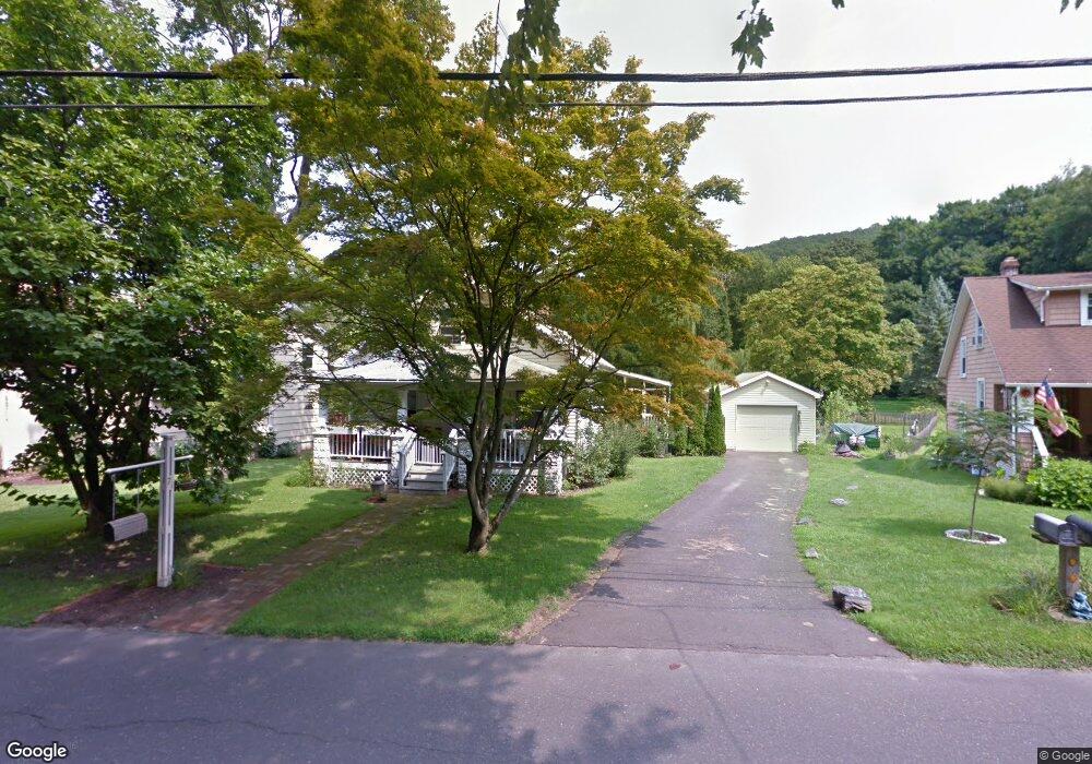
71 Wooster St Bethel, CT 06801
Estimated Value: $395,534 - $446,000
3
Beds
1
Bath
1,238
Sq Ft
$339/Sq Ft
Est. Value
About This Home
This home is located at 71 Wooster St, Bethel, CT 06801 and is currently estimated at $420,134, approximately $339 per square foot. 71 Wooster St is a home located in Fairfield County with nearby schools including R.M.T. Johnson School, Bethel Middle School, and Bethel High School.
Ownership History
Date
Name
Owned For
Owner Type
Purchase Details
Closed on
Dec 23, 2008
Sold by
Muhlfeld Christian
Bought by
Perrefort Dirk and Perrefort Jessica
Current Estimated Value
Home Financials for this Owner
Home Financials are based on the most recent Mortgage that was taken out on this home.
Original Mortgage
$204,000
Outstanding Balance
$135,162
Interest Rate
6.27%
Mortgage Type
Purchase Money Mortgage
Estimated Equity
$284,972
Create a Home Valuation Report for This Property
The Home Valuation Report is an in-depth analysis detailing your home's value as well as a comparison with similar homes in the area
Home Values in the Area
Average Home Value in this Area
Purchase History
| Date | Buyer | Sale Price | Title Company |
|---|---|---|---|
| Perrefort Dirk | $255,000 | -- |
Source: Public Records
Mortgage History
| Date | Status | Borrower | Loan Amount |
|---|---|---|---|
| Open | Perrefort Dirk | $49,541 | |
| Open | Perrefort Dirk | $204,000 | |
| Closed | Perrefort Dirk | $51,000 | |
| Closed | Perrefort Dirk | $8,250 |
Source: Public Records
Tax History Compared to Growth
Tax History
| Year | Tax Paid | Tax Assessment Tax Assessment Total Assessment is a certain percentage of the fair market value that is determined by local assessors to be the total taxable value of land and additions on the property. | Land | Improvement |
|---|---|---|---|---|
| 2025 | $5,858 | $192,640 | $79,660 | $112,980 |
| 2024 | $5,619 | $192,640 | $79,660 | $112,980 |
| 2023 | $5,477 | $192,640 | $79,660 | $112,980 |
| 2022 | $4,942 | $142,870 | $79,660 | $63,210 |
| 2021 | $4,895 | $142,870 | $79,660 | $63,210 |
| 2020 | $4,820 | $142,870 | $79,660 | $63,210 |
| 2019 | $4,773 | $142,870 | $79,660 | $63,210 |
| 2018 | $4,696 | $142,870 | $79,660 | $63,210 |
| 2017 | $4,552 | $138,430 | $65,770 | $72,660 |
| 2016 | $4,453 | $138,430 | $65,770 | $72,660 |
| 2015 | $4,455 | $138,430 | $65,770 | $72,660 |
| 2014 | $4,445 | $138,430 | $65,770 | $72,660 |
Source: Public Records
Map
Nearby Homes
- 51 Kingswood Dr
- 12 Eagle Rock Hill Unit 12
- 2 Chestnut St
- 17 Briar Ridge Dr Unit 17
- 121 Great Hill Dr Unit 121
- 10 South St Unit 66
- 48 & 50 Nashville Rd
- 27 Crows Nest Ln Unit 8F
- 80 Tucker St Unit 80
- 66 Nashville Rd Unit L
- 95 Chestnut St Unit D
- 37 Whittlesey Dr
- 2 Judd Ave
- 32 Crows Nest Ln Unit 23
- 4 Bailey Blvd Unit 4
- 302 Lexington Blvd Unit 302
- 148 Grassy Plain St Unit B
- 21 Oven Rock Rd
- 3 Terry Dr
- 4 Winthrop Rd
- 69 Wooster St
- 73 Wooster St
- 67 Wooster St
- 63 Wooster St
- 15 Juniper Rd
- 17 Juniper Rd Unit 19
- 73 1/2 Wooster St
- 59 Wooster St
- 39 Juniper Rd
- 37-39 Juniper Rd
- 43 Juniper Rd
- 13 Juniper Rd
- 55 Wooster St
- 5 Juniper Rd
- 21 Juniper Rd Unit 23
- 66 Wooster St Unit 66A
- 66 Wooster St Unit A
- 9 Juniper Rd Unit 11
- 45 Juniper Rd
- 45 Juniper Rd Unit 45