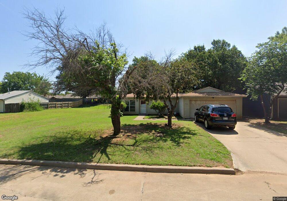
710 Catherine Ln Duncan, OK 73533
Estimated Value: $134,069 - $190,000
5
Beds
2
Baths
1,533
Sq Ft
$99/Sq Ft
Est. Value
About This Home
This home is located at 710 Catherine Ln, Duncan, OK 73533 and is currently estimated at $151,517, approximately $98 per square foot. 710 Catherine Ln is a home located in Stephens County with nearby schools including Mark Twain Elementary School, Duncan Middle School, and Duncan High School.
Ownership History
Date
Name
Owned For
Owner Type
Purchase Details
Closed on
Mar 11, 2005
Sold by
Boydston Jay D and Boydston Lori A
Bought by
Davis Geoffrey Scott and Davis Julia Lynn
Current Estimated Value
Home Financials for this Owner
Home Financials are based on the most recent Mortgage that was taken out on this home.
Original Mortgage
$78,370
Outstanding Balance
$40,201
Interest Rate
5.89%
Mortgage Type
FHA
Estimated Equity
$111,316
Create a Home Valuation Report for This Property
The Home Valuation Report is an in-depth analysis detailing your home's value as well as a comparison with similar homes in the area
Purchase History
| Date | Buyer | Sale Price | Title Company |
|---|---|---|---|
| Davis Geoffrey Scott | $79,500 | None Available |
Source: Public Records
Mortgage History
| Date | Status | Borrower | Loan Amount |
|---|---|---|---|
| Open | Davis Geoffrey Scott | $78,370 |
Source: Public Records
Tax History
| Year | Tax Paid | Tax Assessment Tax Assessment Total Assessment is a certain percentage of the fair market value that is determined by local assessors to be the total taxable value of land and additions on the property. | Land | Improvement |
|---|---|---|---|---|
| 2025 | -- | $8,021 | $774 | $7,247 |
| 2024 | -- | $7,561 | $774 | $6,787 |
| 2023 | $0 | $7,561 | $774 | $6,787 |
| 2022 | $0 | $7,341 | $774 | $6,567 |
| 2021 | $593 | $7,127 | $774 | $6,353 |
| 2020 | $593 | $6,718 | $774 | $5,944 |
| 2019 | $713 | $6,522 | $774 | $5,748 |
| 2018 | $0 | $6,673 | $774 | $5,899 |
| 2017 | $629 | $6,811 | $774 | $6,037 |
| 2016 | $629 | $8,401 | $774 | $7,627 |
| 2015 | $713 | $8,157 | $774 | $7,383 |
| 2014 | $713 | $7,919 | $880 | $7,039 |
Source: Public Records
Map
Nearby Homes
- 602 Fieldcrest Dr
- TBD S 27th St
- 2622 Highcrest Dr
- 2110 W Main St
- 2150 W Main St
- 208 N 29th St
- 261 N 29th St
- 0 W Beech Ave
- 209 N 22nd St
- 2006 W Oak Ave
- 174831 N 2844 Rd
- 168466 9 Mile Rd
- 1905 W Ash Ave
- 451 S 11th St
- 711 S 12th St
- 1405 Lizabeth Dr
- 1109 W Stephens Ave
- 123 N Highway 81
- 1705 W Ash Ave
- 1510 Lizabeth Dr
- 714 Catherine Ln
- 718 Catherine Ln
- 609 Westridge Dr
- 702 Catherine Ln
- 605 Westridge Dr
- 701 Westridge Dr
- 2801 Jennifer Ct
- 601 Westridge Dr
- 720 Catherine Ln
- 2802 Johnathan Place
- 624 Catherine Ln
- 705 Westridge Dr
- 170033 N 2740 Rd
- 273979 E 1710 Rd
- 2805 Jennifer Ct
- 2806 Johnathan Place
- 509 Westridge Dr
- 724 Catherine Ln
- 509 Westridge Dr
- 2802 Jennifer Ct
Your Personal Tour Guide
Ask me questions while you tour the home.