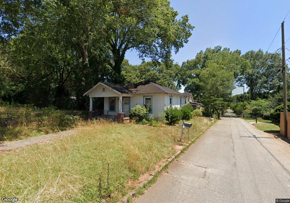
710 Dalerose Ave Decatur, GA 30030
Estimated Value: $544,000 - $2,201,068
--
Bed
--
Bath
918
Sq Ft
$1,215/Sq Ft
Est. Value
About This Home
This home is located at 710 Dalerose Ave, Decatur, GA 30030 and is currently estimated at $1,115,517, approximately $1,215 per square foot. 710 Dalerose Ave is a home with nearby schools including Avondale Elementary School, Druid Hills Middle School, and Druid Hills High School.
Ownership History
Date
Name
Owned For
Owner Type
Purchase Details
Closed on
Jul 17, 2025
Sold by
Baum Matthew
Bought by
Overlook At Avondale Lp
Current Estimated Value
Purchase Details
Closed on
Oct 18, 2023
Sold by
Gargiulo Joseph C
Bought by
Overlook At Avondale Lp
Purchase Details
Closed on
Oct 17, 2023
Sold by
Gargiulo Joseph C
Bought by
Overlook At Avondale Lp
Purchase Details
Closed on
May 19, 2004
Sold by
Pittman Fred E
Bought by
Pittman Fred E
Create a Home Valuation Report for This Property
The Home Valuation Report is an in-depth analysis detailing your home's value as well as a comparison with similar homes in the area
Home Values in the Area
Average Home Value in this Area
Purchase History
| Date | Buyer | Sale Price | Title Company |
|---|---|---|---|
| Overlook At Avondale Lp | -- | -- | |
| Overlook At Avondale Lp | $2,100,000 | -- | |
| Overlook At Avondale Lp | $2,100,000 | -- | |
| Pittman Fred E | -- | -- |
Source: Public Records
Tax History Compared to Growth
Tax History
| Year | Tax Paid | Tax Assessment Tax Assessment Total Assessment is a certain percentage of the fair market value that is determined by local assessors to be the total taxable value of land and additions on the property. | Land | Improvement |
|---|---|---|---|---|
| 2025 | $10,758 | $136,920 | $42,360 | $94,560 |
| 2024 | $5,600 | $111,920 | $42,360 | $69,560 |
| 2023 | $5,600 | $109,160 | $37,680 | $71,480 |
| 2022 | $4,788 | $89,680 | $36,000 | $53,680 |
| 2021 | $4,423 | $82,000 | $36,000 | $46,000 |
| 2020 | $3,850 | $83,520 | $36,000 | $47,520 |
| 2019 | $2,009 | $85,800 | $40,000 | $45,800 |
| 2018 | $2,078 | $42,520 | $14,882 | $27,638 |
| 2017 | $2,017 | $42,520 | $14,882 | $27,638 |
| 2016 | $2,028 | $42,520 | $14,882 | $27,638 |
| 2014 | $1,819 | $42,520 | $14,720 | $27,800 |
Source: Public Records
Map
Nearby Homes
- 2773 Craigie Ave
- 827 Derrydown Way
- 2630 Talley St Unit 326
- 2630 Talley St Unit 106
- 874 Ashwood Walk
- 847 Regal Path Ln
- 408 Sycamore Dr Unit D
- 230 New St Unit 2201-47
- 230 New St Unit 2201-4
- 221 Mountain View St
- 2600 New St Unit 2203
- Olmstead Plan at New Talley Station - Stacks
- Dalton Plan at New Talley Station - Stacks
- McKoy Plan at New Talley Station - Stacks
- 201 New St Unit 2304-105
- 201 New St Unit 2304-1
- 201 New St Unit 2203-1
- 201 New St Unit 2203-101
- 201 New St Unit 2305-108
- 201 New St Unit 2305-1
- 718 Dalerose Ave
- 717 Dalerose Ave
- 722 Dalerose Ave
- 717 Brown Place
- 728 Dalerose Ave Unit 2
- 728 Dalerose Ave
- 730 Dalerose Ave
- 729 Dalerose Ave
- 716 Hillmont Ave
- 722 Hillmont Ave
- 729 Brown Place
- 734 Dalerose Ave
- 735 Dalerose Ave
- 726 Hillmont Ave
- 0 Hillmont Ave Unit 7471852
- 0 Hillmont Ave Unit 7267638
- 0 Hillmont Ave Unit 8805969
- 0 Hillmont Ave Unit 8766767
- 0 Hillmont Ave Unit 8693649
- 0 Hillmont Ave Unit 8533027