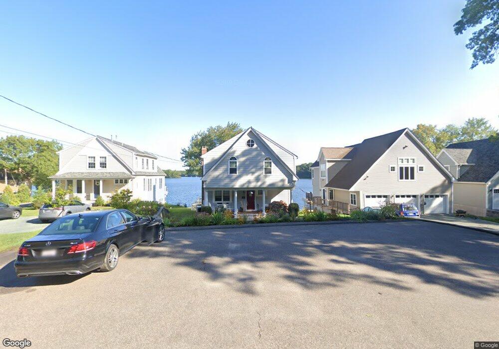
710 Eastside Rd Wrentham, MA 02093
Estimated Value: $847,258 - $1,071,000
3
Beds
3
Baths
1,710
Sq Ft
$550/Sq Ft
Est. Value
About This Home
This home is located at 710 Eastside Rd, Wrentham, MA 02093 and is currently estimated at $940,565, approximately $550 per square foot. 710 Eastside Rd is a home located in Norfolk County with nearby schools including Delaney Elementary School and Charles E Roderick.
Ownership History
Date
Name
Owned For
Owner Type
Purchase Details
Closed on
May 14, 2020
Sold by
Burke Beverly L
Bought by
Burke Ft
Current Estimated Value
Purchase Details
Closed on
Dec 15, 2016
Sold by
Burke David M and Burke Beverly L
Bought by
Deberghes Adrien E and Deberghes Kristen P
Purchase Details
Closed on
Dec 31, 1984
Bought by
Burke David M and Burke Beverly L
Create a Home Valuation Report for This Property
The Home Valuation Report is an in-depth analysis detailing your home's value as well as a comparison with similar homes in the area
Purchase History
| Date | Buyer | Sale Price | Title Company |
|---|---|---|---|
| Burke Ft | -- | None Available | |
| Deberghes Adrien E | -- | -- | |
| Burke David M | -- | -- |
Source: Public Records
Mortgage History
| Date | Status | Borrower | Loan Amount |
|---|---|---|---|
| Previous Owner | Burke David M | $200,000 |
Source: Public Records
Tax History
| Year | Tax Paid | Tax Assessment Tax Assessment Total Assessment is a certain percentage of the fair market value that is determined by local assessors to be the total taxable value of land and additions on the property. | Land | Improvement |
|---|---|---|---|---|
| 2025 | $9,927 | $856,500 | $468,100 | $388,400 |
| 2024 | $9,688 | $807,300 | $468,100 | $339,200 |
| 2023 | $8,922 | $707,000 | $419,500 | $287,500 |
| 2022 | $8,104 | $592,800 | $345,100 | $247,700 |
| 2021 | $8,571 | $609,200 | $381,500 | $227,700 |
| 2020 | $9,047 | $634,900 | $388,300 | $246,600 |
| 2019 | $8,999 | $637,300 | $402,100 | $235,200 |
| 2018 | $8,840 | $620,800 | $403,800 | $217,000 |
| 2017 | $8,627 | $605,400 | $395,600 | $209,800 |
| 2016 | $8,457 | $592,200 | $384,100 | $208,100 |
| 2015 | $8,504 | $567,700 | $369,300 | $198,400 |
| 2014 | $8,394 | $548,300 | $355,200 | $193,100 |
Source: Public Records
Map
Nearby Homes
- 12 Earle Stewart Ln
- 2 Earle Stewart Ln
- 10 Earle Stewart Ln Unit Lot 5
- 3 Earle Stewart Ln
- 135 Creek St Unit 2
- 500 Franklin St
- 10 Nature View Dr
- 15 Nature View Dr
- 440 Chestnut St
- 50 Reed Fulton Ave Unit Lot 61
- 613 West St
- 955 Summer St
- 1222 South St
- 45 Joshua Rd
- 75 Jordan Rd
- 282 Thurston St
- 3 Oak View Terrace Unit 3
- 0 Fall Ln
- 246 Forest Grove Ave
- 440 South St
- 700 Eastside Rd
- 720 Eastside Rd
- 690 Eastside Rd
- 730 Eastside Rd
- 740 Eastside Rd
- 680 Eastside Rd
- 750 Eastside Rd
- 670 Eastside Rd
- 660 Eastside Rd
- 735 Eastside Rd
- 760 Eastside Rd
- 650 Eastside Rd
- 770 Eastside Rd
- 640 Eastside Rd
- 780 Eastside Rd
- 610 Eastside Rd
- 800 Eastside Rd
- 600 Eastside Rd
- 810 Eastside Rd
- 590 Eastside Rd
Your Personal Tour Guide
Ask me questions while you tour the home.