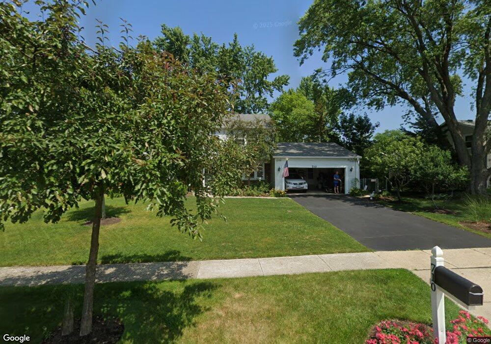
710 Essington Ln Buffalo Grove, IL 60089
Estimated Value: $517,238 - $593,000
--
Bed
3
Baths
2,136
Sq Ft
$261/Sq Ft
Est. Value
About This Home
This home is located at 710 Essington Ln, Buffalo Grove, IL 60089 and is currently estimated at $558,310, approximately $261 per square foot. 710 Essington Ln is a home located in Lake County with nearby schools including Ivy Hall Elementary School, Twin Groves Middle School, and Adlai E Stevenson High School.
Ownership History
Date
Name
Owned For
Owner Type
Purchase Details
Closed on
Sep 30, 1998
Sold by
Magrini Peter A and Magrini Cheryl T
Bought by
Oneill William J and Oneill Pamela E
Current Estimated Value
Home Financials for this Owner
Home Financials are based on the most recent Mortgage that was taken out on this home.
Original Mortgage
$154,000
Outstanding Balance
$33,717
Interest Rate
6.9%
Estimated Equity
$524,593
Create a Home Valuation Report for This Property
The Home Valuation Report is an in-depth analysis detailing your home's value as well as a comparison with similar homes in the area
Home Values in the Area
Average Home Value in this Area
Purchase History
| Date | Buyer | Sale Price | Title Company |
|---|---|---|---|
| Oneill William J | $240,000 | -- |
Source: Public Records
Mortgage History
| Date | Status | Borrower | Loan Amount |
|---|---|---|---|
| Open | Oneill William J | $154,000 |
Source: Public Records
Tax History Compared to Growth
Tax History
| Year | Tax Paid | Tax Assessment Tax Assessment Total Assessment is a certain percentage of the fair market value that is determined by local assessors to be the total taxable value of land and additions on the property. | Land | Improvement |
|---|---|---|---|---|
| 2024 | $12,225 | $143,261 | $33,966 | $109,295 |
| 2023 | $12,485 | $135,177 | $32,049 | $103,128 |
| 2022 | $12,485 | $130,729 | $30,994 | $99,735 |
| 2021 | $12,006 | $129,320 | $30,660 | $98,660 |
| 2020 | $11,961 | $132,155 | $30,765 | $101,390 |
| 2019 | $12,283 | $131,668 | $30,652 | $101,016 |
| 2018 | $11,025 | $122,393 | $30,293 | $92,100 |
| 2017 | $10,815 | $119,536 | $29,586 | $89,950 |
| 2016 | $10,531 | $114,465 | $28,331 | $86,134 |
| 2015 | $10,250 | $107,047 | $26,495 | $80,552 |
| 2014 | $9,390 | $97,232 | $28,456 | $68,776 |
| 2012 | $9,311 | $97,427 | $28,513 | $68,914 |
Source: Public Records
Map
Nearby Homes
- 800 Clohesey Dr
- 610 Checker Dr
- 931 Shady Grove Ln
- 711 Woodhollow Ln
- 950 Belmar Ln
- 12 Cloverdale Ct
- 390 Springside Ln
- 1141 Devonshire Rd
- 887 Saybrook Ln Unit 2
- 1032 Courtland Dr Unit 9
- 1265 Devonshire Rd
- 412 Chateau Dr
- 1325 Fairfax Ln
- 746 Old Checker Rd Unit E5
- 1324 Fairfax Ln Unit B32
- 1112 Auburn Ln
- 310 Lakeview Ct
- 221 Thornapple Ct
- 1118 Larraway Dr
- 1113 Lockwood Dr
- 720 Essington Ln
- 590 Twisted Oak Ln
- 600 Twisted Oak Ln
- 730 Essington Ln
- 711 Essington Ln
- 721 Essington Ln
- 691 Essington Ln
- 610 Twisted Oak Ln
- 740 Essington Ln
- 731 Essington Ln
- 681 Essington Ln
- 670 Essington Ln
- 741 Essington Ln
- 671 Essington Ln
- 700 Indian Spring Ln
- 710 Indian Spring Ln
- 601 Twisted Oak Ln
- 750 Essington Ln
- 690 Indian Spring Ln