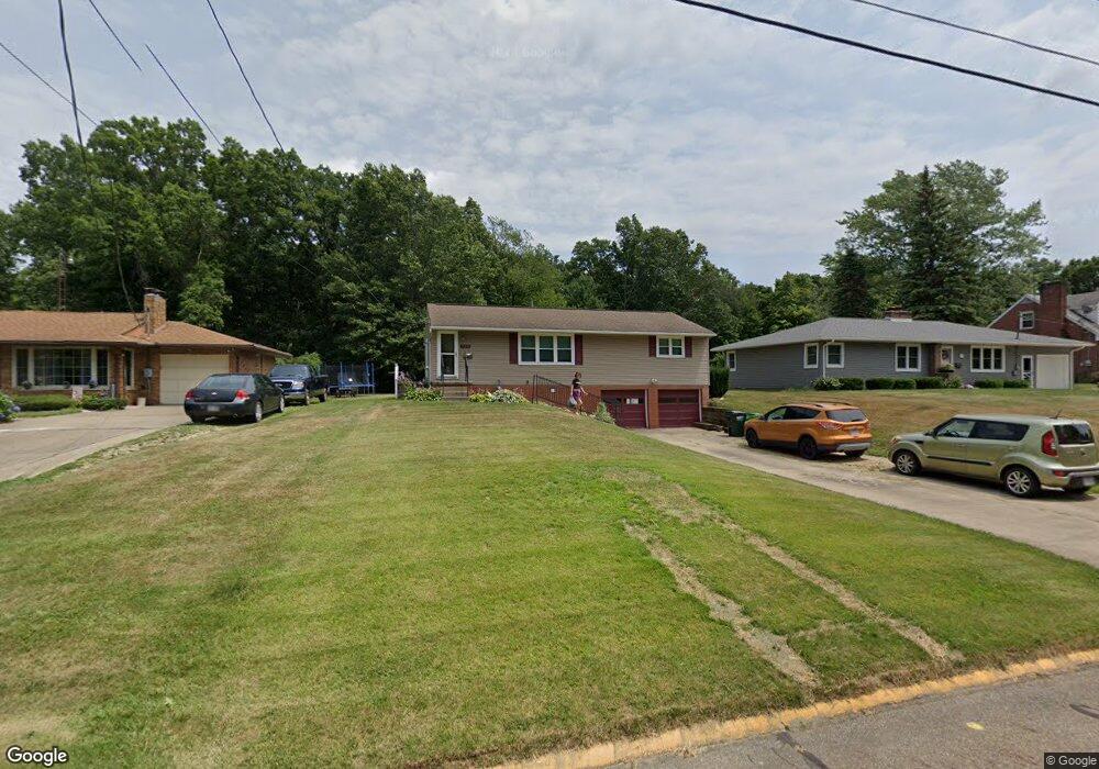
710 Fernwood Blvd Alliance, OH 44601
Estimated Value: $170,000 - $199,000
3
Beds
2
Baths
1,144
Sq Ft
$160/Sq Ft
Est. Value
About This Home
This home is located at 710 Fernwood Blvd, Alliance, OH 44601 and is currently estimated at $182,914, approximately $159 per square foot. 710 Fernwood Blvd is a home located in Stark County with nearby schools including Alliance Early Learning School, Alliance Intermediate School at Northside, and Alliance Middle School.
Ownership History
Date
Name
Owned For
Owner Type
Purchase Details
Closed on
Jul 7, 2005
Sold by
Robenstine Christine M and Robenstine Rick L
Bought by
Buzzelli Michael John
Current Estimated Value
Home Financials for this Owner
Home Financials are based on the most recent Mortgage that was taken out on this home.
Original Mortgage
$96,400
Outstanding Balance
$50,614
Interest Rate
5.75%
Mortgage Type
Fannie Mae Freddie Mac
Estimated Equity
$132,300
Purchase Details
Closed on
Jan 15, 1999
Sold by
Burns Pete and Burns Jane F
Bought by
Shivers Christine M
Home Financials for this Owner
Home Financials are based on the most recent Mortgage that was taken out on this home.
Original Mortgage
$70,000
Interest Rate
6.79%
Mortgage Type
Purchase Money Mortgage
Purchase Details
Closed on
Jun 24, 1997
Sold by
Chaplin Bill R
Bought by
Burns Pete and Burns Jane
Home Financials for this Owner
Home Financials are based on the most recent Mortgage that was taken out on this home.
Original Mortgage
$50,000
Interest Rate
8.01%
Mortgage Type
New Conventional
Create a Home Valuation Report for This Property
The Home Valuation Report is an in-depth analysis detailing your home's value as well as a comparison with similar homes in the area
Home Values in the Area
Average Home Value in this Area
Purchase History
| Date | Buyer | Sale Price | Title Company |
|---|---|---|---|
| Buzzelli Michael John | $96,500 | -- | |
| Shivers Christine M | $87,500 | -- | |
| Burns Pete | $80,000 | -- |
Source: Public Records
Mortgage History
| Date | Status | Borrower | Loan Amount |
|---|---|---|---|
| Open | Buzzelli Michael John | $96,400 | |
| Previous Owner | Shivers Christine M | $70,000 | |
| Previous Owner | Burns Pete | $50,000 |
Source: Public Records
Tax History Compared to Growth
Tax History
| Year | Tax Paid | Tax Assessment Tax Assessment Total Assessment is a certain percentage of the fair market value that is determined by local assessors to be the total taxable value of land and additions on the property. | Land | Improvement |
|---|---|---|---|---|
| 2025 | -- | $46,870 | $15,020 | $31,850 |
| 2024 | -- | $46,870 | $15,020 | $31,850 |
| 2023 | $1,601 | $39,830 | $11,480 | $28,350 |
| 2022 | $1,611 | $39,830 | $11,480 | $28,350 |
| 2021 | $1,613 | $39,830 | $11,480 | $28,350 |
| 2020 | $1,484 | $34,240 | $9,980 | $24,260 |
| 2019 | $1,463 | $34,240 | $9,980 | $24,260 |
| 2018 | $1,470 | $34,240 | $9,980 | $24,260 |
| 2017 | $1,427 | $32,690 | $8,330 | $24,360 |
| 2016 | $1,292 | $29,370 | $8,330 | $21,040 |
| 2015 | $1,304 | $29,370 | $8,330 | $21,040 |
| 2014 | $1,273 | $27,310 | $7,740 | $19,570 |
| 2013 | $635 | $27,310 | $7,740 | $19,570 |
Source: Public Records
Map
Nearby Homes
- 1038 Fairview Place
- 734 Parkway Blvd
- 970 Kingsway St
- 896 Parkway Blvd
- 725 W Summit St
- 565 W Broadway St
- 738 Kingsway St
- 645 W Summit St
- 1201 Overlook Dr
- 1321 Parkway Blvd
- 345 W Market St
- 0 W Main St Unit 5090123
- 329 1/2 W Main St
- 1515 S Rockhill Ave
- 140 W Summit St
- 132 S Haines Ave
- 432 Johnson Ave
- 511 W Ely St
- 163 W Market St
- 884 W College Rd
- 720 Fernwood Blvd
- 690 Fernwood Blvd
- 680 Fernwood Blvd
- 740 Fernwood Blvd
- 660 Fernwood Blvd
- 760 Fernwood Blvd
- 804 Fernwood Blvd
- 711 Fairview Place
- 630 Fernwood Blvd
- 812 Fernwood Blvd
- 729 Fairview Place
- 689 Fairview Place
- 820 Fernwood Blvd
- 671 Fairview Place
- 757 Fairview Place
- 1180 W Cambridge St
- 649 Fairview Place
- 811 Fairview Place
- 1190 Marion Ct
- 848 Fernwood Blvd