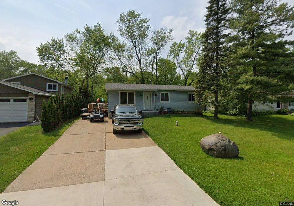
710 Harry Paul Dr Lake Orion, MI 48362
Estimated Value: $231,375 - $288,000
3
Beds
1
Bath
960
Sq Ft
$264/Sq Ft
Est. Value
About This Home
This home is located at 710 Harry Paul Dr, Lake Orion, MI 48362 and is currently estimated at $253,344, approximately $263 per square foot. 710 Harry Paul Dr is a home located in Oakland County with nearby schools including Orion Oaks Elementary School, Oakview Middle School, and Lake Orion Community High School.
Ownership History
Date
Name
Owned For
Owner Type
Purchase Details
Closed on
Jan 4, 2011
Sold by
Hartsoe Sandra K and Mortgage Electronic Registrati
Bought by
Deutsche Bank National Trust Company
Current Estimated Value
Purchase Details
Closed on
Dec 12, 1995
Sold by
Washburn Joe W
Bought by
Hartsoe Sandra K
Home Financials for this Owner
Home Financials are based on the most recent Mortgage that was taken out on this home.
Original Mortgage
$81,186
Interest Rate
7.43%
Create a Home Valuation Report for This Property
The Home Valuation Report is an in-depth analysis detailing your home's value as well as a comparison with similar homes in the area
Home Values in the Area
Average Home Value in this Area
Purchase History
| Date | Buyer | Sale Price | Title Company |
|---|---|---|---|
| Deutsche Bank National Trust Company | $123,445 | None Available | |
| Hartsoe Sandra K | $81,400 | -- |
Source: Public Records
Mortgage History
| Date | Status | Borrower | Loan Amount |
|---|---|---|---|
| Previous Owner | Hartsoe Sandra K | $81,186 |
Source: Public Records
Tax History Compared to Growth
Tax History
| Year | Tax Paid | Tax Assessment Tax Assessment Total Assessment is a certain percentage of the fair market value that is determined by local assessors to be the total taxable value of land and additions on the property. | Land | Improvement |
|---|---|---|---|---|
| 2024 | $1,839 | $85,550 | $0 | $0 |
| 2023 | $1,753 | $78,620 | $0 | $0 |
| 2022 | $3,059 | $71,360 | $0 | $0 |
| 2021 | $2,627 | $66,660 | $0 | $0 |
| 2020 | $1,601 | $60,200 | $0 | $0 |
| 2019 | $2,350 | $57,280 | $0 | $0 |
| 2018 | $2,292 | $55,380 | $0 | $0 |
| 2017 | $2,211 | $55,380 | $0 | $0 |
| 2016 | $2,193 | $49,890 | $0 | $0 |
| 2015 | -- | $43,400 | $0 | $0 |
| 2014 | -- | $37,850 | $0 | $0 |
| 2011 | -- | $38,390 | $0 | $0 |
Source: Public Records
Map
Nearby Homes
- 0 Susan Marie St
- 411 Heights Rd
- 0000 Garden Dr
- 481 Heights Rd
- 471 Algene St
- 980 Sherry Dr
- 694 Ferndale Ave
- 0000 S Lapeer Rd
- 853 Merritt Ave
- 593 Heights Rd
- 00 Heights Rd
- 769 Markdale St
- 418 Converse Ct
- 498 Green Hill Ln
- 000 King Cir
- 599 Westpointe Ct
- 305 Goldengate St
- 328 S Broadway St
- 985 Fairledge St
- 625 W Clarkston Rd
- 700 Harry Paul Dr
- 720 Harry Paul Dr
- 690 Harry Paul Dr
- 730 Harry Paul Dr
- 771 Alan Dr
- 711 Harry Paul Dr
- 721 Harry Paul Dr
- 691 Alan Dr
- 695 Harry Paul Dr
- 670 Harry Paul Dr
- 250 Buckhorn Dr
- 731 Harry Paul Dr
- 270 Buckhorn Dr
- 691 Harry Paul Dr
- 665 Alan Dr
- 230 Buckhorn Dr
- 760 Alan Dr
- 710 Rochester St
- 730 Alan Dr
- 700 Rochester St