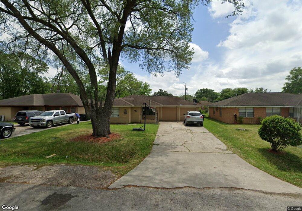
710 Innsdale Dr Houston, TX 77076
Northside-Northline NeighborhoodEstimated Value: $185,000 - $269,000
3
Beds
2
Baths
1,232
Sq Ft
$177/Sq Ft
Est. Value
About This Home
This home is located at 710 Innsdale Dr, Houston, TX 77076 and is currently estimated at $217,828, approximately $176 per square foot. 710 Innsdale Dr is a home located in Harris County with nearby schools including Lyons Elementary School, Burbank Middle School, and Sam Houston Math, Science & Technology Center.
Ownership History
Date
Name
Owned For
Owner Type
Purchase Details
Closed on
Aug 13, 2002
Sold by
Hernandez Mary and Hernandez Mary Gonzalez
Bought by
Chagolla Jose P and Chagolla Catalina
Current Estimated Value
Home Financials for this Owner
Home Financials are based on the most recent Mortgage that was taken out on this home.
Original Mortgage
$71,250
Outstanding Balance
$30,257
Interest Rate
6.6%
Estimated Equity
$187,571
Create a Home Valuation Report for This Property
The Home Valuation Report is an in-depth analysis detailing your home's value as well as a comparison with similar homes in the area
Home Values in the Area
Average Home Value in this Area
Purchase History
| Date | Buyer | Sale Price | Title Company |
|---|---|---|---|
| Chagolla Jose P | -- | North American Title Co |
Source: Public Records
Mortgage History
| Date | Status | Borrower | Loan Amount |
|---|---|---|---|
| Open | Chagolla Jose P | $71,250 |
Source: Public Records
Tax History Compared to Growth
Tax History
| Year | Tax Paid | Tax Assessment Tax Assessment Total Assessment is a certain percentage of the fair market value that is determined by local assessors to be the total taxable value of land and additions on the property. | Land | Improvement |
|---|---|---|---|---|
| 2025 | $3,662 | $175,000 | $72,900 | $102,100 |
| 2024 | $3,662 | $175,000 | $72,900 | $102,100 |
| 2023 | $3,662 | $201,091 | $72,900 | $128,191 |
| 2022 | $3,242 | $147,234 | $38,475 | $108,759 |
| 2021 | $2,913 | $125,000 | $38,475 | $86,525 |
| 2020 | $2,797 | $115,520 | $38,475 | $77,045 |
| 2019 | $2,923 | $115,520 | $38,475 | $77,045 |
| 2018 | $2,095 | $82,789 | $34,425 | $48,364 |
| 2017 | $2,093 | $82,789 | $34,425 | $48,364 |
| 2016 | $2,093 | $82,789 | $34,425 | $48,364 |
| 2015 | $1,901 | $73,947 | $24,300 | $49,647 |
| 2014 | $1,901 | $73,947 | $24,300 | $49,647 |
Source: Public Records
Map
Nearby Homes
- 415 Briarcliff Dr
- 283 Turner Dr
- 1105 Soren Ln
- 219 Heaney Dr
- 9907 Dipping Brook St
- 9905 Dipping Brook St
- 9920 Dipping Woods St
- 9916 Dipping Woods St
- 207 Dipping Stream St
- 9650 E Hardy Rd
- 9913 Dipping Woods St
- 9925 Dipping Woods St
- 9909 Dipping Woods St
- 702 Pennington St
- 202 Burbank St
- 9902 Clark Rd Unit D
- 9902 Clark Rd Unit I
- 9902 Clark Rd Unit G
- 318 Charlock St
- 9026 Mcgallion Rd
- 706 Innsdale Dr
- 714 Innsdale Dr
- 702 Innsdale Dr
- 718 Innsdale Dr
- 711 Dipping Ln
- 715 Dipping Ln
- 707 Dipping Ln
- 801 Dipping Ln
- 703 Dipping Ln
- 606 Innsdale Dr
- 711 Innsdale Dr
- 707 Innsdale Dr
- 715 Innsdale Dr
- 814 Innsdale Dr
- 805 Dipping Ln
- 703 Innsdale Dr
- 611 Dipping Ln
- 719 Innsdale Dr
- 611 Innsdale Dr
- 809 Dipping Ln