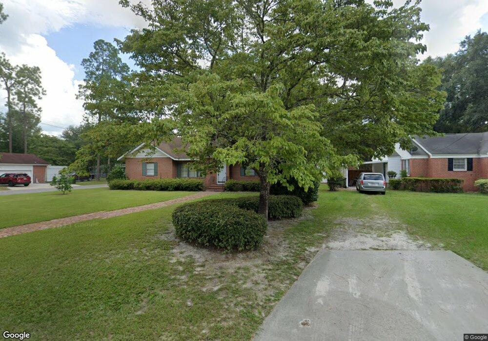
710 Magnolia Dr Waycross, GA 31501
Estimated Value: $210,078 - $227,000
3
Beds
2
Baths
2,040
Sq Ft
$107/Sq Ft
Est. Value
About This Home
This home is located at 710 Magnolia Dr, Waycross, GA 31501 and is currently estimated at $218,270, approximately $106 per square foot. 710 Magnolia Dr is a home located in Ware County with nearby schools including Williams Heights Elementary School, Waycross Middle School, and Ware County High School.
Ownership History
Date
Name
Owned For
Owner Type
Purchase Details
Closed on
Feb 8, 2019
Sold by
Yaun Robert
Bought by
Yaun Robert L
Current Estimated Value
Purchase Details
Closed on
Feb 15, 2000
Sold by
Banks Kyle A and Banks Nicoe
Bought by
Yaun Michele B and Yaun Rob
Purchase Details
Closed on
Oct 31, 1997
Sold by
Parrott Geneva G
Bought by
Banks Kyle A and Banks Nicoe
Purchase Details
Closed on
Aug 22, 1989
Bought by
Parrott Geneva G
Create a Home Valuation Report for This Property
The Home Valuation Report is an in-depth analysis detailing your home's value as well as a comparison with similar homes in the area
Home Values in the Area
Average Home Value in this Area
Purchase History
| Date | Buyer | Sale Price | Title Company |
|---|---|---|---|
| Yaun Robert L | -- | -- | |
| Yaun Michele B | $82,500 | -- | |
| Banks Kyle A | $70,000 | -- | |
| Parrott Geneva G | $30,800 | -- |
Source: Public Records
Tax History Compared to Growth
Tax History
| Year | Tax Paid | Tax Assessment Tax Assessment Total Assessment is a certain percentage of the fair market value that is determined by local assessors to be the total taxable value of land and additions on the property. | Land | Improvement |
|---|---|---|---|---|
| 2024 | $2,102 | $78,876 | $4,800 | $74,076 |
| 2023 | $2,146 | $54,745 | $2,984 | $51,761 |
| 2022 | $1,835 | $54,745 | $2,984 | $51,761 |
| 2021 | $1,705 | $45,509 | $2,984 | $42,525 |
| 2020 | $1,545 | $39,400 | $2,984 | $36,416 |
| 2019 | $1,530 | $38,128 | $2,984 | $35,144 |
| 2018 | $1,507 | $36,855 | $2,984 | $33,871 |
| 2017 | $1,470 | $36,855 | $2,984 | $33,871 |
| 2016 | $1,470 | $36,855 | $2,984 | $33,871 |
| 2015 | $1,480 | $36,854 | $2,984 | $33,871 |
| 2014 | $1,478 | $36,855 | $2,984 | $33,871 |
| 2013 | -- | $46,622 | $2,983 | $43,639 |
Source: Public Records
Map
Nearby Homes
- 713 Magnolia Dr
- 808 Satilla Blvd
- 506 Magnolia Dr
- 1101 Cherokee Dr
- 511 Richmond Ave
- 903 Atlantic Ave
- 0 Saint Marys Dr Unit (TRACT 2 0.25 ACRES)
- 707 Euclid Ave
- 1100 Atlantic Ave
- 0 Goodwin St
- 907 Euclid Ave
- 1205 Dean Dr
- 807 College St
- 7438 Central Ave
- 1009 Euclid Ave
- 1002 Baltimore Ave
- 1100 Euclid Ave
- 1001 Coral Rd
- 706 Cherokee Cir
- 1204 Richmond Ave
- 708 Magnolia Dr
- 712 Magnolia Dr
- 805 Shadow Lawn
- 709 Magnolia Dr
- 704 Magnolia Dr
- 810 Shadow Lawn
- 808 Shadow Lawn
- 714 Magnolia Dr
- 803 Shadow Lawn
- 711 Magnolia Dr
- 900 Satilla Blvd
- 806 Shadow Lawn
- 700 Magnolia Dr
- 704 Atlantic Ave
- 708 Atlantic Ave
- 902 Satilla Blvd
- 812 Satilla Blvd
- 810 Satilla Blvd
- 801 Shadow Lawn
- 809 Saint Marys Dr