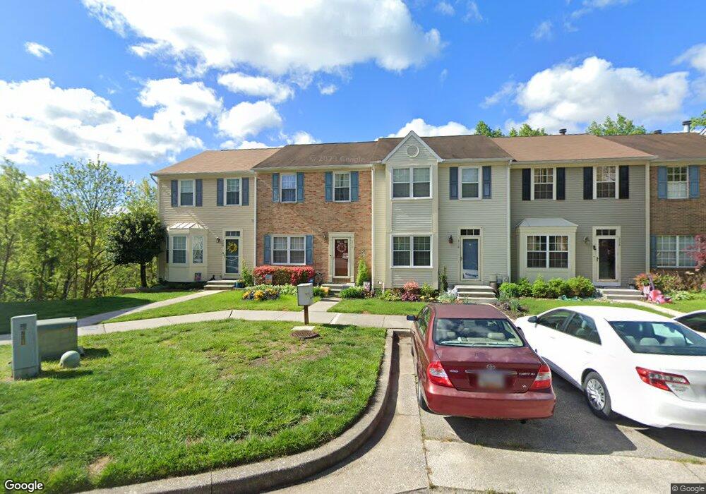
710 Marianne Ln Catonsville, MD 21228
Estimated Value: $403,744 - $470,000
--
Bed
3
Baths
1,400
Sq Ft
$312/Sq Ft
Est. Value
About This Home
This home is located at 710 Marianne Ln, Catonsville, MD 21228 and is currently estimated at $436,186, approximately $311 per square foot. 710 Marianne Ln is a home located in Baltimore County with nearby schools including Westchester Elementary School, Catonsville Middle School, and Catonsville High School.
Ownership History
Date
Name
Owned For
Owner Type
Purchase Details
Closed on
Jun 27, 2007
Sold by
Coles Eugene P and Coles Venita L
Bought by
Frey Valarie A
Current Estimated Value
Purchase Details
Closed on
May 29, 2007
Sold by
Coles Eugene P and Coles Venita L
Bought by
Frey Valarie A
Purchase Details
Closed on
Nov 6, 2001
Sold by
Coles Eugene P
Bought by
Coles Eugene P and Coles Venita L
Purchase Details
Closed on
Aug 18, 2000
Sold by
Hesterberg Norman J
Bought by
Coles Eugene P and Coles Venita L
Create a Home Valuation Report for This Property
The Home Valuation Report is an in-depth analysis detailing your home's value as well as a comparison with similar homes in the area
Home Values in the Area
Average Home Value in this Area
Purchase History
| Date | Buyer | Sale Price | Title Company |
|---|---|---|---|
| Frey Valarie A | -- | -- | |
| Frey Valarie A | -- | -- | |
| Coles Eugene P | -- | -- | |
| Coles Eugene P | $133,000 | -- |
Source: Public Records
Tax History Compared to Growth
Tax History
| Year | Tax Paid | Tax Assessment Tax Assessment Total Assessment is a certain percentage of the fair market value that is determined by local assessors to be the total taxable value of land and additions on the property. | Land | Improvement |
|---|---|---|---|---|
| 2025 | $4,433 | $334,967 | -- | -- |
| 2024 | $4,433 | $310,600 | $100,000 | $210,600 |
| 2023 | $2,104 | $296,633 | $0 | $0 |
| 2022 | $4,062 | $282,667 | $0 | $0 |
| 2021 | $3,827 | $268,700 | $100,000 | $168,700 |
| 2020 | $3,827 | $268,700 | $100,000 | $168,700 |
| 2019 | $3,606 | $268,700 | $100,000 | $168,700 |
| 2018 | $3,658 | $279,500 | $76,400 | $203,100 |
| 2017 | $3,290 | $270,133 | $0 | $0 |
| 2016 | $2,800 | $260,767 | $0 | $0 |
| 2015 | $2,800 | $251,400 | $0 | $0 |
| 2014 | $2,800 | $251,400 | $0 | $0 |
Source: Public Records
Map
Nearby Homes
- 2621 Westchester Ave
- 8369 Governor Grayson Way
- 311 Radstock Rd
- 2310 Rockwell Ave
- 20 Bryans Mill Way
- 4 Rumford Dr Unit 203
- 9794 Blue Ivy Way
- 3 Rumford Dr Unit 202
- 2203 Rockwell Ave
- 105 Oella Ave
- 2421 Quilting Bee Rd
- 3598 Fels Ln
- 3646 Fels Ln
- 2208 W Geipe Rd
- 2110 Edmondson Ave
- 8412 Merryman St
- 8483 Frederick Rd
- 627 Meyers Dr
- 627 Meyers Dr Unit PARCEL 108
- 2007 Rockwell Ave
- 712 Marianne Ln
- 708 Marianne Ln
- 714 Marianne Ln
- 716 Marianne Ln
- 706 Marianne Ln
- 718 Marianne Ln
- 704 Marianne Ln
- 702 Marianne Ln
- 720 Marianne Ln
- 700 Marianne Ln
- 722 Marianne Ln
- 724 Marianne Ln
- 654 Marianne Ln
- 726 Marianne Ln
- 652 Marianne Ln
- 728 Marianne Ln
- 650 Marianne Ln
- 648 Marianne Ln
- 730 Marianne Ln
- 646 Marianne Ln