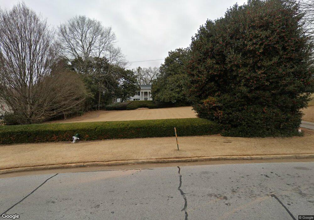
710 Milledge Cir Athens, GA 30606
Five Points NeighborhoodEstimated Value: $2,052,000 - $2,912,930
--
Bed
1
Bath
5,718
Sq Ft
$432/Sq Ft
Est. Value
About This Home
This home is located at 710 Milledge Cir, Athens, GA 30606 and is currently estimated at $2,468,643, approximately $431 per square foot. 710 Milledge Cir is a home located in Clarke County with nearby schools including Barrow Elementary School, Clarke Middle School, and Clarke Central High School.
Ownership History
Date
Name
Owned For
Owner Type
Purchase Details
Closed on
Oct 29, 1998
Sold by
Sinyard Leslie and Sinyard Robert D
Bought by
Sinyard Leslie S
Current Estimated Value
Purchase Details
Closed on
Apr 25, 1997
Sold by
Sinyard Robert D and Leslie Sinyard
Bought by
Sinyard Leslie
Purchase Details
Closed on
Jul 1, 1994
Sold by
Sams Anita B
Bought by
Sinyard Robert D and Leslie Sinyard
Create a Home Valuation Report for This Property
The Home Valuation Report is an in-depth analysis detailing your home's value as well as a comparison with similar homes in the area
Home Values in the Area
Average Home Value in this Area
Purchase History
| Date | Buyer | Sale Price | Title Company |
|---|---|---|---|
| Sinyard Leslie S | -- | -- | |
| Sinyard Leslie | -- | -- | |
| Sinyard Leslie | -- | -- | |
| Sinyard Robert D | $610,000 | -- |
Source: Public Records
Tax History Compared to Growth
Tax History
| Year | Tax Paid | Tax Assessment Tax Assessment Total Assessment is a certain percentage of the fair market value that is determined by local assessors to be the total taxable value of land and additions on the property. | Land | Improvement |
|---|---|---|---|---|
| 2025 | $31,876 | $1,087,888 | $251,000 | $836,888 |
| 2024 | $29,904 | $972,909 | $251,000 | $721,909 |
| 2023 | $29,904 | $876,665 | $251,000 | $625,665 |
| 2022 | $26,455 | $839,309 | $251,000 | $588,309 |
| 2021 | $21,389 | $644,699 | $251,000 | $393,699 |
| 2020 | $18,969 | $572,876 | $251,000 | $321,876 |
| 2019 | $18,683 | $560,302 | $251,000 | $309,302 |
| 2018 | $18,683 | $560,302 | $251,000 | $309,302 |
| 2017 | $18,683 | $560,302 | $251,000 | $309,302 |
| 2016 | $18,213 | $546,471 | $251,000 | $295,471 |
| 2015 | $17,173 | $515,085 | $225,900 | $289,185 |
| 2014 | $16,853 | $504,925 | $225,900 | $279,025 |
Source: Public Records
Map
Nearby Homes
- 590 Highland Ave
- 589 W Lake Dr
- 490 Mcwhorter Dr
- 175 Tillman Ln
- 104 W Lake Ct
- 164 Plum Nelly Rd
- 169 Fortson Cir
- 495 Woodlawn Ave
- 224 Fortson Dr
- 206 Fortson Dr
- 577 W Cloverhurst Ave
- 275 Westview Dr
- 2019 S Lumpkin St
- 1055 Baxter St Unit 504
- 155 Harold Dr
- 255 Pine Valley Dr
- 338 Springdale St
- 265 Springdale St
- 997 S Milledge Ave Unit 2
- 662 Milledge Cir
- 720 Milledge Circle Tract 2
- 730 Milledge Cir
- 720 Milledge Cir
- 652 Milledge Cir
- 644 Milledge Cir
- 638 Milledge Cir
- 597 Highland Ave
- 230 Meadowview Rd
- 745 Milledge Cir
- 604 Highland Ave
- 725 Milledge Cir
- 120 Meadowbrook Rd
- 740 Milledge Cir
- 636 Milledge Cir
- 593 Highland Ave
- 199 Rock Glen Rd
- 853 Bobbin Mill Rd
- 198 Rock Glenn Rd
- 755 Milledge Cir