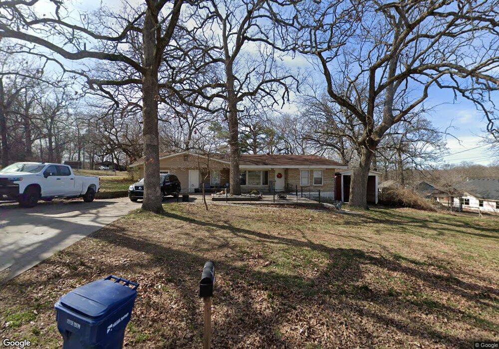
710 N Carl St Siloam Springs, AR 72761
Estimated Value: $284,000 - $364,000
3
Beds
2
Baths
2,231
Sq Ft
$140/Sq Ft
Est. Value
About This Home
This home is located at 710 N Carl St, Siloam Springs, AR 72761 and is currently estimated at $312,063, approximately $139 per square foot. 710 N Carl St is a home located in Benton County with nearby schools including Northside Elementary School, Delbert Pete & Pat Allen Elementary School, and Southside Elementary School.
Ownership History
Date
Name
Owned For
Owner Type
Purchase Details
Closed on
Apr 19, 2018
Sold by
Davis Sandra K and Sandra K Davis Revocable Trust
Bought by
Coon Daniel and Coon Katelyn
Current Estimated Value
Home Financials for this Owner
Home Financials are based on the most recent Mortgage that was taken out on this home.
Original Mortgage
$136,800
Outstanding Balance
$117,393
Interest Rate
4.44%
Mortgage Type
New Conventional
Estimated Equity
$194,670
Purchase Details
Closed on
Mar 22, 2010
Sold by
Allen Sharen
Bought by
Davis Sandra K
Purchase Details
Closed on
Jul 1, 2002
Bought by
West Rev Tr (2P)
Purchase Details
Closed on
Apr 8, 1974
Bought by
Dixon
Create a Home Valuation Report for This Property
The Home Valuation Report is an in-depth analysis detailing your home's value as well as a comparison with similar homes in the area
Home Values in the Area
Average Home Value in this Area
Purchase History
| Date | Buyer | Sale Price | Title Company |
|---|---|---|---|
| Coon Daniel | $144,000 | Empire Title Company | |
| Davis Sandra K | -- | None Available | |
| West Rev Tr (2P) | $119,000 | -- | |
| Dixon | $25,000 | -- |
Source: Public Records
Mortgage History
| Date | Status | Borrower | Loan Amount |
|---|---|---|---|
| Open | Coon Daniel | $136,800 |
Source: Public Records
Tax History Compared to Growth
Tax History
| Year | Tax Paid | Tax Assessment Tax Assessment Total Assessment is a certain percentage of the fair market value that is determined by local assessors to be the total taxable value of land and additions on the property. | Land | Improvement |
|---|---|---|---|---|
| 2025 | $1,652 | $40,493 | $7,400 | $33,093 |
| 2024 | $1,618 | $40,493 | $7,400 | $33,093 |
| 2023 | $1,541 | $30,030 | $5,600 | $24,430 |
| 2022 | $1,098 | $30,030 | $5,600 | $24,430 |
| 2021 | $1,028 | $30,030 | $5,600 | $24,430 |
| 2020 | $965 | $23,270 | $5,600 | $17,670 |
| 2019 | $965 | $23,270 | $5,600 | $17,670 |
| 2018 | $990 | $23,270 | $5,600 | $17,670 |
| 2017 | $917 | $23,270 | $5,600 | $17,670 |
| 2016 | $917 | $23,270 | $5,600 | $17,670 |
| 2015 | $1,267 | $22,000 | $4,230 | $17,770 |
| 2014 | $917 | $22,000 | $4,230 | $17,770 |
Source: Public Records
Map
Nearby Homes
- 1050 W Garland St Unit A & B
- 730 N Walnut Ct
- 607 Amanda Dr
- 606 Gail Dr
- 0000 N Elm St
- TBD South N Elm St
- 605 Teri Dr
- 402 Greenwood
- 1707 N Dogwood St
- 1715 N Dogwood St
- 1609 N Dogwood St
- 1309 N Dogwood St
- 1617 N Dogwood St
- 1601 N Dogwood St
- 1541 N Dogwood St
- 1533 N Dogwood St
- 411 N Maple St
- 1108 Deerfield Meadow
- 401 Glenwood Place
- 101 N Dogwood St
- 950 W Garland St
- 1024 W Garland St
- 702 N Carl St
- 901 W Garland St
- 1045 W Garland St
- 955 W Garland St
- 1050 W Garland St
- 905 W Garland St
- 819 W Elgin St
- 706 N Carl St
- 812 W Elgin St
- 823 W Elgin St
- 1023 W Garland St
- 1106 W Garland St
- 806 W Elgin St
- 810 W Elgin St
- 905 W Elgin St
- 707 W Garland St
- 706 W Garland St
- 0 W Garland St