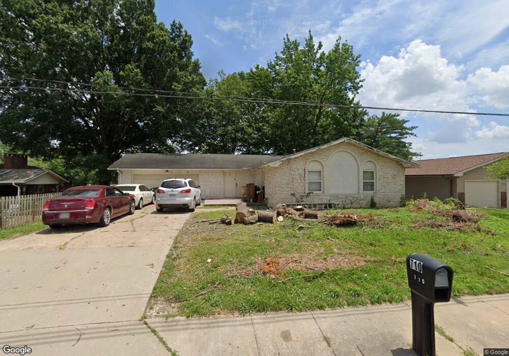
710 N Mount Auburn Rd Cape Girardeau, MO 63701
Estimated Value: $200,000 - $255,000
3
Beds
2
Baths
1,560
Sq Ft
$146/Sq Ft
Est. Value
About This Home
This home is located at 710 N Mount Auburn Rd, Cape Girardeau, MO 63701 and is currently estimated at $227,567, approximately $145 per square foot. 710 N Mount Auburn Rd is a home with nearby schools including Clippard Elementary School, Central Junior High School, and Central Middle School.
Ownership History
Date
Name
Owned For
Owner Type
Purchase Details
Closed on
Jan 10, 2005
Sold by
Desai Rajendra and Desai Shobha
Bought by
Slaughter Freddie L and Slaughter Glodean
Current Estimated Value
Home Financials for this Owner
Home Financials are based on the most recent Mortgage that was taken out on this home.
Original Mortgage
$116,910
Outstanding Balance
$70,442
Interest Rate
8.81%
Mortgage Type
Adjustable Rate Mortgage/ARM
Estimated Equity
$157,125
Create a Home Valuation Report for This Property
The Home Valuation Report is an in-depth analysis detailing your home's value as well as a comparison with similar homes in the area
Home Values in the Area
Average Home Value in this Area
Purchase History
| Date | Buyer | Sale Price | Title Company |
|---|---|---|---|
| Slaughter Freddie L | -- | None Available |
Source: Public Records
Mortgage History
| Date | Status | Borrower | Loan Amount |
|---|---|---|---|
| Open | Slaughter Freddie L | $116,910 |
Source: Public Records
Tax History Compared to Growth
Tax History
| Year | Tax Paid | Tax Assessment Tax Assessment Total Assessment is a certain percentage of the fair market value that is determined by local assessors to be the total taxable value of land and additions on the property. | Land | Improvement |
|---|---|---|---|---|
| 2025 | $14 | $27,770 | $2,710 | $25,060 |
| 2024 | $14 | $26,460 | $2,590 | $23,870 |
| 2023 | $1,375 | $26,460 | $2,590 | $23,870 |
| 2022 | $1,268 | $24,380 | $2,380 | $22,000 |
| 2021 | $1,268 | $24,380 | $2,380 | $22,000 |
| 2020 | $1,271 | $24,380 | $2,380 | $22,000 |
| 2019 | $1,269 | $24,380 | $0 | $0 |
| 2018 | $1,267 | $24,380 | $0 | $0 |
| 2017 | $1,270 | $24,380 | $0 | $0 |
| 2016 | $1,265 | $24,380 | $0 | $0 |
| 2015 | $1,266 | $24,380 | $0 | $0 |
| 2014 | $1,272 | $24,380 | $0 | $0 |
Source: Public Records
Map
Nearby Homes
- 3269 Hopper Rd
- 3022 Wisteria Dr
- 3027 Wisteria Dr
- 1000 N Mount Auburn Rd
- 3552 Mill View Crossing
- 901 Pheasant Cove Dr
- 3106 Mimosa St
- 725 Old Mill Dr
- 769 Cedar Ln
- 3014 Keystone Dr
- 3657 Engram St
- 835 Lochinvar Ln
- 807 Caribou Ct
- 3466 Hopper Rd
- 3036 Keystone Dr
- 1070 Dorothy St
- 1107 Dorothy St
- 2615 Maria Louise Ln
- 3046 Beavercreek Dr
- 2629 Hopper Rd
- 706 N Mount Auburn Rd
- 3127 Dogwood Dr
- 3135 Laurel Ln
- 3123 Dogwood Dr
- 3138 Westfield Dr
- 3131 Laurel Ln
- 3134 Westfield Dr
- 3134 Dogwood Dr
- 3126 Dogwood Dr
- 3127 Laurel Ln
- 3130 Westfield Dr
- 3140 Laurel Ln
- 638 Mt Auburn
- 3202 Chateau Dr
- 0 Hunze St
- 3126 Laurel Ln
- 3122 Dogwood Dr
- 3123 Laurel Ln
- 3126 Westfield Dr
- 3206 Chateau Dr