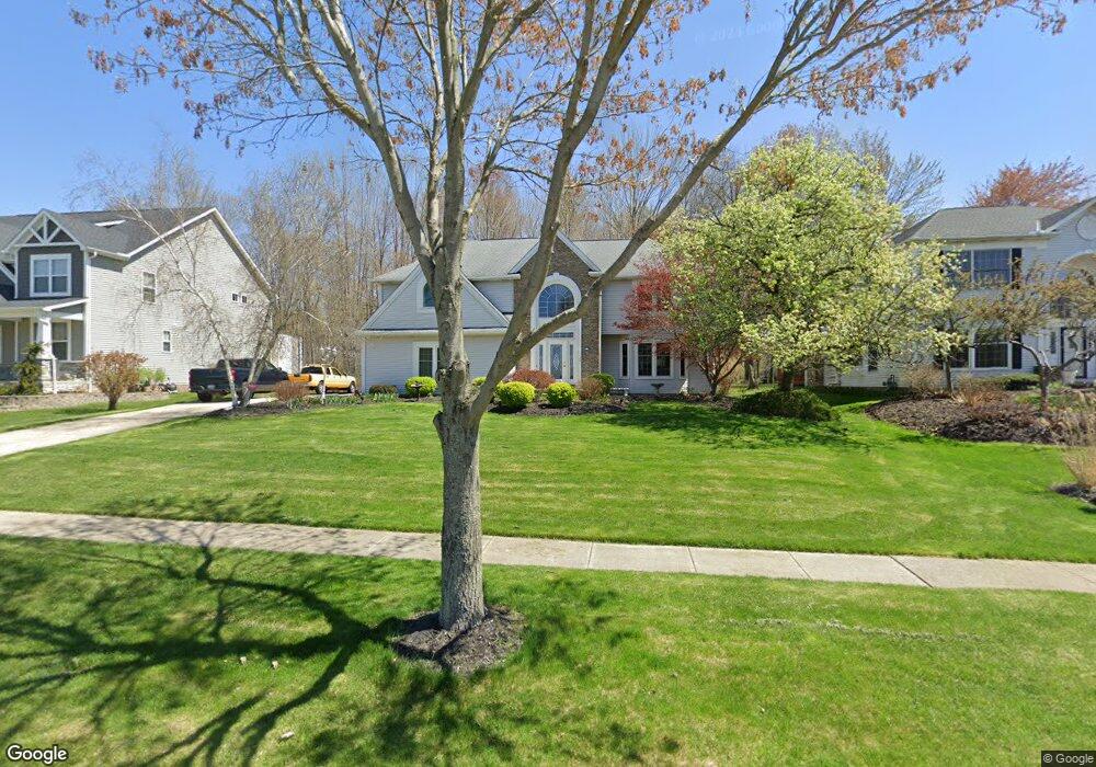
710 Nancy Dr Aurora, OH 44202
Estimated Value: $576,268 - $699,000
4
Beds
3
Baths
3,042
Sq Ft
$212/Sq Ft
Est. Value
About This Home
This home is located at 710 Nancy Dr, Aurora, OH 44202 and is currently estimated at $644,567, approximately $211 per square foot. 710 Nancy Dr is a home located in Portage County with nearby schools including Miller Elementary School, Craddock/Miller Elementary School, and Leighton Elementary School.
Ownership History
Date
Name
Owned For
Owner Type
Purchase Details
Closed on
Oct 24, 2005
Sold by
Daus Edward A and Daus Karen A
Bought by
Lewandowski Robert P and Lewandowski Connie J
Current Estimated Value
Home Financials for this Owner
Home Financials are based on the most recent Mortgage that was taken out on this home.
Original Mortgage
$335,700
Outstanding Balance
$180,135
Interest Rate
5.8%
Mortgage Type
Purchase Money Mortgage
Estimated Equity
$464,432
Purchase Details
Closed on
Jan 11, 2002
Sold by
Craven Thomas W
Bought by
Daus Edward A and Daus Karen A
Home Financials for this Owner
Home Financials are based on the most recent Mortgage that was taken out on this home.
Original Mortgage
$285,000
Interest Rate
7.07%
Mortgage Type
Balloon
Purchase Details
Closed on
Nov 12, 1993
Bought by
Craven Thomas W
Create a Home Valuation Report for This Property
The Home Valuation Report is an in-depth analysis detailing your home's value as well as a comparison with similar homes in the area
Home Values in the Area
Average Home Value in this Area
Purchase History
| Date | Buyer | Sale Price | Title Company |
|---|---|---|---|
| Lewandowski Robert P | $395,000 | Multiple | |
| Daus Edward A | $300,000 | Chicago Title Insurance Comp | |
| Craven Thomas W | $246,000 | -- |
Source: Public Records
Mortgage History
| Date | Status | Borrower | Loan Amount |
|---|---|---|---|
| Open | Lewandowski Robert P | $335,700 | |
| Closed | Daus Edward A | $285,000 |
Source: Public Records
Tax History
| Year | Tax Paid | Tax Assessment Tax Assessment Total Assessment is a certain percentage of the fair market value that is determined by local assessors to be the total taxable value of land and additions on the property. | Land | Improvement |
|---|---|---|---|---|
| 2024 | $8,031 | $179,660 | $35,000 | $144,660 |
| 2023 | $7,821 | $142,450 | $31,500 | $110,950 |
| 2022 | $7,083 | $142,450 | $31,500 | $110,950 |
| 2021 | $7,154 | $142,450 | $31,500 | $110,950 |
| 2020 | $6,810 | $127,160 | $31,500 | $95,660 |
| 2019 | $6,865 | $127,160 | $31,500 | $95,660 |
| 2017 | $6,995 | $117,780 | $29,750 | $88,030 |
| 2016 | $6,303 | $117,780 | $29,750 | $88,030 |
Source: Public Records
Map
Nearby Homes
- S/L 4 Trentstone Cir
- S/L 8 Trentstone Cir
- S/L 15 Trentstone Cir
- 601 Trentstone Cir
- 436 Cochran Rd
- 543 Sherwood Dr
- S/L 3 Iris Place
- 825 Club Dr W
- 909 Grand View Ln Unit 909
- 622 Club Dr W
- 855 Club Dr W
- 752 Club Dr W
- 762 Club Dr W
- 954 Bryce Ave
- 640 Club Dr W
- 515 Woodview Trail
- 739 Grand View Ln Unit 739
- 830 Club Dr W
- 9924 Pebble Beach Cove
- 1060 Bryce Ave
- 700 Nancy Dr
- 714 Nancy Dr
- 860 Rock Creek Dr
- 718 Nancy Dr
- 880 Rock Creek Dr
- 850 Rock Creek Dr
- 869 Rock Creek Dr
- 722 Nancy Dr
- 686 Nancy Dr
- 890 Rock Creek Dr
- 840 Rock Creek Dr
- 721 Nancy Dr
- 885 Rock Creek Dr
- 865 Rock Creek Dr
- 845 Rock Creek Dr
- 900 Rock Creek Dr
- 895 Rock Creek Dr
- 725 Nancy Dr
- 830 Rock Creek Dr
- 668 Nancy Dr
Your Personal Tour Guide
Ask me questions while you tour the home.