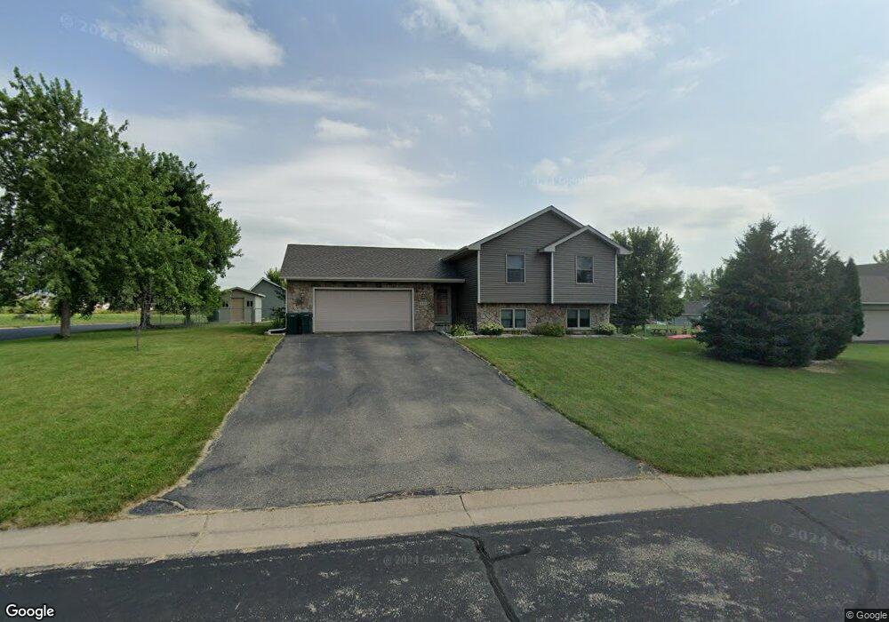
710 Robert Phillip Rd Roberts, WI 54023
Warren NeighborhoodEstimated Value: $351,000 - $374,000
3
Beds
2
Baths
2,146
Sq Ft
$169/Sq Ft
Est. Value
About This Home
This home is located at 710 Robert Phillip Rd, Roberts, WI 54023 and is currently estimated at $362,649, approximately $168 per square foot. 710 Robert Phillip Rd is a home located in St. Croix County with nearby schools including Saint Croix Central Elementary School, Saint Croix Central Middle School, and St. Croix Central High School.
Ownership History
Date
Name
Owned For
Owner Type
Purchase Details
Closed on
Apr 24, 2024
Sold by
Dykes Charles and Dykes Mindy
Bought by
Cress Kyle and Cress Kylie
Current Estimated Value
Home Financials for this Owner
Home Financials are based on the most recent Mortgage that was taken out on this home.
Original Mortgage
$288,000
Outstanding Balance
$283,581
Interest Rate
6.74%
Mortgage Type
New Conventional
Estimated Equity
$79,068
Purchase Details
Closed on
Sep 29, 2014
Sold by
Holman Christopher J and Holman Karen M
Bought by
Dykes Charles and Dykes Mindy
Purchase Details
Closed on
Jun 8, 2005
Sold by
Delta Construction Inc
Bought by
Holman Christopher J
Home Financials for this Owner
Home Financials are based on the most recent Mortgage that was taken out on this home.
Original Mortgage
$36,300
Interest Rate
5.91%
Mortgage Type
Stand Alone Second
Create a Home Valuation Report for This Property
The Home Valuation Report is an in-depth analysis detailing your home's value as well as a comparison with similar homes in the area
Home Values in the Area
Average Home Value in this Area
Purchase History
| Date | Buyer | Sale Price | Title Company |
|---|---|---|---|
| Cress Kyle | $360,000 | Burnet Title | |
| Dykes Charles | $205,000 | -- | |
| Holman Christopher J | $181,500 | None Available |
Source: Public Records
Mortgage History
| Date | Status | Borrower | Loan Amount |
|---|---|---|---|
| Open | Cress Kyle | $288,000 | |
| Previous Owner | Holman Christopher J | $36,300 |
Source: Public Records
Tax History Compared to Growth
Tax History
| Year | Tax Paid | Tax Assessment Tax Assessment Total Assessment is a certain percentage of the fair market value that is determined by local assessors to be the total taxable value of land and additions on the property. | Land | Improvement |
|---|---|---|---|---|
| 2024 | $43 | $324,700 | $71,200 | $253,500 |
| 2023 | $4,445 | $197,900 | $35,600 | $162,300 |
| 2022 | $4,086 | $197,900 | $35,600 | $162,300 |
| 2021 | $4,100 | $197,900 | $35,600 | $162,300 |
| 2020 | $4,154 | $197,900 | $35,600 | $162,300 |
| 2019 | $4,041 | $197,900 | $35,600 | $162,300 |
| 2018 | $3,863 | $197,900 | $35,600 | $162,300 |
| 2017 | $3,159 | $196,400 | $35,600 | $160,800 |
| 2016 | $3,159 | $134,000 | $28,400 | $105,600 |
| 2015 | $3,139 | $134,000 | $28,400 | $105,600 |
| 2014 | $2,955 | $134,000 | $28,400 | $105,600 |
| 2013 | $2,783 | $134,000 | $28,400 | $105,600 |
Source: Public Records
Map
Nearby Homes
- 249 (Lot 240) Dakota Ave
- 1224 US Highway 12
- 1129 Briarwood Blvd
- 247 Eagle Ridge Dr
- 200 N Vine St
- 1113 N Cheyenne St
- 405 S Division St
- 112 W Brewer St
- 603 S Division St
- 610 Field Point St
- 611 Field Point St
- 617 Field Point St
- 619 Field Point St
- 628 Franklin St
- 622 Field Point St
- 640 Franklin St
- 880 110th St
- TBD 119th Ave
- XXX Lot #10 110th Ave
- 1104 60th Ave
- 710 Robert Phillip Place
- 708 Robert Phillip Rd
- 711 Sarah Anne Ave
- 709 Sarah Anne Ave
- 713 Robert Phillip Place
- 713 Robert Phillip Rd
- 711 Robert Phillip Rd
- 706 Robert Phillip Place
- 708/710 Sarah Anne Ave
- 706 Robert Phillip Road Rd
- 706 Robert Phillip Rd
- 707 Sarah Anne Ave
- 709 Robert Phillip Rd
- 709 Robert Phillip Place
- 712 Ryan Ronald Rd
- 718 Sarah Anne Ave
- 716 Sarah Anne Ave
- 716 Sarah Anne Ave Unit 716/718
- 710 Ryan Ronald Rd
- 704 Robert Phillip Rd