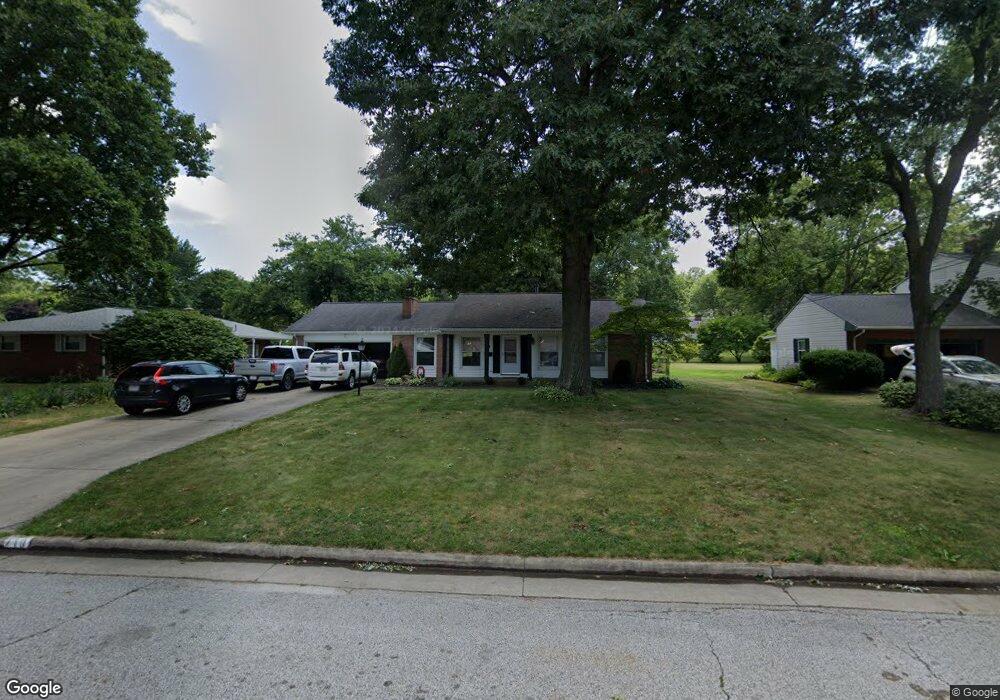
710 Ruth Ave SW North Canton, OH 44720
Estimated Value: $225,286 - $279,000
3
Beds
2
Baths
1,281
Sq Ft
$199/Sq Ft
Est. Value
About This Home
This home is located at 710 Ruth Ave SW, North Canton, OH 44720 and is currently estimated at $254,322, approximately $198 per square foot. 710 Ruth Ave SW is a home located in Stark County with nearby schools including Orchard Hill Intermediate School, North Canton Middle School, and Hoover High School.
Ownership History
Date
Name
Owned For
Owner Type
Purchase Details
Closed on
Jul 28, 2003
Sold by
Braden Barbara and Symes Barbara
Bought by
Bernard Douglas J and Bernard Michelle R
Current Estimated Value
Home Financials for this Owner
Home Financials are based on the most recent Mortgage that was taken out on this home.
Original Mortgage
$152,750
Outstanding Balance
$65,695
Interest Rate
5.3%
Mortgage Type
Purchase Money Mortgage
Estimated Equity
$188,627
Purchase Details
Closed on
Jul 21, 1999
Sold by
Symes Robin
Bought by
Symes Barbara
Purchase Details
Closed on
Sep 27, 1996
Sold by
Grady Joseph P
Bought by
Symes Barbara R
Purchase Details
Closed on
May 30, 1991
Create a Home Valuation Report for This Property
The Home Valuation Report is an in-depth analysis detailing your home's value as well as a comparison with similar homes in the area
Home Values in the Area
Average Home Value in this Area
Purchase History
| Date | Buyer | Sale Price | Title Company |
|---|---|---|---|
| Bernard Douglas J | $157,500 | -- | |
| Symes Barbara | -- | -- | |
| Symes Barbara R | $126,500 | -- | |
| -- | $85,500 | -- |
Source: Public Records
Mortgage History
| Date | Status | Borrower | Loan Amount |
|---|---|---|---|
| Open | Bernard Douglas J | $152,750 |
Source: Public Records
Tax History Compared to Growth
Tax History
| Year | Tax Paid | Tax Assessment Tax Assessment Total Assessment is a certain percentage of the fair market value that is determined by local assessors to be the total taxable value of land and additions on the property. | Land | Improvement |
|---|---|---|---|---|
| 2025 | -- | $69,860 | $17,290 | $52,570 |
| 2024 | -- | $69,860 | $17,290 | $52,570 |
| 2023 | $2,866 | $53,590 | $12,990 | $40,600 |
| 2022 | $2,755 | $53,590 | $12,990 | $40,600 |
| 2021 | $2,658 | $53,590 | $12,990 | $40,600 |
| 2020 | $2,515 | $45,540 | $11,270 | $34,270 |
| 2019 | $2,348 | $45,540 | $11,270 | $34,270 |
| 2018 | $2,434 | $45,540 | $11,270 | $34,270 |
| 2017 | $2,186 | $42,950 | $10,990 | $31,960 |
| 2016 | $2,194 | $42,950 | $10,990 | $31,960 |
| 2015 | $2,202 | $42,950 | $10,990 | $31,960 |
| 2014 | $113 | $38,470 | $9,840 | $28,630 |
| 2013 | $1,060 | $38,470 | $9,840 | $28,630 |
Source: Public Records
Map
Nearby Homes
- 727 Lorena St SW
- 1138 Lindy Lane Ave SW
- 0 W Maple St Unit 5135089
- 1236 W Maple St
- 1246 W Maple St Unit 4A
- 1276 Linwood Ave SW
- 1222 W Maple St Unit 6A
- 404 Cordelia St SW
- 1171 Terrace Rd NW
- 624 Portage St NW
- 253 Glenwood St SW
- 742 Portage St NW
- 455 Royer Ave NW
- 218 Bonnett St SW
- 500 Heatherwood St SW
- 608 Werstler Ave NW
- 161 Hallum St SW
- 404 7th St NW
- 322 Schneider St SE
- 140 5th St NE
- 824 Summit St SW
- 720 Ruth Ave SW
- 810 Summit St SW
- 721 Lindy Lane Ave SW
- 827 Glenwood St SW
- 817 Glenwood St SW
- 711 Ruth Ave SW
- 827 Summit St SW
- 848 Summit St SW
- 721 Ruth Ave SW
- 819 Summit St SW
- 835 Summit St SW
- 847 Glenwood St SW
- 811 Summit St SW
- 807 Glenwood St SW
- 841 Summit St SW
- 609 Lindy Lane Ave SW
- 849 Summit St SW
- 855 Glenwood St SW
- 716 Lindy Lane Ave SW