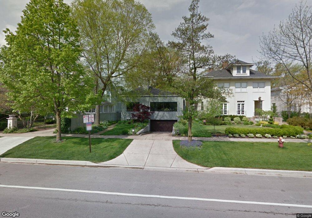
710 Sheridan Rd Evanston, IL 60202
Southeast Evanston NeighborhoodEstimated Value: $1,291,000 - $1,852,000
3
Beds
3
Baths
2,708
Sq Ft
$531/Sq Ft
Est. Value
About This Home
This home is located at 710 Sheridan Rd, Evanston, IL 60202 and is currently estimated at $1,438,963, approximately $531 per square foot. 710 Sheridan Rd is a home located in Cook County with nearby schools including Lincoln Elementary School, Washington Elementary School, and Nichols Middle School.
Ownership History
Date
Name
Owned For
Owner Type
Purchase Details
Closed on
Jul 31, 1996
Sold by
Anderson Neil D and Anderson Gayle L
Bought by
Shea John A and John A Shea Inter Vivos Revocable Trust
Current Estimated Value
Home Financials for this Owner
Home Financials are based on the most recent Mortgage that was taken out on this home.
Original Mortgage
$207,000
Outstanding Balance
$16,538
Interest Rate
8.33%
Estimated Equity
$1,422,425
Create a Home Valuation Report for This Property
The Home Valuation Report is an in-depth analysis detailing your home's value as well as a comparison with similar homes in the area
Home Values in the Area
Average Home Value in this Area
Purchase History
| Date | Buyer | Sale Price | Title Company |
|---|---|---|---|
| Shea John A | $622,500 | Rei Title |
Source: Public Records
Mortgage History
| Date | Status | Borrower | Loan Amount |
|---|---|---|---|
| Open | Shea John A | $207,000 |
Source: Public Records
Tax History Compared to Growth
Tax History
| Year | Tax Paid | Tax Assessment Tax Assessment Total Assessment is a certain percentage of the fair market value that is determined by local assessors to be the total taxable value of land and additions on the property. | Land | Improvement |
|---|---|---|---|---|
| 2024 | $25,661 | $106,000 | $25,350 | $80,650 |
| 2023 | $24,623 | $106,000 | $25,350 | $80,650 |
| 2022 | $24,623 | $106,000 | $25,350 | $80,650 |
| 2021 | $21,226 | $85,980 | $13,520 | $72,460 |
| 2020 | $21,051 | $85,980 | $13,520 | $72,460 |
| 2019 | $20,403 | $93,254 | $13,520 | $79,734 |
| 2018 | $20,056 | $79,387 | $11,407 | $67,980 |
| 2017 | $19,561 | $79,387 | $11,407 | $67,980 |
| 2016 | $19,007 | $79,387 | $11,407 | $67,980 |
| 2015 | $16,921 | $67,605 | $9,506 | $58,099 |
| 2014 | $16,785 | $67,605 | $9,506 | $58,099 |
| 2013 | $16,372 | $67,605 | $9,506 | $58,099 |
Source: Public Records
Map
Nearby Homes
- 616 Michigan Ave Unit G
- 826 Michigan Ave Unit 2B
- 540 Michigan Ave Unit HG
- 530 Sheridan Rd Unit 2B
- 623 Judson Ave
- 530 Michigan Ave Unit 3E
- 721 Hinman Ave Unit 1W
- 918 Michigan Ave Unit 3
- 507 Judson Ave Unit 2D
- 937 Forest Ave Unit 3
- 816 Hinman Ave Unit 4
- 240 Lee St Unit G
- 811 Chicago Ave Unit 309
- 811 Chicago Ave Unit 308
- 811 Chicago Ave Unit 407
- 515 Main St Unit 709
- 714 Seward St
- 1120 Forest Ave
- 7756 N Sheridan Rd Unit 16
- 7730 N Paulina St Unit 1
- 706 Sheridan Rd
- 718 Sheridan Rd
- 722 Sheridan Rd
- 652 Sheridan Rd
- 715 Michigan Ave
- 726 Sheridan Rd
- 648 Sheridan Rd
- 719 Michigan Ave
- 707 Sheridan Rd
- 707 Michigan Ave
- 653 Michigan Ave
- 730 Sheridan Rd
- 642 Sheridan Rd
- 715 Sheridan Rd
- 649 Michigan Ave
- 727 Michigan Ave
- 703 Sheridan Rd
- 701 Sheridan Rd
- 721 Sheridan Rd
- 640 Sheridan Rd