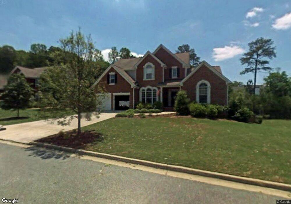
710 Silver Mist Way Unit 4A Canton, GA 30114
Estimated Value: $557,000 - $583,386
4
Beds
4
Baths
2,915
Sq Ft
$196/Sq Ft
Est. Value
About This Home
This home is located at 710 Silver Mist Way Unit 4A, Canton, GA 30114 and is currently estimated at $570,193, approximately $195 per square foot. 710 Silver Mist Way Unit 4A is a home located in Cherokee County with nearby schools including Sixes Elementary School, Freedom Middle School, and Woodstock High School.
Ownership History
Date
Name
Owned For
Owner Type
Purchase Details
Closed on
Dec 19, 2002
Sold by
Watson Roger D
Bought by
Watson Roger D and Watson Kristal
Current Estimated Value
Home Financials for this Owner
Home Financials are based on the most recent Mortgage that was taken out on this home.
Original Mortgage
$219,350
Outstanding Balance
$84,185
Interest Rate
5.13%
Mortgage Type
New Conventional
Estimated Equity
$486,008
Create a Home Valuation Report for This Property
The Home Valuation Report is an in-depth analysis detailing your home's value as well as a comparison with similar homes in the area
Home Values in the Area
Average Home Value in this Area
Purchase History
| Date | Buyer | Sale Price | Title Company |
|---|---|---|---|
| Watson Roger D | -- | -- | |
| Watson Roger D | $274,300 | -- |
Source: Public Records
Mortgage History
| Date | Status | Borrower | Loan Amount |
|---|---|---|---|
| Open | Watson Roger D | $219,350 | |
| Closed | Watson Roger D | $54,800 |
Source: Public Records
Tax History
| Year | Tax Paid | Tax Assessment Tax Assessment Total Assessment is a certain percentage of the fair market value that is determined by local assessors to be the total taxable value of land and additions on the property. | Land | Improvement |
|---|---|---|---|---|
| 2025 | $5,113 | $216,936 | $41,200 | $175,736 |
| 2024 | $5,187 | $222,284 | $44,800 | $177,484 |
| 2023 | $4,651 | $217,472 | $41,600 | $175,872 |
| 2022 | $4,245 | $175,144 | $32,000 | $143,144 |
| 2021 | $4,107 | $154,040 | $26,640 | $127,400 |
| 2020 | $3,788 | $140,160 | $24,000 | $116,160 |
| 2019 | $3,531 | $129,080 | $20,800 | $108,280 |
| 2018 | $3,438 | $124,280 | $20,800 | $103,480 |
| 2017 | $3,315 | $294,700 | $20,800 | $97,080 |
| 2016 | $3,055 | $268,100 | $20,800 | $86,440 |
| 2015 | $2,837 | $247,000 | $20,800 | $78,000 |
| 2014 | $2,741 | $238,400 | $20,800 | $74,560 |
Source: Public Records
Map
Nearby Homes
- 520 Andes Ln
- 208 Sawtooth Ct
- 206 Sawtooth Ct
- 605 Garnet Ct Unit 3
- 415 Crestmont Ln
- 417 Crestmont Ln
- 1600 Mountain Trace
- 2550 Mountain Brook Rd
- 325 Gold Ridge
- 1600 Sixes Rd
- 0 Sixes Creek Trail Unit 7197452
- 1415 Sixes Rd
- 350 Meadows Ln
- 3161 Marble Quarry Rd
- 291 Springs Crossing
- 187 Sixes Creek Trail
- 329 Meadows Ln
- 190 Sixes Creek Trail
- 412 Fernstone Dr
- 216 Manous Way
- 712 Silver Mist Way
- 708 Silver Mist Way Unit 198
- 708 Silver Mist Way
- 721 E Shore Dr
- 703 Silver Mist Way
- 714 Silver Mist Way Unit 4A
- 711 E Shore Dr
- 731 E Shore Dr
- 706 Silver Mist Way
- 705 Silver Mist Way
- 741 E Shore Dr Unit 132
- 741 E Shore Dr
- 741 NE Shore Dr Unit 741
- 704 Silver Mist Way Unit 4A
- 200 Sterling Brook Ln Unit 4A
- 716 Silver Mist Way
- 701 Silver Mist Way
- 701 E Shore Dr
- 702 Silver Mist Way
- 203 Sterling Brook Ln Unit 4A
Your Personal Tour Guide
Ask me questions while you tour the home.