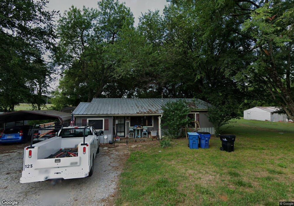
710 Thatcher St Denison, TX 75020
Estimated Value: $159,684 - $179,000
3
Beds
1
Bath
1,232
Sq Ft
$137/Sq Ft
Est. Value
About This Home
This home is located at 710 Thatcher St, Denison, TX 75020 and is currently estimated at $169,342, approximately $137 per square foot. 710 Thatcher St is a home located in Grayson County with nearby schools including Scott Middle School, Denison High School, and St. Luke's Parish Day School.
Ownership History
Date
Name
Owned For
Owner Type
Purchase Details
Closed on
Sep 22, 2016
Sold by
Dill Sylvia D
Bought by
Robinson Paul A
Current Estimated Value
Home Financials for this Owner
Home Financials are based on the most recent Mortgage that was taken out on this home.
Original Mortgage
$79,531
Outstanding Balance
$63,567
Interest Rate
3.45%
Mortgage Type
FHA
Estimated Equity
$105,775
Purchase Details
Closed on
Jul 2, 2010
Sold by
Number Three Cw Stewart Family Limited P
Bought by
Dill Sylvia D
Purchase Details
Closed on
Mar 30, 2009
Sold by
Bmw Properties Inc
Bought by
Cw Stewart Family Limited Partnership
Home Financials for this Owner
Home Financials are based on the most recent Mortgage that was taken out on this home.
Original Mortgage
$32,022
Interest Rate
5.24%
Mortgage Type
Purchase Money Mortgage
Purchase Details
Closed on
Feb 26, 2009
Sold by
Rushing James Daniel
Bought by
Bmw Properties Inc
Home Financials for this Owner
Home Financials are based on the most recent Mortgage that was taken out on this home.
Original Mortgage
$32,022
Interest Rate
5.24%
Mortgage Type
Purchase Money Mortgage
Create a Home Valuation Report for This Property
The Home Valuation Report is an in-depth analysis detailing your home's value as well as a comparison with similar homes in the area
Home Values in the Area
Average Home Value in this Area
Purchase History
| Date | Buyer | Sale Price | Title Company |
|---|---|---|---|
| Robinson Paul A | -- | Grayson County Title | |
| Dill Sylvia D | -- | Red River Title Co | |
| Cw Stewart Family Limited Partnership | -- | Red River Title Co | |
| Bmw Properties Inc | -- | Rockwall Title Co |
Source: Public Records
Mortgage History
| Date | Status | Borrower | Loan Amount |
|---|---|---|---|
| Open | Robinson Paul A | $79,531 | |
| Previous Owner | Cw Stewart Family Limited Partnership | $32,022 | |
| Previous Owner | Bmw Properties Inc | $30,815 |
Source: Public Records
Tax History Compared to Growth
Tax History
| Year | Tax Paid | Tax Assessment Tax Assessment Total Assessment is a certain percentage of the fair market value that is determined by local assessors to be the total taxable value of land and additions on the property. | Land | Improvement |
|---|---|---|---|---|
| 2025 | $3,240 | $142,240 | $55,224 | $87,016 |
| 2024 | $3,240 | $139,464 | $50,310 | $89,154 |
| 2023 | $3,069 | $135,438 | $51,363 | $84,075 |
| 2022 | $3,092 | $130,120 | $51,363 | $78,757 |
| 2021 | $2,173 | $86,167 | $21,762 | $64,405 |
| 2020 | $2,244 | $85,085 | $17,550 | $67,535 |
| 2019 | $2,397 | $87,108 | $17,550 | $69,558 |
| 2018 | $2,249 | $81,053 | $9,360 | $71,693 |
| 2017 | $1,983 | $70,869 | $5,265 | $65,604 |
| 2016 | $1,231 | $59,254 | $5,265 | $53,989 |
| 2015 | $307 | $40,001 | $5,265 | $34,736 |
| 2014 | $466 | $42,016 | $5,265 | $36,751 |
Source: Public Records
Map
Nearby Homes
- 700 Dubois St
- 711 Dubois St
- 601 Dubois St
- 701 W Star St
- 608 W Baker St
- 603 W Star St
- 611 W Baker St
- 607 W Baker St
- 903 Seymore Cir
- 905 Seymore Cir
- 614 W Collins St
- 923 Dubois St
- 938 Amsden St
- 616 & 618 Rice St
- 614 Rice St
- 515 Joy Ln
- 916 W Collins St
- 923 W Collins St
- 921 W Collins St
- 3101 S College Blvd
- 3001 S Barrett Ave
- 715 Thatcher St
- 719 Thatcher St
- 721 Thatcher St
- 630 Thatcher St
- 627 Thatcher St
- 710 Dubois St
- 712 Dubois St
- 726 Dubois St
- 630 Dubois St
- 730 Dubois St
- 628 Dubois St
- 615 Thatcher St
- 624 Dubois St
- 800 Dubois St
- 614 Dubois St
- 715 Dubois St
- 813 Amsden St
- 725 Dubois St
- 2929 S Mirick Ave