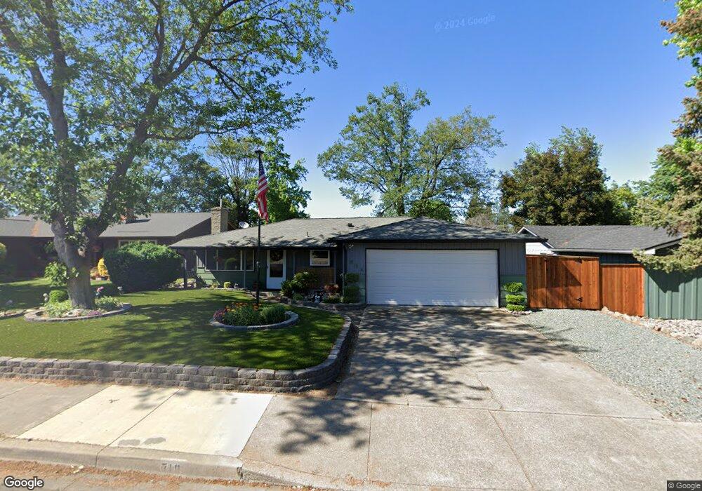
710 W 1st St Phoenix, OR 97535
Estimated Value: $383,000 - $455,000
3
Beds
2
Baths
1,784
Sq Ft
$232/Sq Ft
Est. Value
About This Home
This home is located at 710 W 1st St, Phoenix, OR 97535 and is currently estimated at $414,534, approximately $232 per square foot. 710 W 1st St is a home located in Jackson County with nearby schools including Phoenix Elementary School, Talent Middle School, and Phoenix High School.
Ownership History
Date
Name
Owned For
Owner Type
Purchase Details
Closed on
Aug 2, 2011
Sold by
King Brian W and Wells Fargo Bank N A
Bought by
Federal Home Loan Mortgage Corporation
Current Estimated Value
Purchase Details
Closed on
Apr 24, 2007
Sold by
Ransom Donald F and Ransom Janice M
Bought by
King Brian W
Home Financials for this Owner
Home Financials are based on the most recent Mortgage that was taken out on this home.
Original Mortgage
$216,000
Interest Rate
6.11%
Mortgage Type
Purchase Money Mortgage
Create a Home Valuation Report for This Property
The Home Valuation Report is an in-depth analysis detailing your home's value as well as a comparison with similar homes in the area
Home Values in the Area
Average Home Value in this Area
Purchase History
| Date | Buyer | Sale Price | Title Company |
|---|---|---|---|
| Federal Home Loan Mortgage Corporation | $152,000 | Northwest Title | |
| King Brian W | $270,000 | Amerititle |
Source: Public Records
Mortgage History
| Date | Status | Borrower | Loan Amount |
|---|---|---|---|
| Previous Owner | King Brian W | $216,000 |
Source: Public Records
Tax History Compared to Growth
Tax History
| Year | Tax Paid | Tax Assessment Tax Assessment Total Assessment is a certain percentage of the fair market value that is determined by local assessors to be the total taxable value of land and additions on the property. | Land | Improvement |
|---|---|---|---|---|
| 2025 | $3,120 | $194,550 | $66,390 | $128,160 |
| 2024 | $3,120 | $188,890 | $64,460 | $124,430 |
| 2023 | $3,022 | $183,390 | $62,580 | $120,810 |
| 2022 | $2,942 | $183,390 | $62,580 | $120,810 |
| 2021 | $2,871 | $178,050 | $60,750 | $117,300 |
| 2020 | $2,781 | $172,870 | $58,980 | $113,890 |
| 2019 | $2,707 | $162,960 | $55,580 | $107,380 |
| 2018 | $2,628 | $158,220 | $53,960 | $104,260 |
| 2017 | $2,483 | $158,220 | $53,960 | $104,260 |
| 2016 | $2,416 | $149,150 | $50,870 | $98,280 |
| 2015 | $2,322 | $149,150 | $46,590 | $102,560 |
| 2014 | $2,234 | $140,600 | $43,910 | $96,690 |
Source: Public Records
Map
Nearby Homes
- 105 W 1st St
- 605 W 4th St
- 1620 Pacific Ln
- 309 W 1st St
- 201 S Rose St
- 316 W 3rd St
- 158 Sharon Dr
- 400 W 5th St
- 301 N Church St
- 404 Oak St
- 133 S Main St
- 2011 Camp Baker Rd Unit n/a
- 504 Elm St
- 3459 S Pacific Hwy
- 4119 S Pacific Hwy
- 817 Amerman Dr
- 454 Elm St
- 510 N Main St
- 612 N Main St
- 300 Luman Rd Unit 205