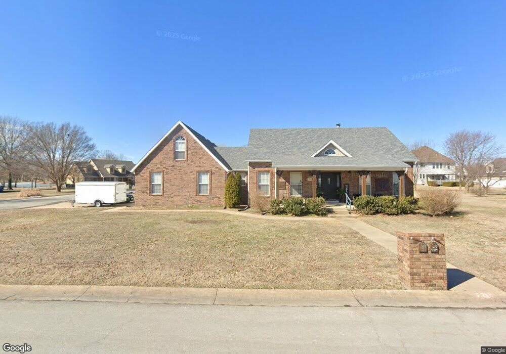
710 W Briarbrook Ln Carl Junction, MO 64834
Briarbrook NeighborhoodEstimated Value: $289,000 - $352,000
4
Beds
3
Baths
2,481
Sq Ft
$133/Sq Ft
Est. Value
About This Home
This home is located at 710 W Briarbrook Ln, Carl Junction, MO 64834 and is currently estimated at $329,511, approximately $132 per square foot. 710 W Briarbrook Ln is a home located in Jasper County with nearby schools including Carl Junction Primary School (K-1), Carl Junction Intermediate School, and Carl Junction Primary School (2-3).
Ownership History
Date
Name
Owned For
Owner Type
Purchase Details
Closed on
Sep 2, 2022
Sold by
Luton S Scott S and Luton Julie A
Bought by
Hargis Charles Eugene and Hargis Pamela Sue
Current Estimated Value
Home Financials for this Owner
Home Financials are based on the most recent Mortgage that was taken out on this home.
Original Mortgage
$249,541
Outstanding Balance
$238,502
Interest Rate
5.3%
Mortgage Type
FHA
Estimated Equity
$91,009
Create a Home Valuation Report for This Property
The Home Valuation Report is an in-depth analysis detailing your home's value as well as a comparison with similar homes in the area
Home Values in the Area
Average Home Value in this Area
Purchase History
| Date | Buyer | Sale Price | Title Company |
|---|---|---|---|
| Hargis Charles Eugene | -- | None Listed On Document |
Source: Public Records
Mortgage History
| Date | Status | Borrower | Loan Amount |
|---|---|---|---|
| Open | Hargis Charles Eugene | $249,541 |
Source: Public Records
Tax History Compared to Growth
Tax History
| Year | Tax Paid | Tax Assessment Tax Assessment Total Assessment is a certain percentage of the fair market value that is determined by local assessors to be the total taxable value of land and additions on the property. | Land | Improvement |
|---|---|---|---|---|
| 2024 | $2,494 | $39,200 | $3,340 | $35,860 |
| 2023 | $2,494 | $39,200 | $3,340 | $35,860 |
| 2022 | $2,479 | $38,960 | $3,340 | $35,620 |
| 2021 | $2,146 | $38,960 | $3,340 | $35,620 |
| 2020 | $2,000 | $35,830 | $3,340 | $32,490 |
| 2019 | $1,902 | $35,830 | $3,340 | $32,490 |
| 2018 | $1,871 | $35,470 | $0 | $0 |
| 2017 | $1,876 | $35,470 | $0 | $0 |
| 2016 | $1,961 | $37,390 | $0 | $0 |
| 2015 | $1,922 | $37,390 | $0 | $0 |
| 2014 | $1,922 | $37,390 | $0 | $0 |
Source: Public Records
Map
Nearby Homes
- 507 W Briarbrook Ln Unit 509
- 908 Aberdeen Ave
- 120 Cody John Way
- 104 Van Dusen Dr
- 305 Anita Dr
- 304 Belgian Blue Blvd
- 308 Belgian Blue Blvd
- 232 Hickory Place
- 909 Silver Oaks Dr
- 905 Silver Oaks Dr
- 205 Hickory Place
- 910 Silver Oaks
- 702 Copper Oaks Dr
- 907 Silver Oaks Dr
- 3000 Plan at Fox Briar
- 2500 Plan at Fox Briar
- 2575 Plan at Fox Briar
- 2550 Two Story Plan at Fox Briar
- 2410 Plan at Fox Briar
- 2360 Two Story Plan at Fox Briar
- 714 Springhill Dr
- 712 Springhill Dr
- 708 W Briarbrook Ln
- 801 W Briarbrook Ln
- 709 W Briarbrook Ln
- 801 Briarbrook Dr
- 707 Springhill Dr
- 710 Springhill Dr
- 707 W Briarbrook Ln
- 802 W Briarbrook Ln
- 803 W Briarbrook Ln
- 706 W Briarbrook Ln
- 708 Springhill Dr
- 705 W Briarbrook Ln
- 910 Briarbrook Dr
- 705 Springhill Dr
- 1002 Briarbrook Dr
- 1002 Briarbrook Dr Unit 1
- 706 Springhill Dr
- 807 W Briarbrook Ln