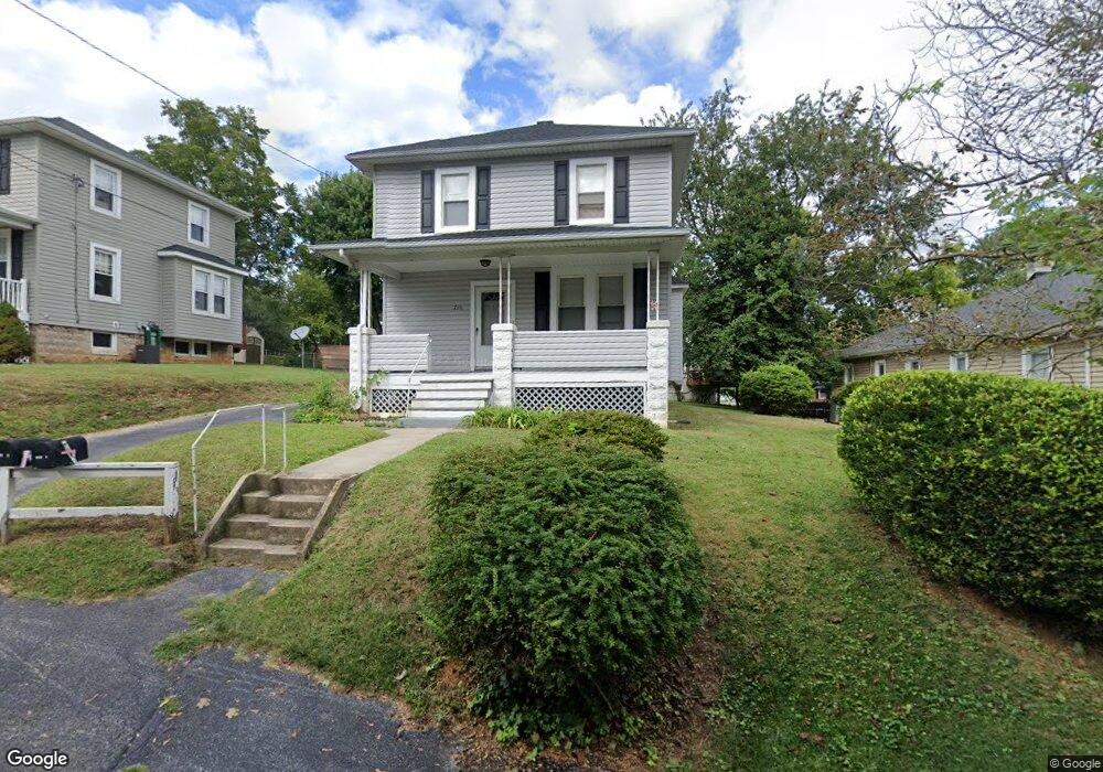
710 Woodsdale Rd Catonsville, MD 21228
Estimated Value: $296,000 - $403,000
1
Bed
1
Bath
1,462
Sq Ft
$228/Sq Ft
Est. Value
About This Home
This home is located at 710 Woodsdale Rd, Catonsville, MD 21228 and is currently estimated at $332,991, approximately $227 per square foot. 710 Woodsdale Rd is a home located in Baltimore County with nearby schools including Hillcrest Elementary School, Catonsville Middle School, and Catonsville High School.
Ownership History
Date
Name
Owned For
Owner Type
Purchase Details
Closed on
Dec 23, 2019
Sold by
Mcintyre Timothy G and Dayhoff Allen B
Bought by
Mcintyre Timothy G
Current Estimated Value
Home Financials for this Owner
Home Financials are based on the most recent Mortgage that was taken out on this home.
Original Mortgage
$105,000
Outstanding Balance
$71,491
Interest Rate
3.73%
Mortgage Type
New Conventional
Estimated Equity
$261,500
Purchase Details
Closed on
Feb 26, 2002
Sold by
Fischer Anna D
Bought by
Mcintyre Timothy G and Dayhoff Allen B
Create a Home Valuation Report for This Property
The Home Valuation Report is an in-depth analysis detailing your home's value as well as a comparison with similar homes in the area
Home Values in the Area
Average Home Value in this Area
Purchase History
| Date | Buyer | Sale Price | Title Company |
|---|---|---|---|
| Mcintyre Timothy G | -- | Lawyers Advantage Ttl Group | |
| Mcintyre Timothy G | $96,500 | -- |
Source: Public Records
Mortgage History
| Date | Status | Borrower | Loan Amount |
|---|---|---|---|
| Open | Mcintyre Timothy G | $105,000 |
Source: Public Records
Tax History Compared to Growth
Tax History
| Year | Tax Paid | Tax Assessment Tax Assessment Total Assessment is a certain percentage of the fair market value that is determined by local assessors to be the total taxable value of land and additions on the property. | Land | Improvement |
|---|---|---|---|---|
| 2025 | $3,806 | $253,467 | -- | -- |
| 2024 | $3,806 | $236,000 | $92,000 | $144,000 |
| 2023 | $3,802 | $227,500 | $0 | $0 |
| 2022 | $3,644 | $219,000 | $0 | $0 |
| 2021 | $2,990 | $210,500 | $92,000 | $118,500 |
| 2020 | $2,990 | $199,900 | $0 | $0 |
| 2019 | $2,866 | $189,300 | $0 | $0 |
| 2018 | $2,981 | $178,700 | $77,000 | $101,700 |
| 2017 | $2,733 | $173,533 | $0 | $0 |
| 2016 | $2,948 | $168,367 | $0 | $0 |
| 2015 | $2,948 | $163,200 | $0 | $0 |
| 2014 | $2,948 | $163,200 | $0 | $0 |
Source: Public Records
Map
Nearby Homes
- 509 Valcour Rd
- 905 Woodsdale Rd
- 429 Lafayette Ave
- 518 Ingleside Ave
- 514 Kent Ave
- 133 Wesley Ave
- 3 Arthur Ave
- 172 Winters Ln
- 177 Winters Ln
- 206 Winters Ln
- 42 Winters Ln
- 0 Melvin Ave
- 5926 Old Frederick Rd
- 38A Winters Ln
- 201 Suter Rd
- 27 Glenwood Ave
- 6142 Regent Park Rd
- 14 Glenwood Ave
- 312 Small Ct
- 19 Somerset Rd
- 708 Woodsdale Rd
- 712 Woodsdale Rd
- 504 Valcour Rd
- 506 Valcour Rd
- 714 Woodsdale Rd
- 711 Woodsdale Rd
- 713 Woodsdale Rd
- 508 Valcour Rd
- 716 Woodsdale Rd
- 505 Valcour Rd
- 500 Dorchester Rd
- 715 Woodsdale Rd
- 507 Valcour Rd
- 503 Valcour Rd
- 510 Valcour Rd
- 705 Woodsdale Rd Unit NA
- 705 Woodsdale Rd
- 501 Valcour Rd
- Lot 15,16,17 Raynor Bridal Path Ave
- 700 Raynor Ave