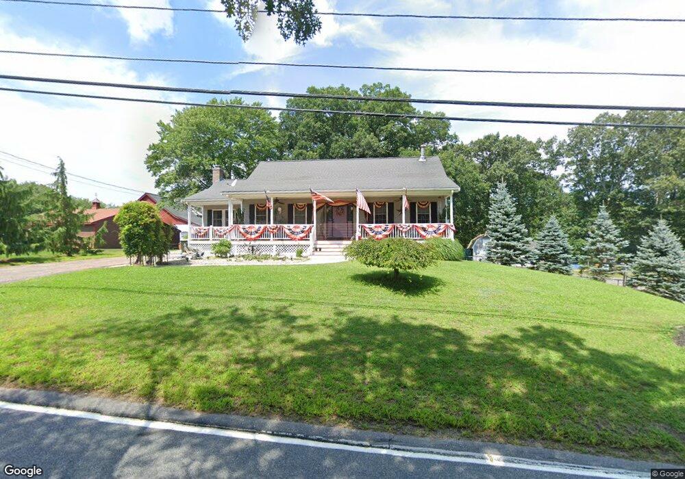
710 Wrentham Rd Bellingham, MA 02019
Estimated Value: $555,000 - $738,000
2
Beds
2
Baths
2,310
Sq Ft
$281/Sq Ft
Est. Value
About This Home
This home is located at 710 Wrentham Rd, Bellingham, MA 02019 and is currently estimated at $649,401, approximately $281 per square foot. 710 Wrentham Rd is a home located in Norfolk County with nearby schools including Joseph F. DiPietro Elementary, Bellingham High School, and Rise Prep Mayoral Academy Middle School.
Ownership History
Date
Name
Owned For
Owner Type
Purchase Details
Closed on
Jul 29, 2011
Sold by
Fnma
Bought by
Lane Kenneth and Cullen Cynthia
Current Estimated Value
Home Financials for this Owner
Home Financials are based on the most recent Mortgage that was taken out on this home.
Original Mortgage
$115,000
Outstanding Balance
$79,439
Interest Rate
4.52%
Mortgage Type
Purchase Money Mortgage
Estimated Equity
$569,962
Purchase Details
Closed on
Apr 2, 1999
Sold by
Baillargeon Jacques N and Baillargeon Gail T
Bought by
Ord William C and Ord Shirley A
Home Financials for this Owner
Home Financials are based on the most recent Mortgage that was taken out on this home.
Original Mortgage
$141,000
Interest Rate
6.78%
Mortgage Type
Purchase Money Mortgage
Create a Home Valuation Report for This Property
The Home Valuation Report is an in-depth analysis detailing your home's value as well as a comparison with similar homes in the area
Home Values in the Area
Average Home Value in this Area
Purchase History
| Date | Buyer | Sale Price | Title Company |
|---|---|---|---|
| Lane Kenneth | $265,000 | -- | |
| Ord William C | $149,000 | -- |
Source: Public Records
Mortgage History
| Date | Status | Borrower | Loan Amount |
|---|---|---|---|
| Open | Lane Kenneth | $115,000 | |
| Previous Owner | Ord William C | $200,965 | |
| Previous Owner | Ord William C | $10,000 | |
| Previous Owner | Ord William C | $141,000 |
Source: Public Records
Tax History Compared to Growth
Tax History
| Year | Tax Paid | Tax Assessment Tax Assessment Total Assessment is a certain percentage of the fair market value that is determined by local assessors to be the total taxable value of land and additions on the property. | Land | Improvement |
|---|---|---|---|---|
| 2025 | $7,079 | $563,600 | $135,300 | $428,300 |
| 2024 | $6,818 | $530,200 | $123,600 | $406,600 |
| 2023 | $6,572 | $503,600 | $117,700 | $385,900 |
| 2022 | $6,451 | $458,200 | $98,100 | $360,100 |
| 2021 | $6,196 | $430,000 | $98,100 | $331,900 |
| 2020 | $5,762 | $405,200 | $98,100 | $307,100 |
| 2019 | $5,631 | $396,300 | $98,100 | $298,200 |
| 2018 | $5,299 | $367,700 | $99,000 | $268,700 |
| 2017 | $5,125 | $357,400 | $99,000 | $258,400 |
| 2016 | $4,950 | $346,400 | $103,000 | $243,400 |
| 2015 | $4,765 | $334,400 | $99,000 | $235,400 |
| 2014 | $4,715 | $321,600 | $95,500 | $226,100 |
Source: Public Records
Map
Nearby Homes
- 9 Pebble Cir Unit 9
- 24 Palmetto Dr Unit 24
- 21 Palmetto Dr Unit 21
- 65 Palmetto Dr Unit 65
- 29 Squire Ln
- 219 Dawn Blvd
- 20 Nature View Dr
- 25 Nature View Dr
- 340 Wrentham Rd
- 124 Lake St
- 10 Stoneham Dr
- 444 Knollwood Dr
- 1250 Pulaski Blvd
- 2 Duhamel Way
- 56 Arland Ct
- 2095 West St
- 202 Paine St
- 245 W Wrentham Rd
- 194 Paine St
- 180 Pine Swamp Rd
- 700 Wrentham Rd
- 702 Wrentham Rd Unit 700
- 702 Wrentham Rd
- 702 Wrentham Rd Unit 799
- 700 Wrentham Rd Unit 799
- 705 Wrentham Rd
- 703 Wrentham Rd Unit 1
- 703 Wrentham Rd Unit 2
- 703 Wrentham Rd Unit 703B
- 703 Wrentham Rd Unit 703A
- 703 Wrentham Rd
- 680-682 Wrentham Rd
- 680 Wrentham Rd Unit 682
- 2775 West St
- 701 Wrentham Rd
- 2785 West St
- 29 Luke St
- 660 Wrentham Rd
- 709 Wrentham Rd
- 630 Wrentham Rd