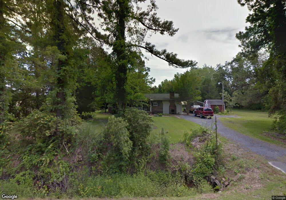
7100 Highway 366 Conway, SC 29526
3
Beds
1
Bath
1,092
Sq Ft
30,056
Sq Ft Lot
About This Home
This home is located at 7100 Highway 366, Conway, SC 29526. 7100 Highway 366 is a home with nearby schools including Daisy Elementary School, Loris Middle School, and Loris High School.
Ownership History
Date
Name
Owned For
Owner Type
Purchase Details
Closed on
Mar 17, 2005
Sold by
Oppel Kevin T
Bought by
Oppel Kevin T and Howard Robin C
Purchase Details
Closed on
Mar 10, 2005
Sold by
Oppel Terri L
Bought by
Oppel Kevin T
Purchase Details
Closed on
May 3, 2000
Sold by
Fairhurst Nina
Bought by
Oppel Kevin T and Oppel Terri L
Home Financials for this Owner
Home Financials are based on the most recent Mortgage that was taken out on this home.
Original Mortgage
$72,750
Outstanding Balance
$23,255
Interest Rate
8.14%
Mortgage Type
Purchase Money Mortgage
Purchase Details
Closed on
May 3, 1999
Sold by
Stevens Kenneth A and Estate Of Kyoko Stevens
Bought by
Fairhurst Nina
Create a Home Valuation Report for This Property
The Home Valuation Report is an in-depth analysis detailing your home's value as well as a comparison with similar homes in the area
Home Values in the Area
Average Home Value in this Area
Purchase History
| Date | Buyer | Sale Price | Title Company |
|---|---|---|---|
| Oppel Kevin T | -- | -- | |
| Oppel Kevin T | -- | -- | |
| Oppel Kevin T | $75,000 | -- | |
| Fairhurst Nina | -- | -- |
Source: Public Records
Mortgage History
| Date | Status | Borrower | Loan Amount |
|---|---|---|---|
| Open | Oppel Kevin T | $72,750 |
Source: Public Records
Tax History
| Year | Tax Paid | Tax Assessment Tax Assessment Total Assessment is a certain percentage of the fair market value that is determined by local assessors to be the total taxable value of land and additions on the property. | Land | Improvement |
|---|---|---|---|---|
| 2025 | $426 | $0 | $0 | $0 |
| 2024 | $426 | $8,280 | $2,484 | $5,796 |
| 2023 | $426 | $3,181 | $629 | $2,552 |
| 2021 | $390 | $4,771 | $943 | $3,828 |
| 2020 | $321 | $4,771 | $943 | $3,828 |
| 2019 | $321 | $4,771 | $943 | $3,828 |
| 2018 | $0 | $4,966 | $832 | $4,134 |
| 2017 | $326 | $3,311 | $555 | $2,756 |
| 2016 | -- | $3,311 | $555 | $2,756 |
| 2015 | $326 | $3,311 | $555 | $2,756 |
| 2014 | $302 | $3,311 | $555 | $2,756 |
Source: Public Records
Map
Nearby Homes
- 7144 S Carolina 366
- 7136 S Carolina 366
- 4142 Highway 554
- 4138 Highway 554
- 4138 State Hwy 554
- 4142 State Hwy 554 St
- 112 Furnies Place
- 124 Furnies Place
- 116 Furnies Place
- 120 Furnies Place
- 136 Furnies Place
- 128 Furnies Place
- 4190 Highway 554
- 4190 State Hwy 554
- LOT 1 W G Rd Unit Lot 1 W G RD
- 3760 S Carolina 366
- 3817 Woodlawn Dr
- 2181 S Carolina 66
- 2195 S Carolina 66
- TBD Highway 545 Unit TBD Hannahrae Court
- 7101 Highway 366
- 7054 Highway 366
- 1780 Deer Dog Ln
- 7157 Highway 366
- 1790 Deer Dog Ln
- 7176 Highway 366
- 4036 State Highway 554
- 4036 Highway 554
- 1800 Deer Dog Ln
- 4100 S Carolina 366
- 4021 Highway 554 Unit Conv Store & Race Ka
- 4021 Highway 554
- 4007 Highway 554
- 4085 Highway 366
- 3959 Highway 554
- 4022 Highway 554
- TBD Highway 554
- 1284 Cheyenne Rd Unit Lot 1
- 4142 Highway 554 Unit lot 28
- 4138 Highway 554 Unit lot 27
Your Personal Tour Guide
Ask me questions while you tour the home.