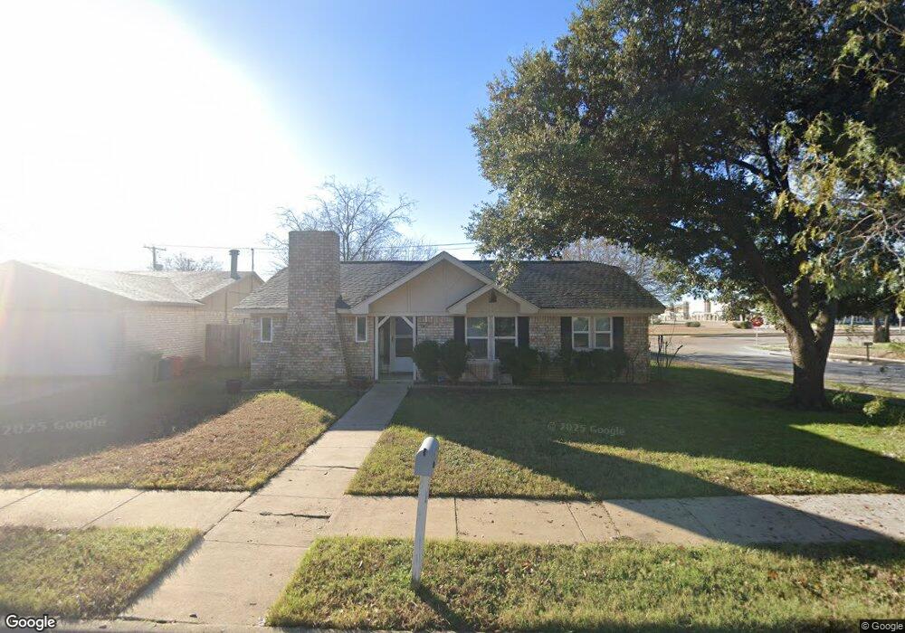
7100 Lancashire Dr North Richland Hills, TX 76182
Estimated Value: $282,504 - $292,000
3
Beds
2
Baths
1,465
Sq Ft
$197/Sq Ft
Est. Value
About This Home
This home is located at 7100 Lancashire Dr, North Richland Hills, TX 76182 and is currently estimated at $289,126, approximately $197 per square foot. 7100 Lancashire Dr is a home located in Tarrant County with nearby schools including Foster Village Elementary School, North Ridge Middle School, and Richland High School.
Ownership History
Date
Name
Owned For
Owner Type
Purchase Details
Closed on
Apr 12, 2007
Sold by
Delong Phillip D and Delong Hillip K
Bought by
Smith Julie A
Current Estimated Value
Home Financials for this Owner
Home Financials are based on the most recent Mortgage that was taken out on this home.
Original Mortgage
$98,455
Outstanding Balance
$59,659
Interest Rate
6.19%
Mortgage Type
Purchase Money Mortgage
Estimated Equity
$229,467
Purchase Details
Closed on
Feb 27, 2006
Sold by
American Airlines Fcu
Bought by
Delong Phillip D
Home Financials for this Owner
Home Financials are based on the most recent Mortgage that was taken out on this home.
Original Mortgage
$74,100
Interest Rate
6.19%
Mortgage Type
Purchase Money Mortgage
Purchase Details
Closed on
Dec 15, 2005
Sold by
Zafor Mohammed A and Zafor Donna G
Bought by
American Airlines Fcu
Create a Home Valuation Report for This Property
The Home Valuation Report is an in-depth analysis detailing your home's value as well as a comparison with similar homes in the area
Home Values in the Area
Average Home Value in this Area
Purchase History
| Date | Buyer | Sale Price | Title Company |
|---|---|---|---|
| Smith Julie A | -- | Commonwealth Land | |
| Delong Phillip D | -- | None Available | |
| American Airlines Fcu | $55,850 | None Available |
Source: Public Records
Mortgage History
| Date | Status | Borrower | Loan Amount |
|---|---|---|---|
| Open | Smith Julie A | $98,455 | |
| Previous Owner | Delong Phillip D | $74,100 |
Source: Public Records
Tax History Compared to Growth
Tax History
| Year | Tax Paid | Tax Assessment Tax Assessment Total Assessment is a certain percentage of the fair market value that is determined by local assessors to be the total taxable value of land and additions on the property. | Land | Improvement |
|---|---|---|---|---|
| 2025 | $3,225 | $267,760 | $50,000 | $217,760 |
| 2024 | $3,225 | $267,760 | $50,000 | $217,760 |
| 2023 | $2,936 | $282,455 | $50,000 | $232,455 |
| 2022 | $4,408 | $228,761 | $28,000 | $200,761 |
| 2021 | $4,237 | $211,948 | $28,000 | $183,948 |
| 2020 | $3,852 | $189,822 | $28,000 | $161,822 |
| 2019 | $3,624 | $186,171 | $28,000 | $158,171 |
| 2018 | $2,821 | $125,114 | $28,000 | $97,114 |
| 2017 | $3,060 | $144,659 | $28,000 | $116,659 |
| 2016 | $2,782 | $121,613 | $18,000 | $103,613 |
| 2015 | $2,224 | $94,000 | $10,000 | $84,000 |
| 2014 | $2,224 | $94,000 | $10,000 | $84,000 |
Source: Public Records
Map
Nearby Homes
- 7100 Winchester Rd
- 7133 Winchester Rd
- 6933 Glenhurst Dr
- 6520 Yarmouth Ave
- 7233 Romford Way
- 6321 Little Ranch Rd
- 6717 Dream Dust Dr
- 7400 Bogart Dr
- 6608 Summertime Ln
- 6725 S Fork Dr
- 6608 Swanee Ct
- 5729 Cancun Dr
- 7500 Regal Ln
- 7501 April Ln
- 6437 Route 66
- 6200 Kings Path
- 5704 Glynda Dr
- 5708 Glynda Dr
- 5716 Glynda Dr
- 5712 Glynda Dr
- 7104 Lancashire Dr
- 7108 Lancashire Dr
- 6301 Yarmouth Ave
- 6305 Yarmouth Ave
- 7101 Lancashire Dr
- 6309 Yarmouth Ave
- 7105 Lancashire Dr
- 7112 Lancashire Dr
- 7109 Lancashire Dr
- 6313 Yarmouth Ave
- 7116 Lancashire Dr
- 7113 Lancashire Dr
- 6317 Yarmouth Ave
- 7100 Chatham Rd
- 7114 Mid Cities Blvd
- 7104 Chatham Rd
- 7117 Lancashire Dr
- 7124 Mid Cities Blvd
- 7120 Lancashire Dr
- 7108 Chatham Rd