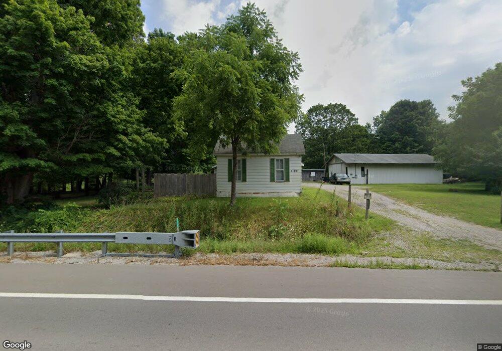
7100 N State Rd Davison, MI 48423
Estimated Value: $80,000 - $170,000
2
Beds
1
Bath
616
Sq Ft
$217/Sq Ft
Est. Value
About This Home
This home is located at 7100 N State Rd, Davison, MI 48423 and is currently estimated at $133,831, approximately $217 per square foot. 7100 N State Rd is a home located in Genesee County with nearby schools including Columbiaville Elementary School, Otisville Elementary School, and Lakeville Middle School.
Ownership History
Date
Name
Owned For
Owner Type
Purchase Details
Closed on
Feb 28, 2017
Sold by
Taylor Jessica
Bought by
Tharrett Donald R
Current Estimated Value
Home Financials for this Owner
Home Financials are based on the most recent Mortgage that was taken out on this home.
Original Mortgage
$23,800
Outstanding Balance
$19,700
Interest Rate
4.19%
Mortgage Type
Purchase Money Mortgage
Estimated Equity
$114,131
Purchase Details
Closed on
May 15, 2001
Sold by
Mckeachie Laverne A and Mckeachie Glenda G
Bought by
Johnson Garnet J and Johnson Luella J
Create a Home Valuation Report for This Property
The Home Valuation Report is an in-depth analysis detailing your home's value as well as a comparison with similar homes in the area
Home Values in the Area
Average Home Value in this Area
Purchase History
| Date | Buyer | Sale Price | Title Company |
|---|---|---|---|
| Tharrett Donald R | $38,000 | None Available | |
| Johnson Garnet J | $35,000 | -- |
Source: Public Records
Mortgage History
| Date | Status | Borrower | Loan Amount |
|---|---|---|---|
| Open | Tharrett Donald R | $23,800 |
Source: Public Records
Tax History
| Year | Tax Paid | Tax Assessment Tax Assessment Total Assessment is a certain percentage of the fair market value that is determined by local assessors to be the total taxable value of land and additions on the property. | Land | Improvement |
|---|---|---|---|---|
| 2025 | $2,683 | $64,600 | $0 | $0 |
| 2024 | $567 | $61,500 | $0 | $0 |
| 2023 | $541 | $55,700 | $0 | $0 |
| 2022 | $2,373 | $51,000 | $0 | $0 |
| 2021 | $2,358 | $45,900 | $0 | $0 |
| 2020 | $495 | $45,000 | $0 | $0 |
| 2019 | $487 | $42,700 | $0 | $0 |
| 2018 | $1,717 | $40,400 | $0 | $0 |
| 2017 | $1,840 | $40,400 | $0 | $0 |
| 2016 | $1,846 | $38,000 | $0 | $0 |
| 2015 | $967 | $35,700 | $0 | $0 |
| 2014 | $373 | $32,400 | $0 | $0 |
| 2012 | -- | $36,200 | $36,200 | $0 |
Source: Public Records
Map
Nearby Homes
- 6405 N State Rd
- 9465 Hubbard Rd
- 9377 Hubbard Rd
- 11033 Carr Rd
- 6152 N Gale Rd
- 8054 N Gale Rd
- 2444 E Stanley Rd
- 11074 E Mount Morris Rd
- 9110 E Coldwater Rd
- 8353 Gale Rd
- 8460 Gale Rd
- 5346 N Oak Rd
- 10287 Frances Rd
- 5383 N Henderson Rd
- 5438 N Henderson Rd
- 255 Roosevelt Dr
- 490 Harrison Dr
- 1240 N Irish Rd
- 7368 Vassar Rd
- 5165 N Irish Rd
- 7091 N State Rd
- 7074 N State Rd
- 7071 N State Rd
- 9493 Worth Rd
- 9488 Worth Rd
- 9473 Worth Rd
- 7038 N State Rd
- 9480 Worth Rd
- 7022 N State Rd
- 7045 N State Rd
- 9455 Worth Rd
- 9468 Worth Rd
- 7295 N State Rd
- 10041 E Stanley Rd
- 7155 N State Rd
- 9456 Worth Rd
- 10053 E Stanley Rd
- 9445 Worth Rd
- 7008 N State Rd
- 10065 E Stanley Rd
Your Personal Tour Guide
Ask me questions while you tour the home.