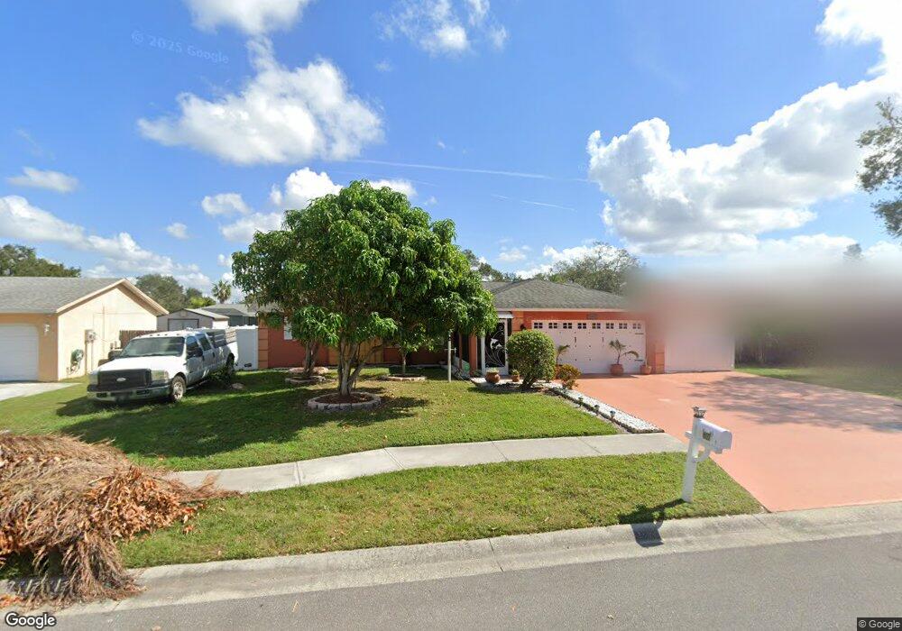
7101 12th Ct E Sarasota, FL 34243
Estimated Value: $340,000 - $373,977
3
Beds
2
Baths
1,873
Sq Ft
$189/Sq Ft
Est. Value
About This Home
This home is located at 7101 12th Ct E, Sarasota, FL 34243 and is currently estimated at $354,494, approximately $189 per square foot. 7101 12th Ct E is a home located in Manatee County with nearby schools including Florine J. Abel Elementary School, Electa Lee Magnet Middle School, and Southeast High School.
Ownership History
Date
Name
Owned For
Owner Type
Purchase Details
Closed on
Oct 21, 2017
Sold by
Bustillo Elias
Bought by
Marrero Diana R
Current Estimated Value
Purchase Details
Closed on
Oct 29, 2004
Sold by
Keeley Robert K and Keeley Melodie A
Bought by
Bustillo Elias and Marrero Diana R
Home Financials for this Owner
Home Financials are based on the most recent Mortgage that was taken out on this home.
Original Mortgage
$145,600
Interest Rate
5.6%
Mortgage Type
Purchase Money Mortgage
Create a Home Valuation Report for This Property
The Home Valuation Report is an in-depth analysis detailing your home's value as well as a comparison with similar homes in the area
Home Values in the Area
Average Home Value in this Area
Purchase History
| Date | Buyer | Sale Price | Title Company |
|---|---|---|---|
| Marrero Diana R | -- | Attorney | |
| Bustillo Elias | $182,000 | Masters Title Services Inc |
Source: Public Records
Mortgage History
| Date | Status | Borrower | Loan Amount |
|---|---|---|---|
| Previous Owner | Bustillo Elias | $145,600 | |
| Closed | Bustillo Elias | $27,300 |
Source: Public Records
Tax History Compared to Growth
Tax History
| Year | Tax Paid | Tax Assessment Tax Assessment Total Assessment is a certain percentage of the fair market value that is determined by local assessors to be the total taxable value of land and additions on the property. | Land | Improvement |
|---|---|---|---|---|
| 2025 | $1,293 | $109,856 | -- | -- |
| 2024 | $1,293 | $106,760 | -- | -- |
| 2023 | $1,247 | $103,650 | $0 | $0 |
| 2022 | $1,166 | $100,631 | $0 | $0 |
| 2021 | $1,119 | $97,700 | $0 | $0 |
| 2020 | $1,110 | $96,351 | $0 | $0 |
| 2019 | $1,077 | $94,185 | $0 | $0 |
| 2018 | $1,053 | $92,429 | $0 | $0 |
| 2017 | $966 | $90,528 | $0 | $0 |
| 2016 | $951 | $88,666 | $0 | $0 |
| 2015 | $947 | $88,050 | $0 | $0 |
| 2014 | $947 | $87,351 | $0 | $0 |
| 2013 | $930 | $86,060 | $0 | $0 |
Source: Public Records
Map
Nearby Homes
- 1219 70th Dr E
- 911 Wee Burn Place
- 1112 Longfellow Rd
- 1147 Longfellow Rd Unit 157C
- 1143 Longfellow Rd
- 7019 8th Ct E
- 1052 Longfellow Cir
- 1190 Longfellow Way Unit 135-C
- 1125 Longfellow Way Unit 125B
- 6860 Whitman Ct Unit 32B
- 927 Byron Ln Unit 13-B
- 940 Byron Ct Unit 17
- 1116 Danny Dr
- 1320 Magellan Dr
- 7205 Alderwood Dr
- 6555 Connecticut Ave
- 530 Saint Andrews Dr
- 6515 15th St E Unit L14
- 6515 15th St E Unit G14
- 6515 15th St E Unit E4
