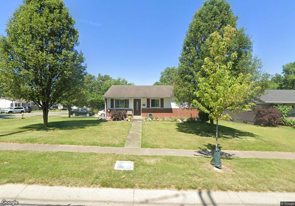
7101 Memory Ln Cincinnati, OH 45239
Estimated Value: $179,000 - $212,000
3
Beds
2
Baths
1,026
Sq Ft
$187/Sq Ft
Est. Value
About This Home
This home is located at 7101 Memory Ln, Cincinnati, OH 45239 and is currently estimated at $191,626, approximately $186 per square foot. 7101 Memory Ln is a home located in Hamilton County with nearby schools including White Oak Middle School, Colerain High School, and Cincinnati Achievement Academy.
Ownership History
Date
Name
Owned For
Owner Type
Purchase Details
Closed on
Feb 19, 2010
Sold by
Asher Joe and Asher Melissa M
Bought by
Atwood Gerald and Atwood Effie B
Current Estimated Value
Home Financials for this Owner
Home Financials are based on the most recent Mortgage that was taken out on this home.
Original Mortgage
$58,400
Outstanding Balance
$38,193
Interest Rate
5.11%
Mortgage Type
New Conventional
Estimated Equity
$153,433
Purchase Details
Closed on
Feb 13, 2008
Sold by
Schuck Wilma M
Bought by
Asher Joe
Purchase Details
Closed on
Feb 21, 1998
Sold by
Berg Susan Redelman and Schuck Wilma M
Bought by
Schuck Wilma M
Purchase Details
Closed on
Jul 3, 1996
Sold by
Schuck Wilma M
Bought by
Berg Susan Redelmann
Create a Home Valuation Report for This Property
The Home Valuation Report is an in-depth analysis detailing your home's value as well as a comparison with similar homes in the area
Home Values in the Area
Average Home Value in this Area
Purchase History
| Date | Buyer | Sale Price | Title Company |
|---|---|---|---|
| Atwood Gerald | $73,000 | Attorney | |
| Asher Joe | $43,500 | Ltoc | |
| Schuck Wilma M | -- | -- | |
| Berg Susan Redelmann | -- | -- |
Source: Public Records
Mortgage History
| Date | Status | Borrower | Loan Amount |
|---|---|---|---|
| Open | Atwood Gerald | $58,400 |
Source: Public Records
Tax History
| Year | Tax Paid | Tax Assessment Tax Assessment Total Assessment is a certain percentage of the fair market value that is determined by local assessors to be the total taxable value of land and additions on the property. | Land | Improvement |
|---|---|---|---|---|
| 2025 | $2,443 | $41,412 | $8,302 | $33,110 |
| 2023 | $2,299 | $41,412 | $8,302 | $33,110 |
| 2022 | $1,512 | $22,243 | $6,489 | $15,754 |
| 2021 | $1,527 | $22,243 | $6,489 | $15,754 |
| 2020 | $1,508 | $22,243 | $6,489 | $15,754 |
| 2019 | $1,378 | $18,848 | $5,499 | $13,349 |
| 2018 | $1,239 | $18,848 | $5,499 | $13,349 |
| 2017 | $1,191 | $18,848 | $5,499 | $13,349 |
| 2016 | $1,519 | $23,506 | $7,574 | $15,932 |
| 2015 | $1,512 | $23,506 | $7,574 | $15,932 |
| 2014 | $1,517 | $23,506 | $7,574 | $15,932 |
| 2013 | $1,571 | $25,550 | $8,232 | $17,318 |
Source: Public Records
Map
Nearby Homes
- 2757 Banning Rd
- 6751 Rutherford Ct
- 2836 Banning Rd
- 2427 Crosley Meadow
- 2391 Deblin Dr
- 2820 Geraldine Dr
- 2405 Amelia Ct
- 2424 Banning Rd
- 2806 Breezy Way
- 2564 Altura Dr
- 2730 Byrneside Dr
- 2680 Royal Glen Dr
- 2528 Flanigan Ct
- 2801 Byrneside Dr
- 2342 Banning Rd
- 2503 Flanigan Ct
- 2268 Deblin Dr
- 5970 Colerain Ave
- 3140 Banning Rd
- 3181 Preserve Ln
- 7117 Memory Ln
- 2644 Banning Rd
- 2656 Banning Rd
- 2610 Banning Rd
- 7133 Memory La
- 7133 Memory Ln
- 7091 Memory Ln
- 2637 Banning Rd
- 2660 Banning Rd
- 2600 Banning Rd
- 2645 Banning Rd
- 7149 Memory Ln
- 7136 Memory Ln
- 2601 Banning Rd
- 7051 Memory Ln
- 2655 Banning Rd
- 2596 Banning Rd
- 2668 Banning Rd
- 7068 Memory Ln
- 7156 Memory Ln
Your Personal Tour Guide
Ask me questions while you tour the home.