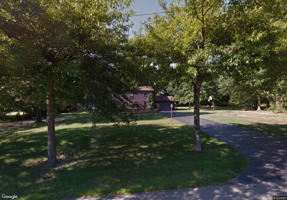
7103 Pine Grove Dr Hubbard, OH 44425
Estimated Value: $294,000 - $432,000
4
Beds
4
Baths
2,480
Sq Ft
$140/Sq Ft
Est. Value
About This Home
This home is located at 7103 Pine Grove Dr, Hubbard, OH 44425 and is currently estimated at $346,703, approximately $139 per square foot. 7103 Pine Grove Dr is a home located in Trumbull County with nearby schools including Hubbard Elementary School, Hubbard Middle School, and Hubbard High School.
Ownership History
Date
Name
Owned For
Owner Type
Purchase Details
Closed on
Feb 19, 2025
Sold by
Kilar William P and Kilar Susan A
Bought by
Kbm Llc
Current Estimated Value
Purchase Details
Closed on
Apr 28, 2016
Sold by
Kilar Thomas Paul and Kilar Marilyn Kay
Bought by
Kilar Thomas Paul and Kilar Marilyn Kay
Purchase Details
Closed on
Jan 1, 1990
Bought by
Thomas Paul Kilar J and Thomas S
Create a Home Valuation Report for This Property
The Home Valuation Report is an in-depth analysis detailing your home's value as well as a comparison with similar homes in the area
Home Values in the Area
Average Home Value in this Area
Purchase History
| Date | Buyer | Sale Price | Title Company |
|---|---|---|---|
| Kbm Llc | -- | None Listed On Document | |
| Kilar William P | -- | None Listed On Document | |
| Kilar Thomas Paul | -- | None Available | |
| Thomas Paul Kilar J | -- | -- |
Source: Public Records
Tax History Compared to Growth
Tax History
| Year | Tax Paid | Tax Assessment Tax Assessment Total Assessment is a certain percentage of the fair market value that is determined by local assessors to be the total taxable value of land and additions on the property. | Land | Improvement |
|---|---|---|---|---|
| 2024 | $6,404 | $105,320 | $9,030 | $96,290 |
| 2023 | $6,404 | $105,320 | $9,030 | $96,290 |
| 2022 | $4,713 | $67,310 | $8,470 | $58,840 |
| 2021 | $4,570 | $64,820 | $8,470 | $56,350 |
| 2020 | $4,584 | $64,820 | $8,470 | $56,350 |
| 2019 | $4,403 | $59,220 | $8,470 | $50,750 |
| 2018 | $4,302 | $59,220 | $8,470 | $50,750 |
| 2017 | $4,293 | $59,220 | $8,470 | $50,750 |
| 2016 | $3,927 | $55,970 | $8,400 | $47,570 |
| 2015 | $3,937 | $55,970 | $8,400 | $47,570 |
| 2014 | $3,880 | $55,970 | $8,400 | $47,570 |
| 2013 | $2,938 | $55,970 | $8,400 | $47,570 |
Source: Public Records
Map
Nearby Homes
- 7111 Pine Grove Dr
- 1911 Hubbard Thomas Rd
- 1354 Stevenson Rd
- 1952 Hubbard Masury Rd
- 6855 Stewart Sharon Rd
- 7737 Elm St
- 7847 Chestnut St
- 7822 2nd St
- 1017 Broadway St
- 132 Drummond Ave
- 7370 Brookwood Dr
- 784 Elmwood Dr
- 764 Jones St
- 462 Elizabeth St
- 395 Elizabeth St
- 5910 Chestnut Ridge Rd
- 138 Moore St
- 611 Moore St
- 248 Myron St
- 6984 Warren Sharon Rd
- 0 Pine Grove Dr
- 7077 Pine Grove Dr
- 7080 Pine Grove Dr
- 7131 Pine Grove Dr
- 7120 Pine Grove Dr
- 7068 Pine Grove Dr
- 7099 White Oak Dr
- 7089 White Oak Dr
- 7105 White Oak Dr
- 7077 White Oak Dr
- 7134 Pine Grove Dr
- 7058 Pine Grove Dr
- 7155 Pine Grove Dr
- 7049 Pine Grove Dr
- 0 Brookfield Rd SW Unit 4053136
- 7067 White Oak Dr
- 7111 White Oak Dr
- 7144 Pine Grove Dr
- 7048 Pine Grove Dr
- 7057 White Oak Dr