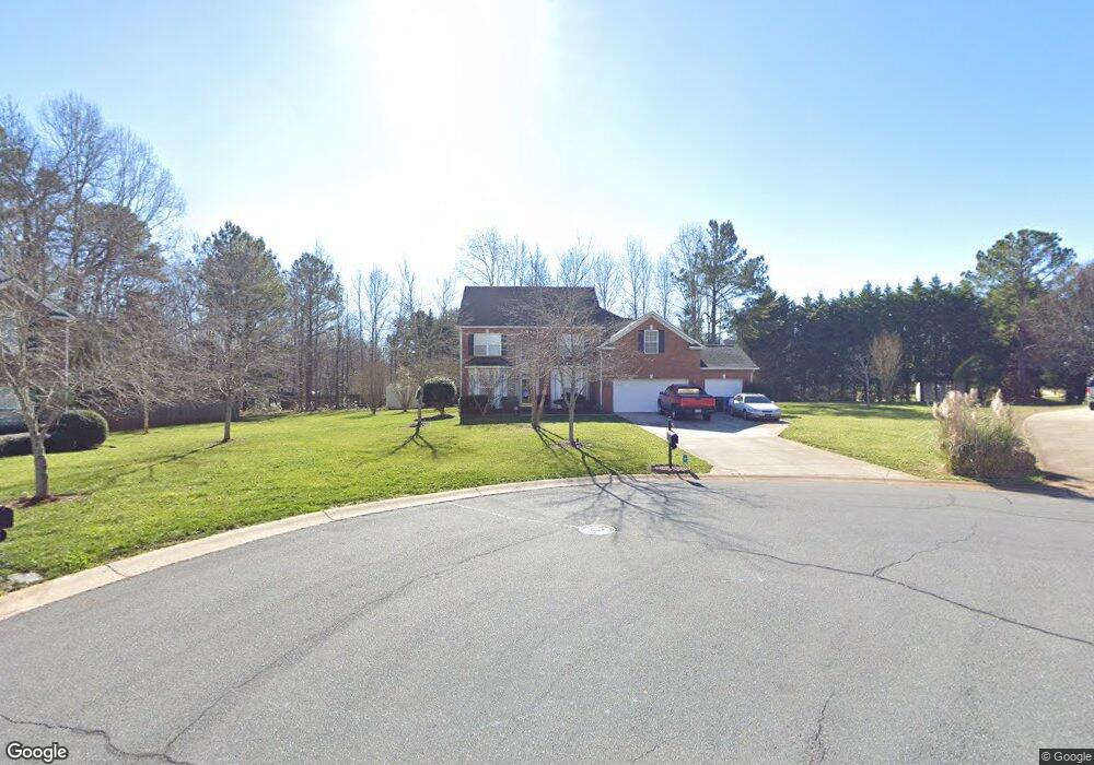
7104 Forrest Rader Dr Mint Hill, NC 28227
Estimated Value: $608,410 - $669,000
6
Beds
3
Baths
3,362
Sq Ft
$190/Sq Ft
Est. Value
About This Home
This home is located at 7104 Forrest Rader Dr, Mint Hill, NC 28227 and is currently estimated at $639,853, approximately $190 per square foot. 7104 Forrest Rader Dr is a home located in Mecklenburg County with nearby schools including Bain Elementary, Mint Hill Middle School, and Independence High.
Ownership History
Date
Name
Owned For
Owner Type
Purchase Details
Closed on
Aug 12, 2014
Sold by
Sherman Carol and Sherman Kristopher L
Bought by
Williams Henry H and Williams Kelly
Current Estimated Value
Home Financials for this Owner
Home Financials are based on the most recent Mortgage that was taken out on this home.
Original Mortgage
$275,000
Outstanding Balance
$210,078
Interest Rate
4.16%
Mortgage Type
VA
Estimated Equity
$429,775
Purchase Details
Closed on
Aug 1, 2011
Sold by
Mullis Martha D
Bought by
Thompson Carol Angela
Home Financials for this Owner
Home Financials are based on the most recent Mortgage that was taken out on this home.
Original Mortgage
$233,916
Interest Rate
4.5%
Mortgage Type
FHA
Purchase Details
Closed on
Apr 27, 2000
Sold by
Cambridge Homes Of Nc Ltd Partnership
Bought by
Mullis Martha D
Create a Home Valuation Report for This Property
The Home Valuation Report is an in-depth analysis detailing your home's value as well as a comparison with similar homes in the area
Home Values in the Area
Average Home Value in this Area
Purchase History
| Date | Buyer | Sale Price | Title Company |
|---|---|---|---|
| Williams Henry H | $275,000 | Master Title Agency | |
| Thompson Carol Angela | $240,000 | Chicago Title | |
| Mullis Martha D | $228,500 | -- |
Source: Public Records
Mortgage History
| Date | Status | Borrower | Loan Amount |
|---|---|---|---|
| Open | Williams Henry H | $275,000 | |
| Previous Owner | Thompson Carol Angela | $233,916 |
Source: Public Records
Tax History Compared to Growth
Tax History
| Year | Tax Paid | Tax Assessment Tax Assessment Total Assessment is a certain percentage of the fair market value that is determined by local assessors to be the total taxable value of land and additions on the property. | Land | Improvement |
|---|---|---|---|---|
| 2025 | $3,664 | $510,500 | $110,000 | $400,500 |
| 2024 | $3,664 | $510,500 | $110,000 | $400,500 |
| 2023 | $3,608 | $510,500 | $110,000 | $400,500 |
| 2022 | $2,861 | $323,600 | $80,000 | $243,600 |
| 2021 | $2,861 | $323,600 | $80,000 | $243,600 |
| 2020 | $2,861 | $323,600 | $80,000 | $243,600 |
| 2019 | $2,855 | $323,600 | $80,000 | $243,600 |
| 2018 | $2,557 | $231,400 | $42,800 | $188,600 |
| 2017 | $2,536 | $231,400 | $42,800 | $188,600 |
| 2016 | $2,533 | $231,400 | $42,800 | $188,600 |
| 2015 | $2,529 | $231,400 | $42,800 | $188,600 |
| 2014 | $2,527 | $231,400 | $42,800 | $188,600 |
Source: Public Records
Map
Nearby Homes
- 10711 Reid Alexander Ln
- 6815 Cinnamon Cir Unit 6C
- 15018 Camus Ct
- 7230 Truelight Church Rd
- 4303 Patriots Hill Rd
- 7445 Forrest Rader Dr
- 3215 Lisburn St
- 5331 Chicopee Dr
- 7710 Grove Hall Ave
- 10200 Atchinson Dr
- 7914 Nelson Rd
- 6545 Old Magnolia Ln
- 13216 Lawyers Rd
- 7701 Matthews-Mint Hill Rd
- 10501 Olde Irongate Ln
- 5108 Kinsbridge Dr
- 5010 Kinsbridge Dr
- 4119 Roe Creek Dr
- Woodwright Plan at Alton Creek
- Henderson Plan at Alton Creek
- 7110 Forrest Rader Dr
- 10825 Reid Alexander Ln
- 7105 Forrest Rader Dr
- 10831 Reid Alexander Ln
- 7120 Forrest Rader Dr
- 10815 Reid Alexander Ln
- 7117 Forrest Rader Dr
- 10957 Lawyers Rd
- 10967 Lawyers Rd
- 7133 Nelson Rd
- 10834 Reid Alexander Ln
- 7108 Travis Reid Ln
- 7129 Forrest Rader Dr
- 7130 Forrest Rader Dr
- 7118 Travis Reid Ln
- 10971 Lawyers Rd
- 7100 Travis Reid Ln
- 10828 Reid Alexander Ln
- 10820 Reid Alexander Ln
- 10810 Reid Alexander Ln