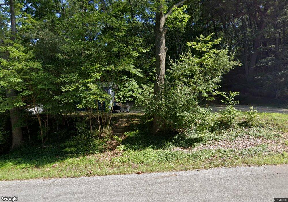
7106 N Poplar Rd Free Soil, MI 49411
Estimated Value: $83,831 - $248,000
2
Beds
1
Bath
750
Sq Ft
$216/Sq Ft
Est. Value
About This Home
This home is located at 7106 N Poplar Rd, Free Soil, MI 49411 and is currently estimated at $161,708, approximately $215 per square foot. 7106 N Poplar Rd is a home located in Mason County.
Ownership History
Date
Name
Owned For
Owner Type
Purchase Details
Closed on
Jun 10, 2022
Sold by
Christine Slawinski
Bought by
Dozer Timothy A and Dozer Laura
Current Estimated Value
Home Financials for this Owner
Home Financials are based on the most recent Mortgage that was taken out on this home.
Original Mortgage
$342,000
Outstanding Balance
$325,414
Interest Rate
5.27%
Mortgage Type
New Conventional
Estimated Equity
-$163,706
Purchase Details
Closed on
Mar 15, 2006
Sold by
Hipshier Happy J and Hipshier Nita M
Bought by
Slawinski Brian and Slawinski Christine
Home Financials for this Owner
Home Financials are based on the most recent Mortgage that was taken out on this home.
Original Mortgage
$76,000
Interest Rate
6.25%
Mortgage Type
Adjustable Rate Mortgage/ARM
Create a Home Valuation Report for This Property
The Home Valuation Report is an in-depth analysis detailing your home's value as well as a comparison with similar homes in the area
Home Values in the Area
Average Home Value in this Area
Purchase History
| Date | Buyer | Sale Price | Title Company |
|---|---|---|---|
| Dozer Timothy A | $380,000 | None Listed On Document | |
| Slawinski Brian | $80,000 | Lakeshore Land & Title |
Source: Public Records
Mortgage History
| Date | Status | Borrower | Loan Amount |
|---|---|---|---|
| Open | Dozer Timothy A | $342,000 | |
| Previous Owner | Slawinski Brian | $76,000 |
Source: Public Records
Tax History Compared to Growth
Tax History
| Year | Tax Paid | Tax Assessment Tax Assessment Total Assessment is a certain percentage of the fair market value that is determined by local assessors to be the total taxable value of land and additions on the property. | Land | Improvement |
|---|---|---|---|---|
| 2025 | $330 | $12,800 | $12,800 | $0 |
| 2024 | -- | $11,300 | $11,300 | $0 |
| 2023 | -- | $7,200 | $7,200 | $0 |
| 2022 | -- | $6,800 | $0 | $0 |
| 2021 | -- | $6,600 | $0 | $0 |
| 2020 | $9 | $6,700 | $0 | $0 |
| 2019 | -- | -- | $0 | $0 |
| 2018 | -- | -- | $0 | $0 |
| 2017 | -- | -- | $0 | $0 |
| 2016 | -- | -- | $0 | $0 |
| 2015 | -- | -- | $0 | $0 |
| 2013 | -- | -- | $0 | $0 |
Source: Public Records
Map
Nearby Homes
- 7075 N Poplar Rd
- 4333 E Town Line Rd
- 6387 N Larson Rd
- V L 118a E Townline Rd
- 6088 N Larson Rd
- V/L E Free Soil Rd
- 0 E Freesoil Unit 40 acres 24030243
- 5680 E Shores Dr
- 1217 E Beyer Rd
- 5915 E Fountain Rd
- 1997 E Townline Rd
- 4293 N Schoenherr Rd
- 5341 N Benson Rd
- V/L 118A E Townline Rd
- 2269 W Treml Rd
- Parcel 2 E Koenig Rd
- 6875 Sauble Rd
- V/L Benson Rd
- 00# N Benson Rd
- V/L N Benson Rd
- 7112 N Poplar Rd
- 7064 N Poplar Rd
- 7111 N Poplar Rd
- 7185 N Poplar Rd
- 7124 N Poplar Rd
- 7130 N Poplar Rd
- 7120 N Poplar Rd
- 7101 N Poplar Rd
- 7095 N Poplar Rd
- 7153 N Poplar Rd
- 7085 N Poplar Rd
- 7121 N Poplar Rd
- 7118 N Poplar Rd
- 7135 N Poplar Rd
- 7143 N Poplar Rd
- 7163 N Poplar Rd
- 7010 N Poplar Rd
- 7196 N Poplar Rd
- 7051 N Poplar Rd
- 7174 N Poplar Rd
