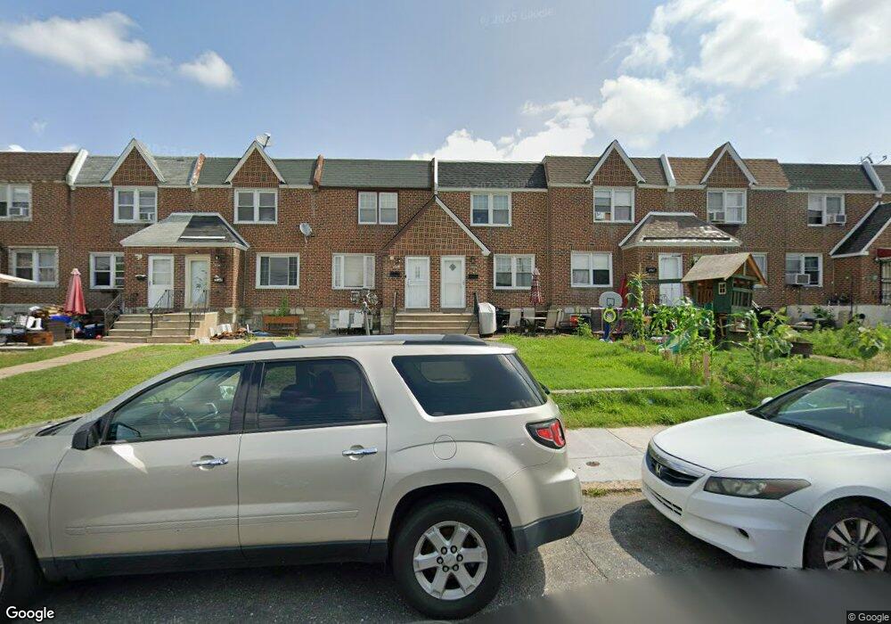
7109 Horrocks St Philadelphia, PA 19149
Castor Gardens NeighborhoodEstimated Value: $241,000 - $258,000
3
Beds
1
Bath
1,296
Sq Ft
$194/Sq Ft
Est. Value
About This Home
This home is located at 7109 Horrocks St, Philadelphia, PA 19149 and is currently estimated at $250,791, approximately $193 per square foot. 7109 Horrocks St is a home located in Philadelphia County with nearby schools including Solomon Solis-Cohen School, Castor Gardens Middle School, and Northeast High School.
Ownership History
Date
Name
Owned For
Owner Type
Purchase Details
Closed on
Jun 12, 2023
Sold by
Jang Ki Hwan and Jang Eun Chang
Bought by
Jang Mike
Current Estimated Value
Purchase Details
Closed on
Jan 26, 2007
Sold by
Jang Yoo Jin and Estate Of Eun Suk Jang
Bought by
Chang Jang Ki Hwan and Chang Jang Eun
Home Financials for this Owner
Home Financials are based on the most recent Mortgage that was taken out on this home.
Original Mortgage
$101,700
Interest Rate
7.2%
Mortgage Type
Purchase Money Mortgage
Purchase Details
Closed on
Mar 5, 2002
Sold by
Addis Sol and Addis Ida
Bought by
Jang Eun Suk
Home Financials for this Owner
Home Financials are based on the most recent Mortgage that was taken out on this home.
Original Mortgage
$60,750
Interest Rate
6.88%
Create a Home Valuation Report for This Property
The Home Valuation Report is an in-depth analysis detailing your home's value as well as a comparison with similar homes in the area
Home Values in the Area
Average Home Value in this Area
Purchase History
| Date | Buyer | Sale Price | Title Company |
|---|---|---|---|
| Jang Mike | -- | Accommodation/Courtesy Recordi | |
| Chang Jang Ki Hwan | $113,000 | None Available | |
| Jang Eun Suk | $84,000 | -- |
Source: Public Records
Mortgage History
| Date | Status | Borrower | Loan Amount |
|---|---|---|---|
| Previous Owner | Chang Jang Ki Hwan | $101,700 | |
| Previous Owner | Jang Eun Suk | $60,750 |
Source: Public Records
Tax History Compared to Growth
Tax History
| Year | Tax Paid | Tax Assessment Tax Assessment Total Assessment is a certain percentage of the fair market value that is determined by local assessors to be the total taxable value of land and additions on the property. | Land | Improvement |
|---|---|---|---|---|
| 2025 | $3,291 | $275,100 | $55,020 | $220,080 |
| 2024 | $3,291 | $275,100 | $55,020 | $220,080 |
| 2023 | $3,291 | $235,100 | $47,020 | $188,080 |
| 2022 | $2,228 | $235,100 | $47,020 | $188,080 |
| 2021 | $2,228 | $0 | $0 | $0 |
| 2020 | $2,228 | $0 | $0 | $0 |
| 2019 | $2,139 | $0 | $0 | $0 |
| 2018 | $1,762 | $0 | $0 | $0 |
| 2017 | $1,762 | $0 | $0 | $0 |
| 2016 | $1,762 | $0 | $0 | $0 |
| 2015 | $1,687 | $0 | $0 | $0 |
| 2014 | -- | $125,900 | $26,926 | $98,974 |
| 2012 | -- | $15,968 | $2,680 | $13,288 |
Source: Public Records
Map
Nearby Homes
- 7123 Souder St
- 7034 Souder St
- 7039 Kindred St
- 7231 Eastwood St
- 7153 Saul St
- 7155 Saul St
- 7247 Eastwood St
- 7050 Lynford St
- 2105 Friendship St
- 7035 Rutland St
- 7019 Rutland St
- 7219 Rutland St
- 7214 Bradford St
- 7123 Castor Ave
- 2140 Princeton Ave
- 6826 Sylvester St
- 6829 Horrocks St
- 2162 Princeton Ave
- 7223 Hanford St
- 6834 Large St
- 7107 Horrocks St
- 7105 Horrocks St
- 7103 Horrocks St
- 7111 Horrocks St
- 1947 Princeton Ave
- 1949 Princeton Ave
- 1943 Princeton Ave
- 1945 Princeton Ave
- 1941 Princeton Ave
- 7101 Horrocks St
- 1951 Princeton Ave
- 7113 Horrocks St
- 1939 Princeton Ave
- 1953 Princeton Ave
- 1955 Princeton Ave
- 7115 Horrocks St
- 1937 Princeton Ave
- 7112 Oakland St
- 7114 Oakland St
- 1957 Princeton Ave