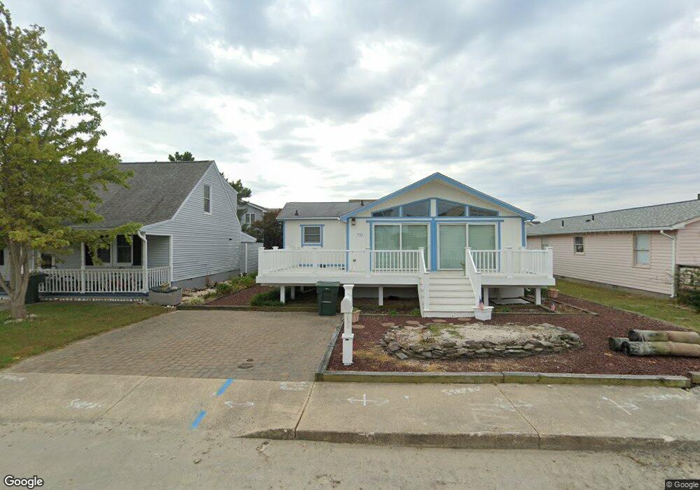
711 141st St Ocean City, MD 21842
Estimated Value: $441,957 - $538,000
--
Bed
2
Baths
1,368
Sq Ft
$364/Sq Ft
Est. Value
About This Home
This home is located at 711 141st St, Ocean City, MD 21842 and is currently estimated at $497,489, approximately $363 per square foot. 711 141st St is a home located in Worcester County with nearby schools including Ocean City Elementary School, Stephen Decatur Middle School, and Berlin Intermediate School.
Ownership History
Date
Name
Owned For
Owner Type
Purchase Details
Closed on
Aug 21, 2023
Sold by
Bosch Louis P Van Den
Bought by
Louis P Van Den Bosch Revocable Trust and Vandenbosch
Current Estimated Value
Purchase Details
Closed on
Jun 28, 2004
Sold by
Vanden Bosch Louis P and Vanden Marisa C
Bought by
Vanden Bosch Louis P and Beneficiary Primary
Purchase Details
Closed on
Jun 27, 1984
Sold by
Balamoti Johnny M
Bought by
Vanden Bosch Louis P and Vanden Marisa C
Home Financials for this Owner
Home Financials are based on the most recent Mortgage that was taken out on this home.
Original Mortgage
$60,000
Interest Rate
14.49%
Create a Home Valuation Report for This Property
The Home Valuation Report is an in-depth analysis detailing your home's value as well as a comparison with similar homes in the area
Home Values in the Area
Average Home Value in this Area
Purchase History
| Date | Buyer | Sale Price | Title Company |
|---|---|---|---|
| Louis P Van Den Bosch Revocable Trust | -- | None Listed On Document | |
| Vandenbosch William T | -- | None Listed On Document | |
| Vanden Bosch Louis P | -- | -- | |
| Vanden Bosch Louis P | $76,000 | -- |
Source: Public Records
Mortgage History
| Date | Status | Borrower | Loan Amount |
|---|---|---|---|
| Previous Owner | Vanden Bosch Louis P | $60,000 |
Source: Public Records
Tax History Compared to Growth
Tax History
| Year | Tax Paid | Tax Assessment Tax Assessment Total Assessment is a certain percentage of the fair market value that is determined by local assessors to be the total taxable value of land and additions on the property. | Land | Improvement |
|---|---|---|---|---|
| 2025 | $3,974 | $347,567 | $0 | $0 |
| 2024 | $3,958 | $283,633 | $0 | $0 |
| 2023 | $3,097 | $219,700 | $142,700 | $77,000 |
| 2022 | $3,045 | $216,700 | $0 | $0 |
| 2021 | $3,020 | $213,700 | $0 | $0 |
| 2020 | $2,989 | $210,700 | $142,700 | $68,000 |
| 2019 | $2,997 | $210,700 | $142,700 | $68,000 |
| 2018 | $2,968 | $210,700 | $142,700 | $68,000 |
| 2017 | $2,924 | $211,600 | $0 | $0 |
| 2016 | -- | $205,967 | $0 | $0 |
| 2015 | $2,702 | $200,333 | $0 | $0 |
| 2014 | $2,702 | $194,700 | $0 | $0 |
Source: Public Records
Map
Nearby Homes
- 703 Loop Rd
- 702A Kelly Rd
- 14125 Sea Captain Rd
- 743 Laurel Ave
- 14109 Dukes Ave
- 13487 Bella Vista Ln Unit U9
- 717 142nd St
- 13450 Madison Ave Unit 8
- 731 Anchor Chain Rd
- 14009 N Ocean Rd
- 14211 Dukes Ave Unit 203
- 13444 Madison Ave
- 13022 Wilson Ave
- 13506 Yellow Banks Ct
- 712 Gulf Stream Dr
- 13032 Wilson Ave Unit 7
- 13032 Wilson Ave Unit 27
- 709 Gulf Stream Dr
- 13031 Hayes Ave Unit 8
- 705 Gulf Stream Dr