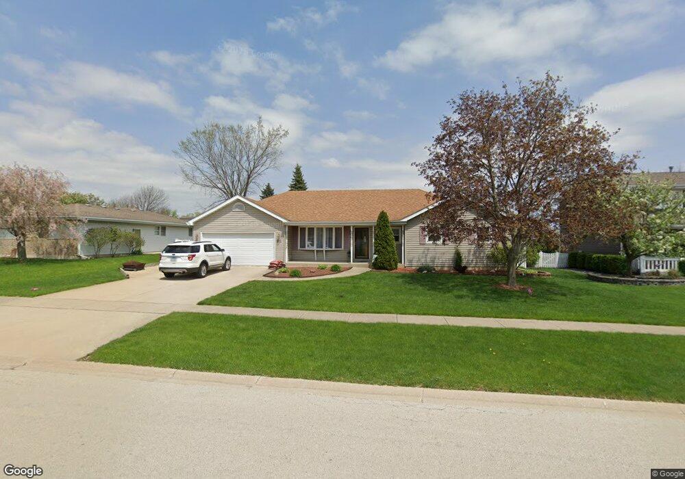
711 Amber Rd New Lenox, IL 60451
Estimated Value: $355,316 - $438,000
--
Bed
--
Bath
--
Sq Ft
10,019
Sq Ft Lot
About This Home
This home is located at 711 Amber Rd, New Lenox, IL 60451 and is currently estimated at $408,829. 711 Amber Rd is a home located in Will County with nearby schools including Bentley Elementary School, Arnold J Tyler School, and Alex M Martino Jr High School.
Ownership History
Date
Name
Owned For
Owner Type
Purchase Details
Closed on
Aug 9, 2002
Sold by
Bitz Steven R and Bitz Amy J
Bought by
Miner Todd L and Miner Michelle L
Current Estimated Value
Home Financials for this Owner
Home Financials are based on the most recent Mortgage that was taken out on this home.
Original Mortgage
$175,410
Interest Rate
6.39%
Purchase Details
Closed on
Nov 18, 1993
Sold by
Nlsb
Bought by
Bitz Steven R and Bitz Amy J
Home Financials for this Owner
Home Financials are based on the most recent Mortgage that was taken out on this home.
Original Mortgage
$120,470
Interest Rate
6.75%
Create a Home Valuation Report for This Property
The Home Valuation Report is an in-depth analysis detailing your home's value as well as a comparison with similar homes in the area
Home Values in the Area
Average Home Value in this Area
Purchase History
| Date | Buyer | Sale Price | Title Company |
|---|---|---|---|
| Miner Todd L | $195,000 | -- | |
| Bitz Steven R | $20,000 | Chicago Title Insurance Co |
Source: Public Records
Mortgage History
| Date | Status | Borrower | Loan Amount |
|---|---|---|---|
| Previous Owner | Miner Todd L | $175,410 | |
| Previous Owner | Bitz Steven R | $120,470 |
Source: Public Records
Tax History Compared to Growth
Tax History
| Year | Tax Paid | Tax Assessment Tax Assessment Total Assessment is a certain percentage of the fair market value that is determined by local assessors to be the total taxable value of land and additions on the property. | Land | Improvement |
|---|---|---|---|---|
| 2024 | $8,307 | $110,369 | $33,360 | $77,009 |
| 2023 | $8,307 | $100,610 | $30,410 | $70,200 |
| 2022 | $7,501 | $92,686 | $28,015 | $64,671 |
| 2021 | $7,114 | $87,168 | $26,347 | $60,821 |
| 2020 | $6,907 | $84,058 | $25,407 | $58,651 |
| 2019 | $6,607 | $81,451 | $24,619 | $56,832 |
| 2018 | $6,451 | $78,643 | $23,770 | $54,873 |
| 2017 | $6,126 | $76,382 | $23,087 | $53,295 |
| 2016 | $5,943 | $74,338 | $22,469 | $51,869 |
| 2015 | $5,722 | $71,998 | $21,762 | $50,236 |
| 2014 | $5,722 | $71,109 | $21,493 | $49,616 |
| 2013 | $5,722 | $72,068 | $21,783 | $50,285 |
Source: Public Records
Map
Nearby Homes
- 920 Barnside Rd
- 235 Roberts Rd
- 203 Tonell Ave
- 805 Regent St
- 117 Walona Ave
- 513 Somerset Ln
- 1017 E Lincoln Hwy
- 328 E Lincoln Hwy
- 718 S Prairie Rd
- 00 NE Corner Cherry Hill Road and Moss Lane Rd
- 125 N Anderson Rd
- 214 Somerset Ct
- 1535 Glenbrooke Ln
- 315 S Pine St
- 1139 Georgias Way
- 1125 Georgias Way
- 1212 Georgias Way
- 1193 Georgias Way
- 1000 S Cedar Rd
- 202 Hickory St