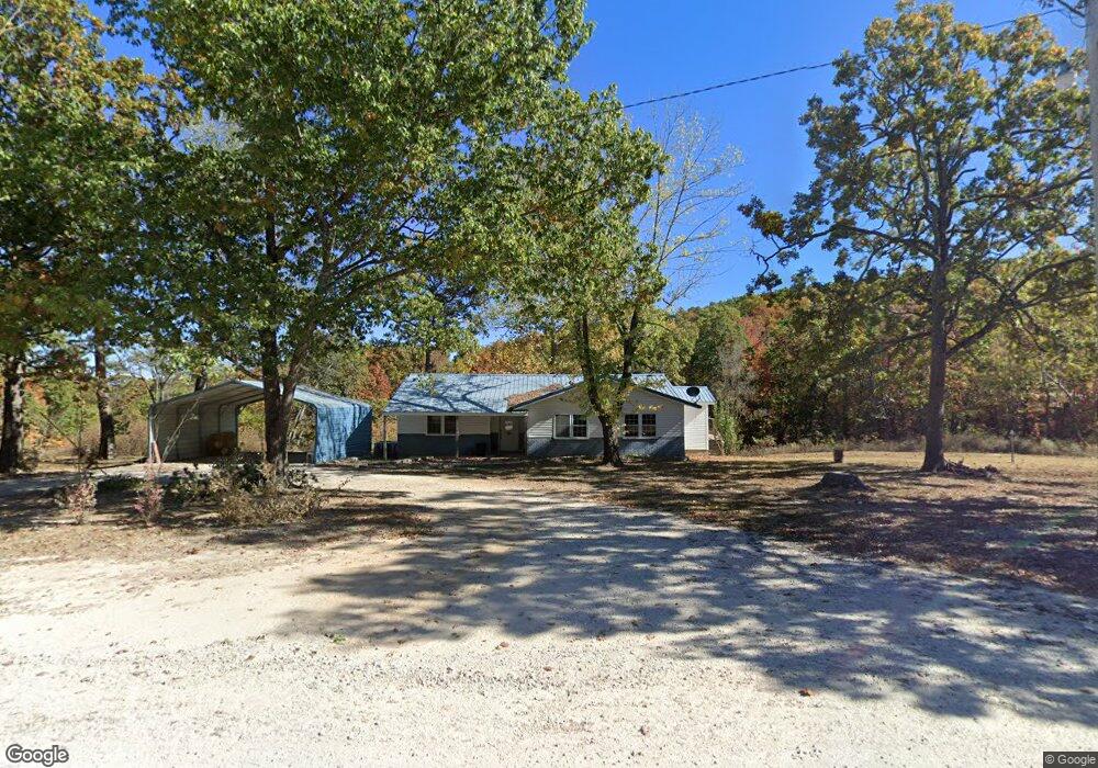
711 Cedar Rd Harrison, AR 72601
Estimated Value: $177,391 - $292,000
Studio
1
Bath
1,198
Sq Ft
$183/Sq Ft
Est. Value
About This Home
This home is located at 711 Cedar Rd, Harrison, AR 72601 and is currently estimated at $219,348, approximately $183 per square foot. 711 Cedar Rd is a home located in Boone County with nearby schools including Alpena Elementary School and Alpena High School.
Ownership History
Date
Name
Owned For
Owner Type
Purchase Details
Closed on
Apr 9, 2021
Sold by
Watson Alta
Bought by
Six Gun Contracting Llc
Current Estimated Value
Home Financials for this Owner
Home Financials are based on the most recent Mortgage that was taken out on this home.
Original Mortgage
$59,500
Interest Rate
2.9%
Mortgage Type
Future Advance Clause Open End Mortgage
Create a Home Valuation Report for This Property
The Home Valuation Report is an in-depth analysis detailing your home's value as well as a comparison with similar homes in the area
Purchase History
| Date | Buyer | Sale Price | Title Company |
|---|---|---|---|
| Six Gun Contracting Llc | $70,000 | None Listed On Document |
Source: Public Records
Mortgage History
| Date | Status | Borrower | Loan Amount |
|---|---|---|---|
| Closed | Six Gun Contracting Llc | $59,500 |
Source: Public Records
Tax History
| Year | Tax Paid | Tax Assessment Tax Assessment Total Assessment is a certain percentage of the fair market value that is determined by local assessors to be the total taxable value of land and additions on the property. | Land | Improvement |
|---|---|---|---|---|
| 2025 | $632 | $16,120 | $5,960 | $10,160 |
| 2024 | $632 | $16,120 | $5,960 | $10,160 |
| 2023 | $632 | $16,120 | $5,960 | $10,160 |
| 2022 | $677 | $16,120 | $5,960 | $10,160 |
| 2021 | $237 | $16,120 | $5,960 | $10,160 |
| 2020 | $227 | $14,610 | $3,480 | $11,130 |
| 2019 | $245 | $14,610 | $3,480 | $11,130 |
| 2018 | $270 | $15,850 | $3,480 | $12,370 |
| 2017 | $252 | $15,850 | $3,480 | $12,370 |
| 2016 | $252 | $13,110 | $3,480 | $9,630 |
| 2015 | $514 | $13,110 | $3,480 | $9,630 |
| 2014 | $164 | $13,110 | $3,480 | $9,630 |
Source: Public Records
Map
Nearby Homes
- 9513 U S 62
- 8764 U S 62
- 11175 Arkansas 392
- 1989 Patton Ln
- 172 Stella Ct
- 160 Stella Ct
- 0 Hwy 392 Unit 1313787
- 0000 Hwy 392
- 0 Old Capps Rd
- 350 Devitos Loop
- 7226 Estes Rd
- 1567 Goff (Lot 28) Rd
- 1669 Goff (Lot 27) Rd
- 1739 Goff (Lot 26) Rd
- 1959 Henley (Lot 3) Dr
- 2259 Ledge Rock Rd
- 11227 Dunkard Rd
- 10836 Hill Country Rd
- 5745 Estes Rd
- 4610 Moonbeam Dr
- 18.86 ac Cedar Rd
- 710 Cedar Rd
- 840 Cedar Rd
- 581 Cedar Rd
- 788 Cedar Rd
- 974 Cedar Rd
- 8002 Wind Rock Ln
- 8002 Wind Rock Ln
- 8295 Wind Rock Ln
- 8295 Wind Rock Ln
- 8006 Wind Rock Ln
- 8129 Wind Rock Ln
- 8222 Wind Rock Ln
- 7740 Valentine Ln
- 1320 Cedar Rd
- 7820 Denning Rd
- 7820 Denning Rd
- 7910 Valentine Ln
- 8357 Wind Rock Ln
- 7651 Valentine Ln
Your Personal Tour Guide
Ask me questions while you tour the home.