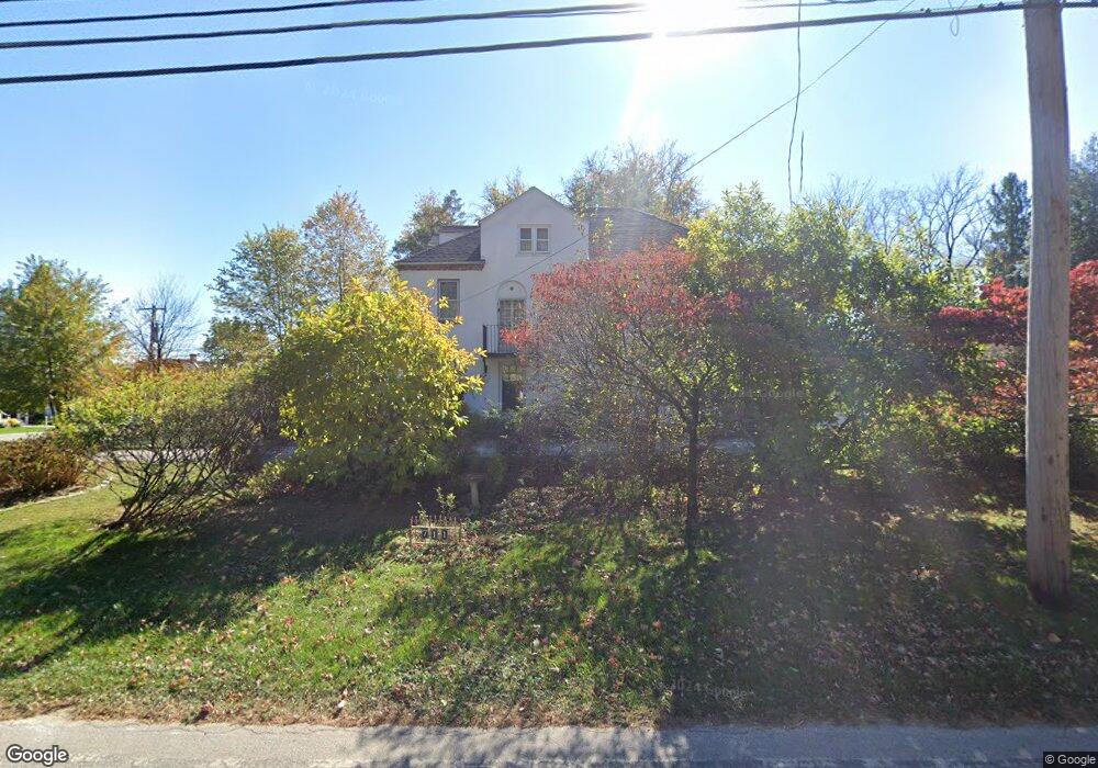
711 Conestoga Rd Berwyn, PA 19312
Estimated Value: $828,894 - $1,075,000
5
Beds
3
Baths
2,831
Sq Ft
$344/Sq Ft
Est. Value
About This Home
This home is located at 711 Conestoga Rd, Berwyn, PA 19312 and is currently estimated at $974,724, approximately $344 per square foot. 711 Conestoga Rd is a home located in Chester County with nearby schools including Hillside Elementary School, Valley Forge Middle School, and Conestoga Senior High School.
Ownership History
Date
Name
Owned For
Owner Type
Purchase Details
Closed on
Jul 31, 2000
Sold by
Flanagan Regina A and Flanagan Louis C
Bought by
Landerl Fred and Novelli Phran
Current Estimated Value
Home Financials for this Owner
Home Financials are based on the most recent Mortgage that was taken out on this home.
Original Mortgage
$252,500
Interest Rate
8.07%
Create a Home Valuation Report for This Property
The Home Valuation Report is an in-depth analysis detailing your home's value as well as a comparison with similar homes in the area
Home Values in the Area
Average Home Value in this Area
Purchase History
| Date | Buyer | Sale Price | Title Company |
|---|---|---|---|
| Landerl Fred | $370,000 | -- |
Source: Public Records
Mortgage History
| Date | Status | Borrower | Loan Amount |
|---|---|---|---|
| Previous Owner | Landerl Fred | $252,500 |
Source: Public Records
Tax History Compared to Growth
Tax History
| Year | Tax Paid | Tax Assessment Tax Assessment Total Assessment is a certain percentage of the fair market value that is determined by local assessors to be the total taxable value of land and additions on the property. | Land | Improvement |
|---|---|---|---|---|
| 2025 | $7,092 | $201,350 | $55,520 | $145,830 |
| 2024 | $7,092 | $201,350 | $55,520 | $145,830 |
| 2023 | $6,662 | $201,350 | $55,520 | $145,830 |
| 2022 | $6,490 | $201,350 | $55,520 | $145,830 |
| 2021 | $6,367 | $201,350 | $55,520 | $145,830 |
| 2020 | $6,191 | $201,350 | $55,520 | $145,830 |
| 2019 | $5,996 | $201,350 | $55,520 | $145,830 |
| 2018 | $5,877 | $201,350 | $55,520 | $145,830 |
| 2017 | $5,737 | $201,350 | $55,520 | $145,830 |
| 2016 | -- | $201,350 | $55,520 | $145,830 |
| 2015 | -- | $201,350 | $55,520 | $145,830 |
| 2014 | -- | $201,350 | $55,520 | $145,830 |
Source: Public Records
Map
Nearby Homes
- 53 Branch Ave
- 875 Old State Rd
- 52 Aiken Ave
- 395 Bair Rd
- 909 Old Lancaster Rd
- 91 Central Ave
- 553 Woodside Ave
- 1 Lfleur Unit 1
- 530 Bair Rd
- 211 Wooded Way
- 524 Woodside Ave
- 328 W Conestoga Rd
- 406 Brighton Cir
- 2 Ile Dhuyere Unit 2
- 6 Avignon Unit 6
- 6 Ile Dhuyere
- 8 Brettagne Unit 8
- 45 Orchard Ln
- 446 Irish Rd
- 302 Old Lancaster Rd
- 80 Cassatt Ave
- 725 Conestoga Rd
- 76 Cassatt Ave
- 731 Conestoga Rd
- 95 Cassatt Ave
- 117 Bair Rd
- 68 Cassatt Ave
- 708 Conestoga Rd
- 737 Conestoga Rd
- 71 Cassatt Ave
- 66 Cassatt Ave
- 685 Conestoga Rd
- 745 Conestoga Rd
- 69 Cassatt Ave
- 141 Bair Rd
- 60 Cassatt Ave
- 679 Conestoga Rd
- 751 Conestoga Rd
- 685 Kromer Ave
- 671 Conestoga Rd