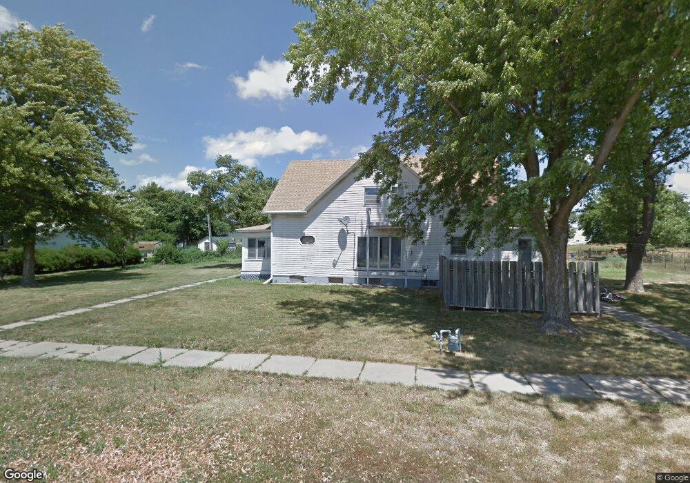
711 E Forrest St Sutton, NE 68979
Estimated Value: $131,000 - $279,679
4
Beds
2
Baths
2,262
Sq Ft
$98/Sq Ft
Est. Value
About This Home
This home is located at 711 E Forrest St, Sutton, NE 68979 and is currently estimated at $222,420, approximately $98 per square foot. 711 E Forrest St is a home located in Clay County with nearby schools including Sutton Elementary School, Sutton Secondary School, and Sutton Christian School.
Ownership History
Date
Name
Owned For
Owner Type
Purchase Details
Closed on
Apr 30, 2024
Sold by
Sutton Community Redevelopment Authority
Bought by
Fehr Roger M and Fehr Mary C
Current Estimated Value
Purchase Details
Closed on
Nov 3, 2023
Sold by
Sterns Christopher L and Sterns Autumn L
Bought by
820 N Elmer Llc
Purchase Details
Closed on
Dec 7, 2020
Sold by
Kube Carla J
Bought by
Sterns Christopher L and Sterns Autumn L
Purchase Details
Closed on
Oct 31, 2006
Sold by
Bayer George H and Amos-Bayer Dolores
Bought by
Sterns Christopher L and Sterns Autumn L
Create a Home Valuation Report for This Property
The Home Valuation Report is an in-depth analysis detailing your home's value as well as a comparison with similar homes in the area
Purchase History
| Date | Buyer | Sale Price | Title Company |
|---|---|---|---|
| Fehr Roger M | $40,000 | Adams Land Title | |
| 820 N Elmer Llc | $90,000 | None Listed On Document | |
| Sterns Christopher L | -- | None Available | |
| Sterns Christopher L | -- | -- |
Source: Public Records
Mortgage History
| Date | Status | Borrower | Loan Amount |
|---|---|---|---|
| Previous Owner | Sterns Christopher L | $17,038 |
Source: Public Records
Tax History
| Year | Tax Paid | Tax Assessment Tax Assessment Total Assessment is a certain percentage of the fair market value that is determined by local assessors to be the total taxable value of land and additions on the property. | Land | Improvement |
|---|---|---|---|---|
| 2025 | $2,942 | $202,425 | $23,160 | $179,265 |
| 2024 | $2,724 | $177,700 | $23,160 | $154,540 |
| 2023 | $3,321 | $177,700 | $23,160 | $154,540 |
| 2022 | $2,910 | $157,565 | $20,035 | $137,530 |
| 2021 | $2,822 | $149,780 | $20,035 | $129,745 |
| 2020 | $2,675 | $149,780 | $20,035 | $129,745 |
| 2019 | $2,325 | $130,925 | $20,035 | $110,890 |
| 2018 | $2,335 | $130,925 | $20,035 | $110,890 |
| 2017 | $2,255 | $130,925 | $20,035 | $110,890 |
| 2016 | $1,981 | $105,380 | $13,860 | $91,520 |
| 2015 | $2,073 | $105,380 | $13,860 | $91,520 |
| 2014 | -- | $92,130 | $13,860 | $78,270 |
| 2013 | -- | $92,130 | $13,860 | $78,270 |
Source: Public Records
Map
Nearby Homes
- . Schwab Subdivision Lots
- Lot 3 Wellman Schwab Subdivision Ave
- 209 E Grove St
- 111 E Forrest St
- 502 S Maltby Ave
- 403 S Way
- 505 N Saunders Ave
- 712 S Maltby Ave
- 902 N Saunders Ave
- 512 N James Ave
- 811 S Saunders Ave
- Road 315
- Sutton Unit NE 68979
- Parcel 3 Walnut St
- Parcel 2 Walnut St
- 1820 Road 6
- 175 N Jackson Ave
- 235 E South St
- 1580
- 1580 Road 320
- 709 E Forrest St
- 712 E Forrest St
- 707 E Forrest St
- 712 E Elm St
- 708 E Forrest St
- 706 E Forrest St
- 703 E Forrest St
- 109 N Owen Ave
- 110 S Phillips Ave
- 702 E Forrest St
- 112 N Phillips Ave
- 705 E Grove St
- 915 E Hickory St
- 711 E Elm St
- 108 N Phillips Ave
- 112 S Phillips Ave
- 202 N Phillips Ave
- 611 E Forrest St
- 612 E Elm St
- 608 E Forrest St
Your Personal Tour Guide
Ask me questions while you tour the home.