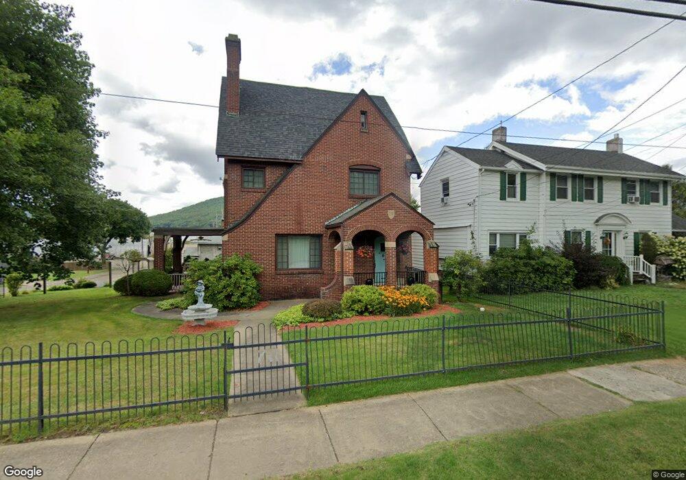
711 E Main St Bradford, PA 16701
Estimated Value: $124,000 - $236,000
Studio
--
Bath
2,184
Sq Ft
$77/Sq Ft
Est. Value
About This Home
This home is located at 711 E Main St, Bradford, PA 16701 and is currently estimated at $167,115, approximately $76 per square foot. 711 E Main St is a home located in McKean County with nearby schools including George Blaisdell Elementary School, School Street Elementary School, and Floyd C. Fretz Middle School.
Ownership History
Date
Name
Owned For
Owner Type
Purchase Details
Closed on
Mar 13, 2006
Sold by
Fox Linda L and Anderson Linda L
Bought by
Andeson Linda L and Anderson David
Current Estimated Value
Home Financials for this Owner
Home Financials are based on the most recent Mortgage that was taken out on this home.
Original Mortgage
$75,000
Interest Rate
6.28%
Mortgage Type
New Conventional
Create a Home Valuation Report for This Property
The Home Valuation Report is an in-depth analysis detailing your home's value as well as a comparison with similar homes in the area
Home Values in the Area
Average Home Value in this Area
Purchase History
| Date | Buyer | Sale Price | Title Company |
|---|---|---|---|
| Andeson Linda L | -- | None Available |
Source: Public Records
Mortgage History
| Date | Status | Borrower | Loan Amount |
|---|---|---|---|
| Closed | Andeson Linda L | $75,000 |
Source: Public Records
Tax History
| Year | Tax Paid | Tax Assessment Tax Assessment Total Assessment is a certain percentage of the fair market value that is determined by local assessors to be the total taxable value of land and additions on the property. | Land | Improvement |
|---|---|---|---|---|
| 2025 | $4,292 | $78,590 | $11,250 | $67,340 |
| 2024 | $4,157 | $78,590 | $11,250 | $67,340 |
| 2023 | $4,157 | $78,590 | $11,250 | $67,340 |
| 2022 | $4,157 | $78,590 | $11,250 | $67,340 |
| 2021 | $4,157 | $78,590 | $11,250 | $67,340 |
| 2020 | $4,157 | $78,590 | $11,250 | $67,340 |
| 2019 | $4,039 | $78,590 | $11,250 | $67,340 |
| 2018 | $40 | $78,590 | $11,250 | $67,340 |
| 2017 | -- | $78,590 | $11,250 | $67,340 |
| 2016 | $3,901 | $78,590 | $11,250 | $67,340 |
| 2015 | $1,947 | $78,590 | $11,250 | $67,340 |
| 2014 | $1,947 | $78,590 | $11,250 | $67,340 |
Source: Public Records
Map
Nearby Homes
Your Personal Tour Guide
Ask me questions while you tour the home.